MA128_AffectedPeople_Risk_adm2_AV_v01-300dpi.jpeg
From the dataset abstract
Map shows the number of reported activities per Sector per Department in Honduras. Critical and High priority response areas are also shown.
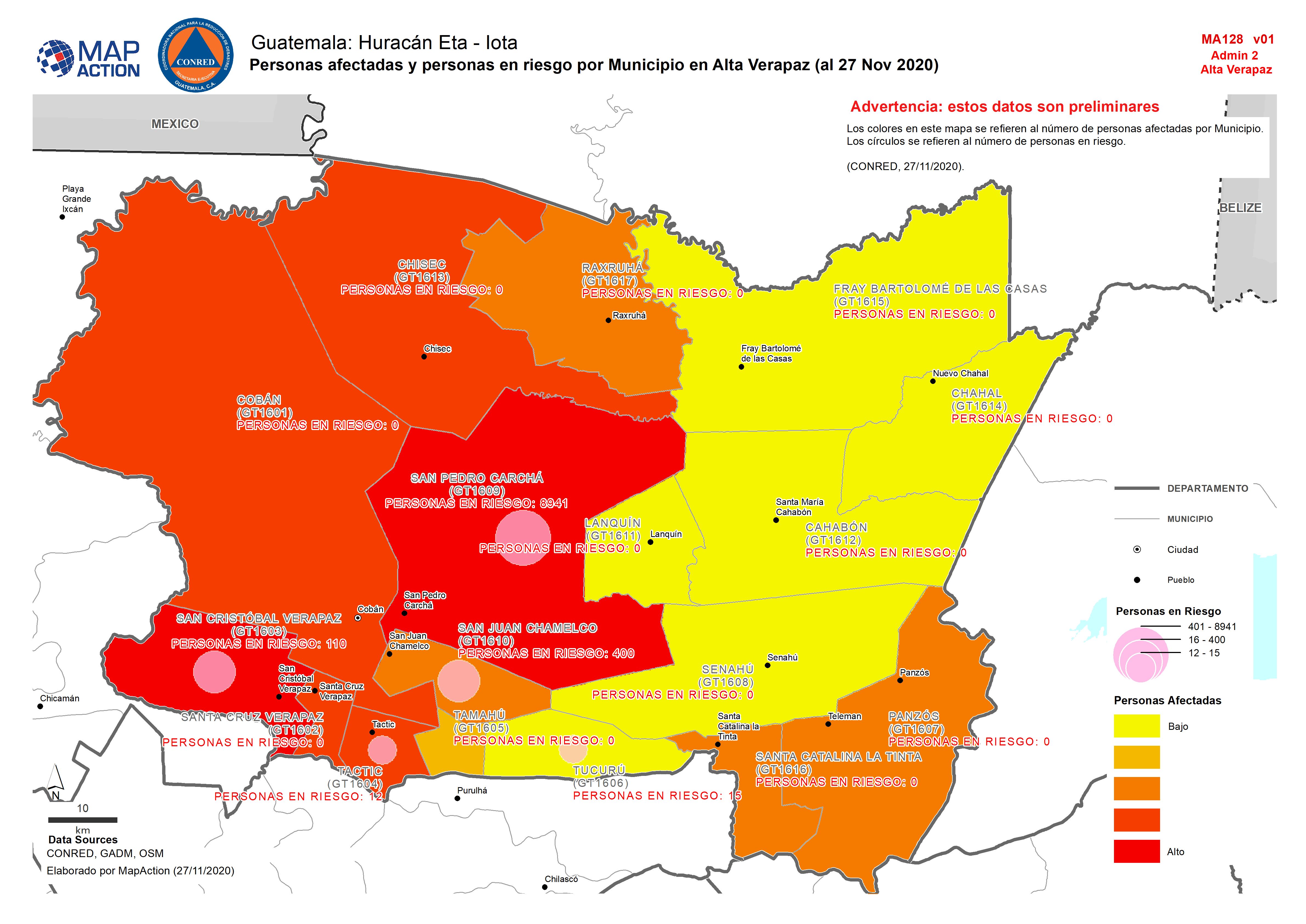
Source: Guatemala: Personas afectadas y personas en riesgo por Municipio en Alta Verapaz (al 27 Nov 2020)
Additional Information
| Field | Value |
|---|---|
| Data last updated | December 5, 2020 |
| Metadata last updated | December 2, 2020 |
| Created | December 2, 2020 |
| Format | JPEG |
| License | License not specified |
| Has views | True |
| Id | 92480788-0b70-4303-9577-4856a88eea23 |
| Mimetype | image/jpeg |
| On same domain | True |
| Package id | 6bf0bc47-86b8-4440-bc83-0f564ff26ebb |
| Revision id | 1f04175d-3495-4e84-a593-7267d1ee0c44 |
| Size | 1.2 MiB |
| State | active |
| Url type | upload |