thumbnail.png
From the dataset abstract
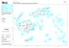
Map shows the Division (Admin level 1) and Province (Admin level 2) boundaries with their associated pcode.
Source: Fiji: Division and Province administration boundaries with Pcodes
Additional Information
| Field | Value |
|---|---|
| Data last updated | December 16, 2020 |
| Metadata last updated | December 16, 2020 |
| Created | December 16, 2020 |
| Format | PNG |
| License | License not specified |
| Has views | True |
| Id | c35bb64e-16ec-495e-b449-10018040f31b |
| Mimetype | image/png |
| On same domain | True |
| Package id | d5410ba0-6ac0-4d36-977c-65857349b165 |
| Position | 2 |
| Revision id | 68e63c33-aba7-410e-8050-626388bbd712 |
| Size | 13.1 KiB |
| State | active |
| Url type | upload |