MA715_OCHA_CentralAmerica_Eta_Iota_adm1-300dpi. ...
From the dataset abstract
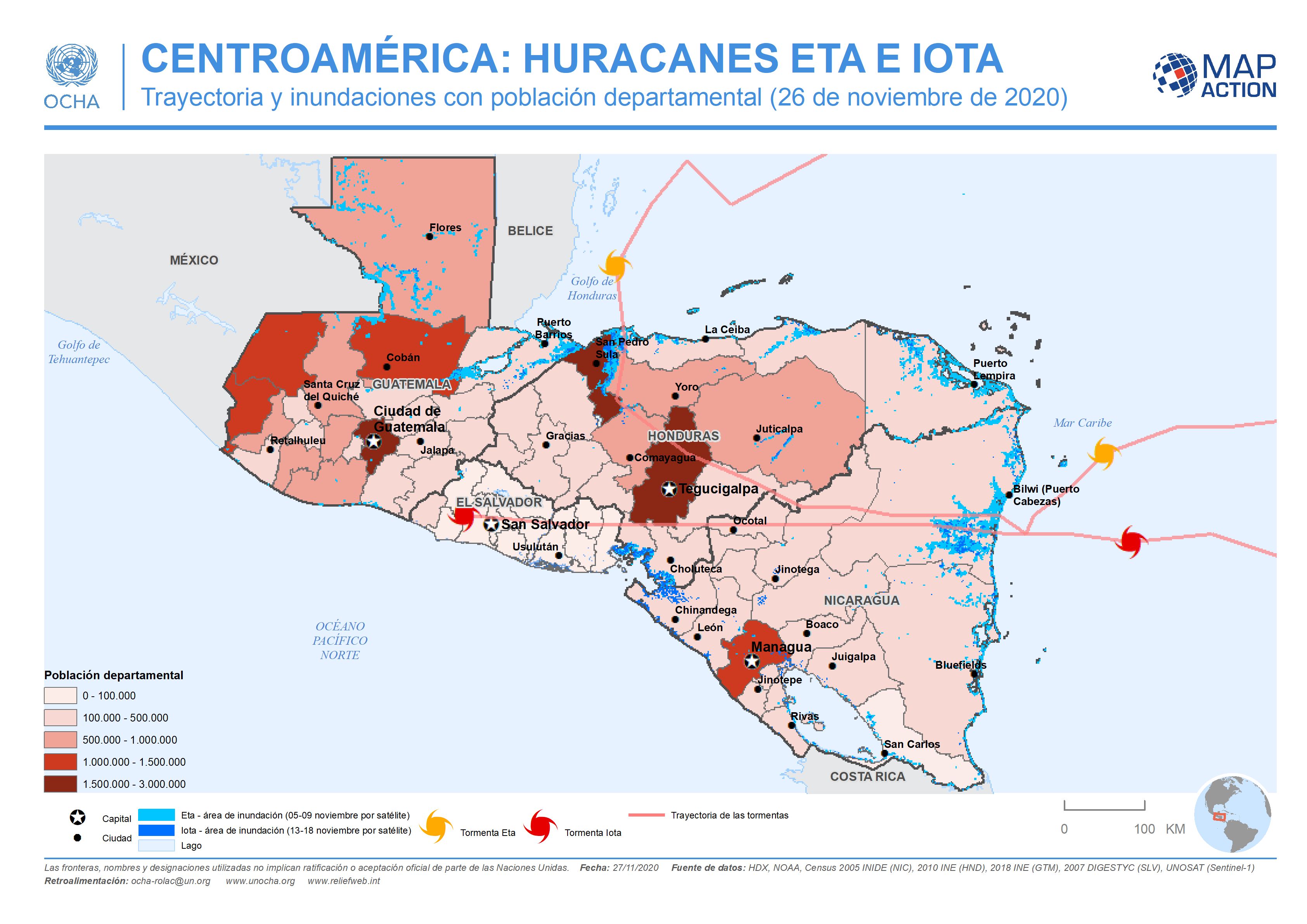
This map shows the storm tracks and flood extents for hurricane Eta and Iota, with baseline administrative 1 level departmental population figures across the affected region (Nicaragua,...
Additional Information
| Field | Value |
|---|---|
| Data last updated | November 27, 2020 |
| Metadata last updated | November 27, 2020 |
| Created | November 27, 2020 |
| Format | JPEG |
| License | License not specified |
| Has views | True |
| Id | f958a3df-f6a1-451d-bfe3-14d6e0b0cbf1 |
| Mimetype | image/jpeg |
| On same domain | True |
| Package id | f065c0d7-0e6d-4aa8-a25d-2178bcbe2980 |
| Revision id | 94adc5d3-2105-4acd-b070-a31b6b9dfbf6 |
| Size | 693.5 KiB |
| State | active |
| Url type | upload |