MA705_OCHA_Nicaragua_Flood_Area-300dpi.jpeg
From the dataset abstract
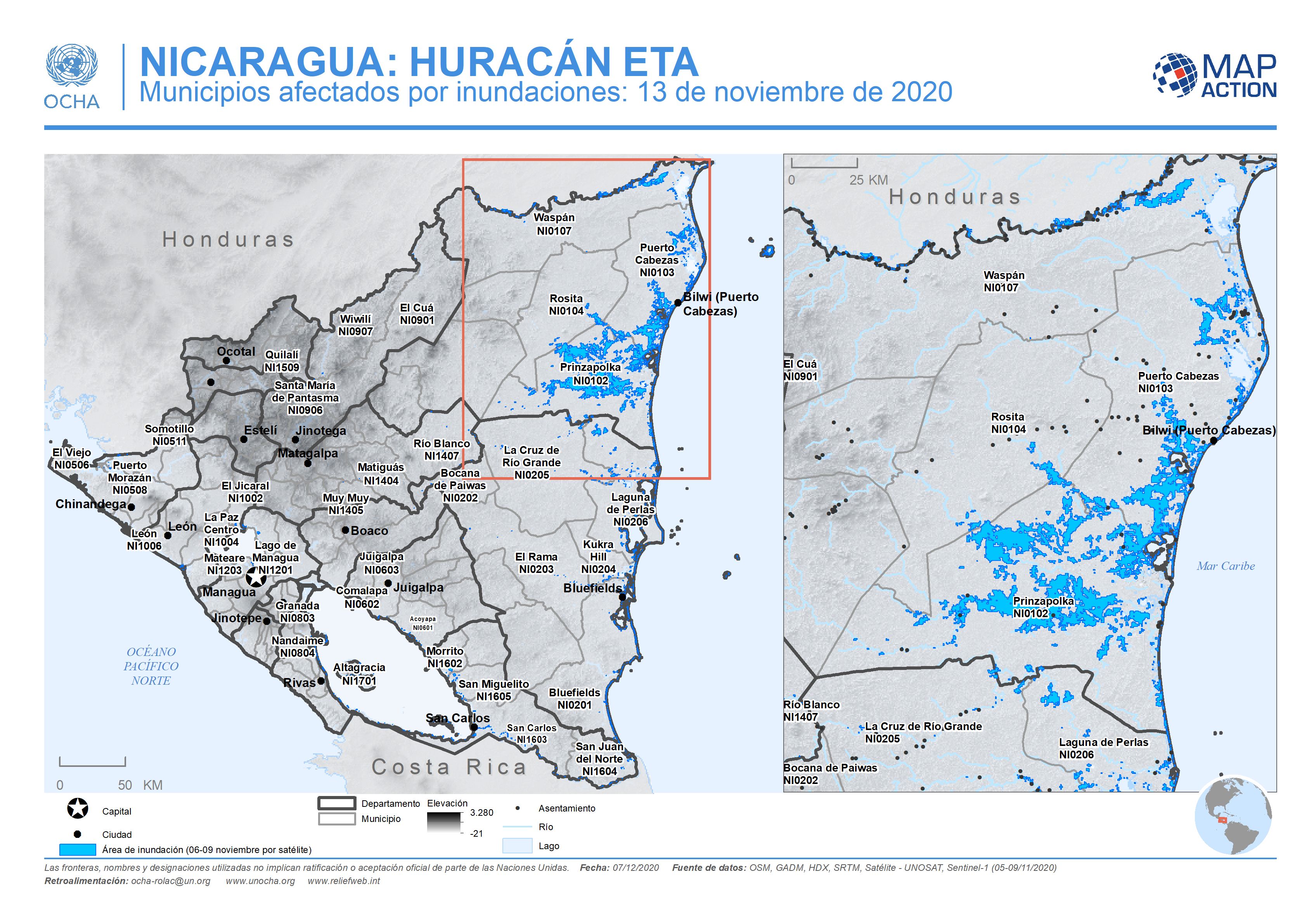
This map shows the administration level 2 municipalities for Nicaragua. Named municipalities are those affected by flood extents, derived from satellite imagery (6-9 November 2020).
Source: NICARAGUA: HURACÁN ETA - Municipios afectados por inundaciones: 13 de noviembre de 2020
Additional Information
| Field | Value |
|---|---|
| Data last updated | December 7, 2020 |
| Metadata last updated | December 7, 2020 |
| Created | December 7, 2020 |
| Format | JPEG |
| License | License not specified |
| Has views | True |
| Id | 47deb235-fd6e-42a6-8ebf-69d39d045702 |
| Mimetype | image/jpeg |
| On same domain | True |
| Package id | 2909961e-1607-40e8-9f73-dd66af042084 |
| Revision id | 5cc38993-b200-417e-933e-5e8eb7a05b7f |
| Size | 1.1 MiB |
| State | active |
| Url type | upload |