MA121_Honduras_EvacuatedAreas_IOTA_v1-300dpi.jpeg
From the dataset abstract
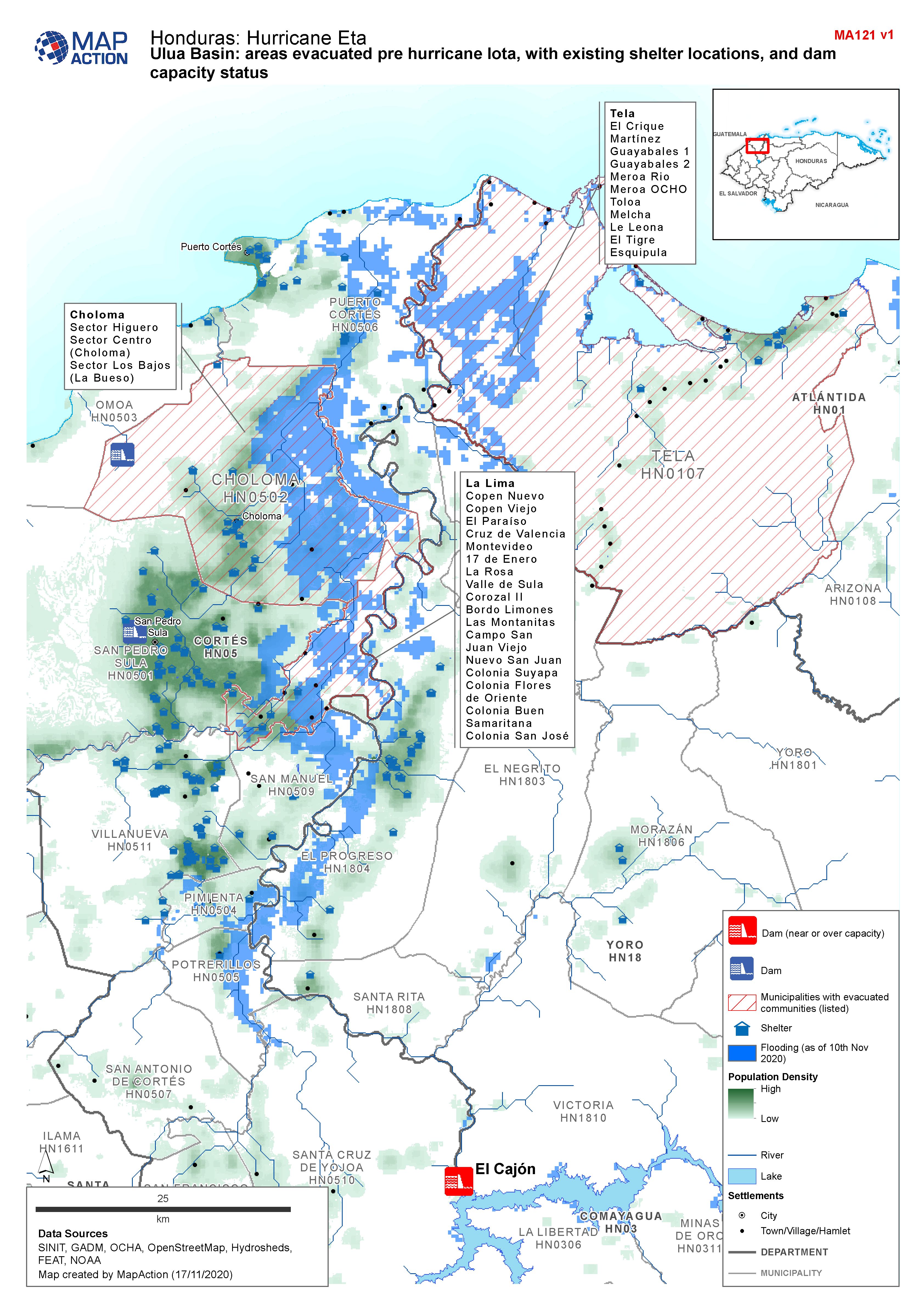
Map shows communities evacuated pre hurricane Iota, and existing shelter locations. Population density and capacity status of dams are also shown.
Additional Information
| Field | Value |
|---|---|
| Data last updated | November 17, 2020 |
| Metadata last updated | November 17, 2020 |
| Created | November 17, 2020 |
| Format | JPEG |
| License | License not specified |
| Has views | True |
| Id | ccdf2699-a1c8-4e00-83ad-31ac39e7386f |
| Mimetype | image/jpeg |
| On same domain | True |
| Package id | 0c503838-aadf-41a1-8832-d100f7712b99 |
| Revision id | 3cb4713f-6889-4d3d-848a-9f0e9ef3781f |
| Size | 1.8 MiB |
| State | active |
| Url type | upload |