MA110_Honduras_Shelter_displacedPop_Admin2_v12- ...
From the dataset abstract
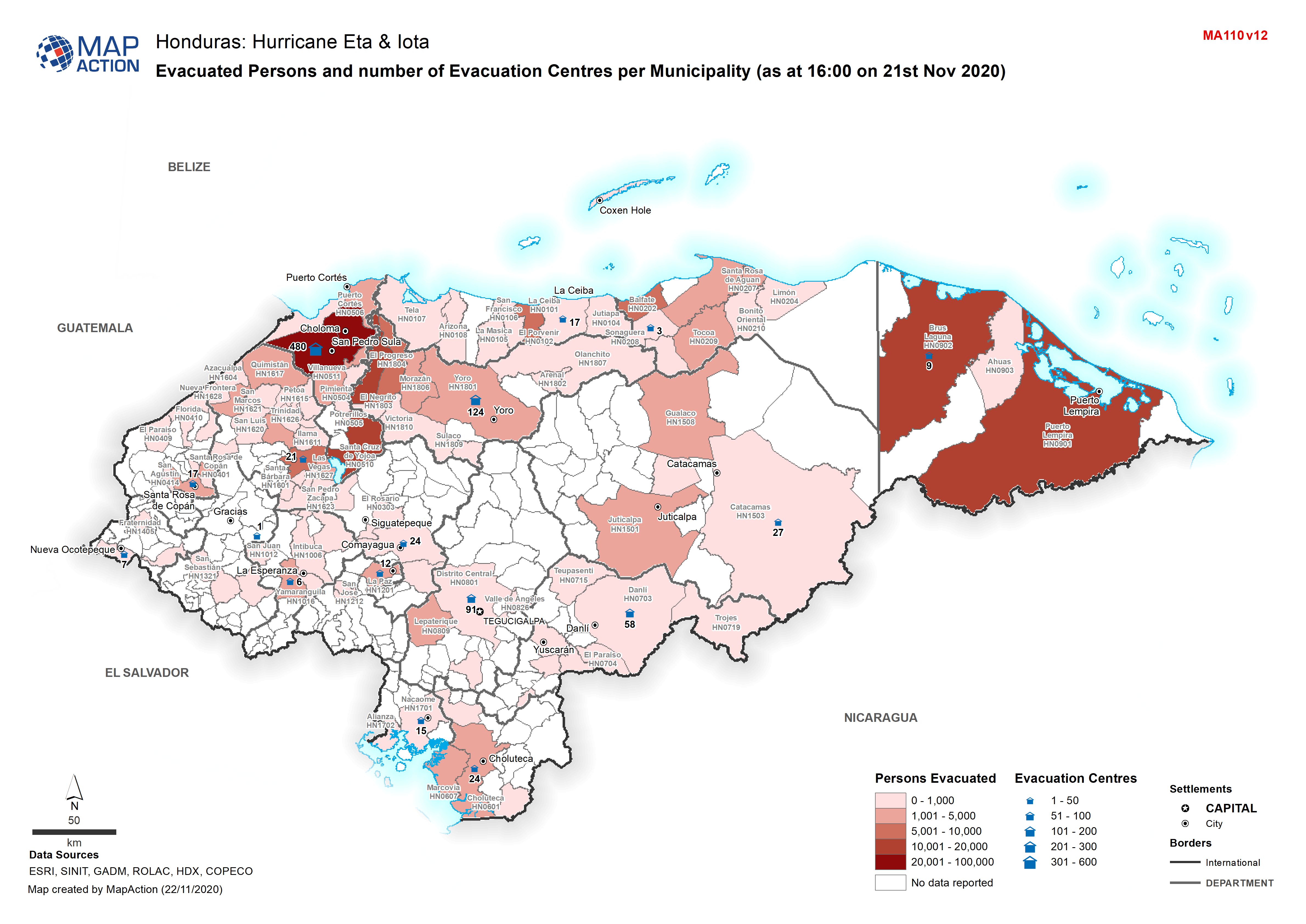
Map shows evacuated persons and number of evacuation centres per Municipality (as at 16:00 on 21st Nov 2020)
Additional Information
| Field | Value |
|---|---|
| Data last updated | November 22, 2020 |
| Metadata last updated | November 22, 2020 |
| Created | November 22, 2020 |
| Format | JPEG |
| License | License not specified |
| Has views | True |
| Id | 702d0d41-2753-4492-828e-646a7a32a8ea |
| Mimetype | image/jpeg |
| On same domain | True |
| Package id | 1d453135-594e-4bb7-9789-0eb3ef3888c9 |
| Revision id | cc3aafa5-6a86-4bcc-8f43-25b91527db8e |
| Size | 1.1 MiB |
| State | active |
| Url type | upload |