MA110_Honduras_Shelter_displacedPop_Admin2-300d ...
From the dataset abstract
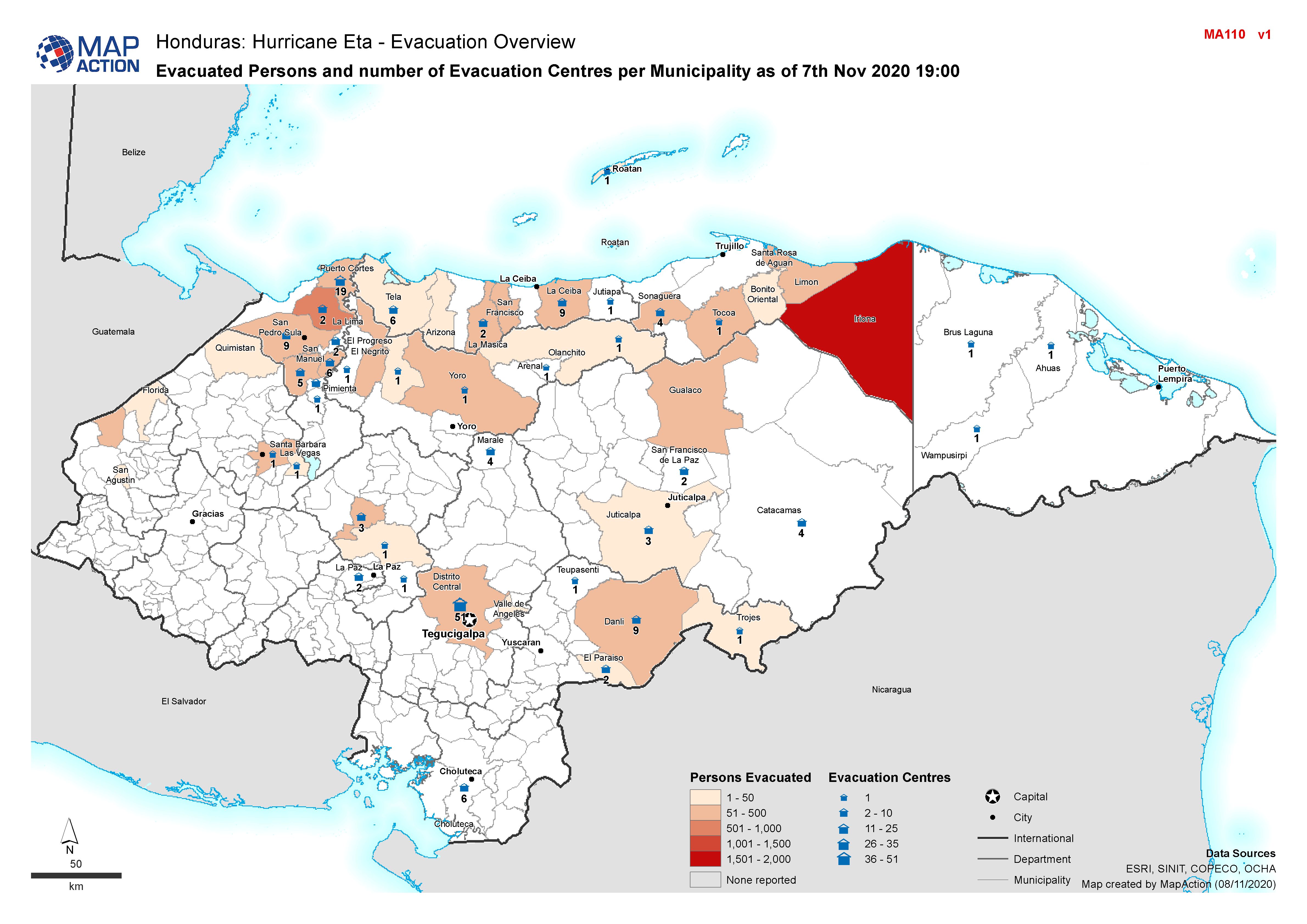
Honduras, Evacuated Persons and number of Evacuation Centres per Municipality as of 7th Nov 2020 19:00
Additional Information
| Field | Value |
|---|---|
| Data last updated | November 8, 2020 |
| Metadata last updated | November 8, 2020 |
| Created | November 8, 2020 |
| Format | JPEG |
| License | License not specified |
| Has views | True |
| Id | 42f77981-0f1a-48ab-80a9-55e62928980c |
| Mimetype | image/jpeg |
| On same domain | True |
| Package id | ca01036e-5899-4fb3-9c05-21432c983cf5 |
| Revision id | b221c6e1-bfdc-46d4-9f69-89e5a8a7b176 |
| Size | 1.1 MiB |
| State | active |
| Url type | upload |