thumbnail.png
From the dataset abstract
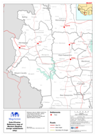
Reference map for UNDAC mission to Côte d’Ivoire in April 2011. Shows western Regions focusing on Montagnes and Moyen-Cavally and adjacent districts of Liberia.
Source: Côte d’Ivoire: Reference map of Western Regions (Large settlements only)
Additional Information
| Field | Value |
|---|---|
| Data last updated | July 28, 2016 |
| Metadata last updated | July 28, 2016 |
| Created | July 28, 2016 |
| Format | PNG |
| License | License not specified |
| Has views | True |
| Id | 9b04787d-79b1-4b7d-97b6-f73e6a06b31d |
| On same domain | True |
| Package id | 42cde299-07d7-4c94-ba23-d57311822d48 |
| Position | 2 |
| Revision id | ac3315c4-674d-40f3-91a6-a7afb0128d69 |
| State | active |
| Url type | upload |