MA005-JPN-AffectedPopulation-v04-A3-300dpi.jpg
From the dataset abstract
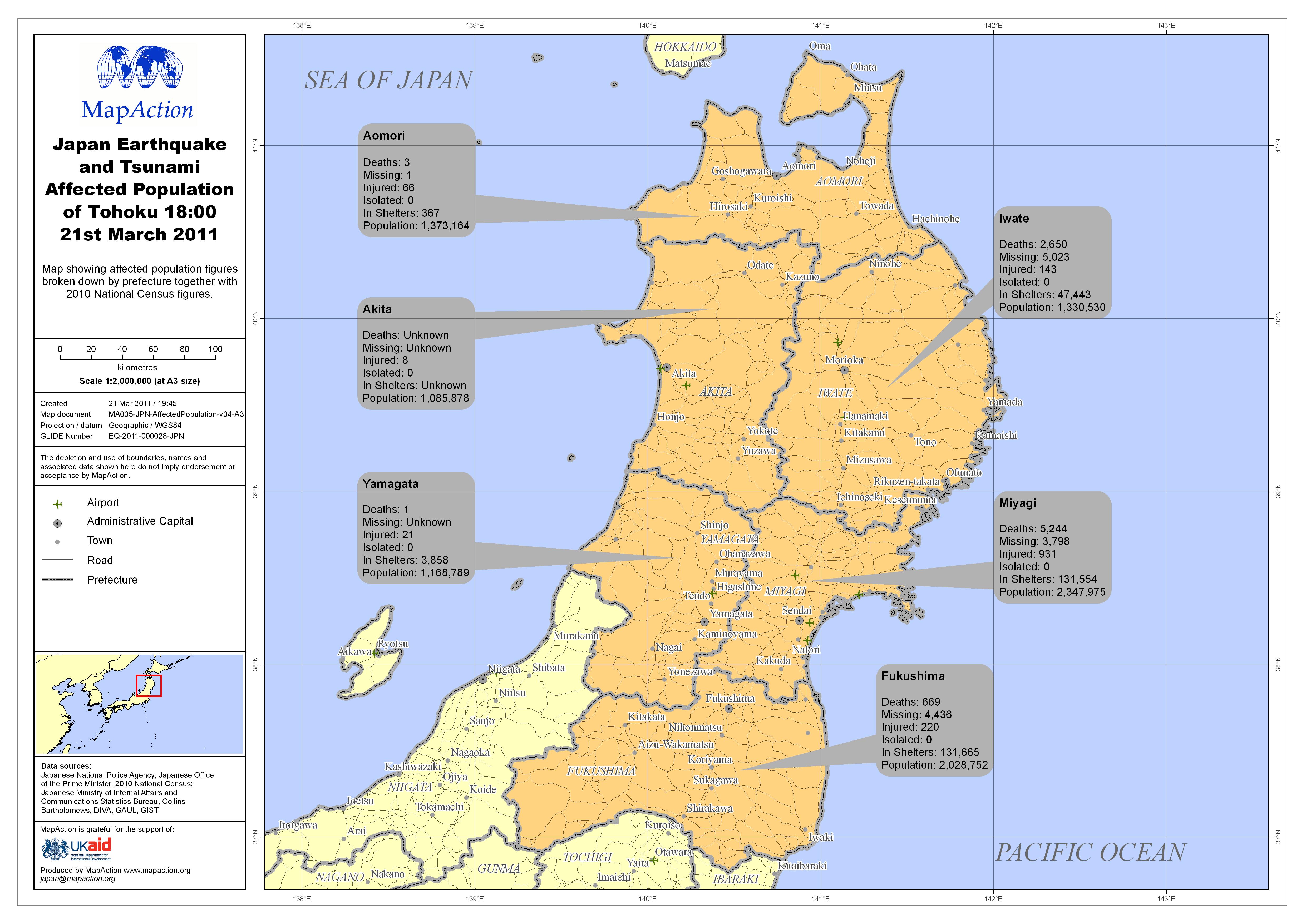
Map showing affected population figures broken down by prefecture together with 2010 National Census figures.
Source: Japan Earthquake and Tsunami Affected Population of Tohoku 18:00 21st March 2011
Additional Information
| Field | Value |
|---|---|
| Data last updated | July 4, 2016 |
| Metadata last updated | July 4, 2016 |
| Created | July 4, 2016 |
| Format | JPEG |
| License | License not specified |
| Has views | True |
| Id | bfa6c57e-9e02-4668-8856-9ee7d96af0df |
| On same domain | True |
| Package id | a0e800ac-5be6-45b8-86b7-d4c0648f69c0 |
| Revision id | 4503e3f6-83e7-4aed-a0c2-cafa87337545 |
| State | active |
| Url type | upload |