MA005-JPN-AffectedPopulation-v03-A3-300dpi.jpg
From the dataset abstract
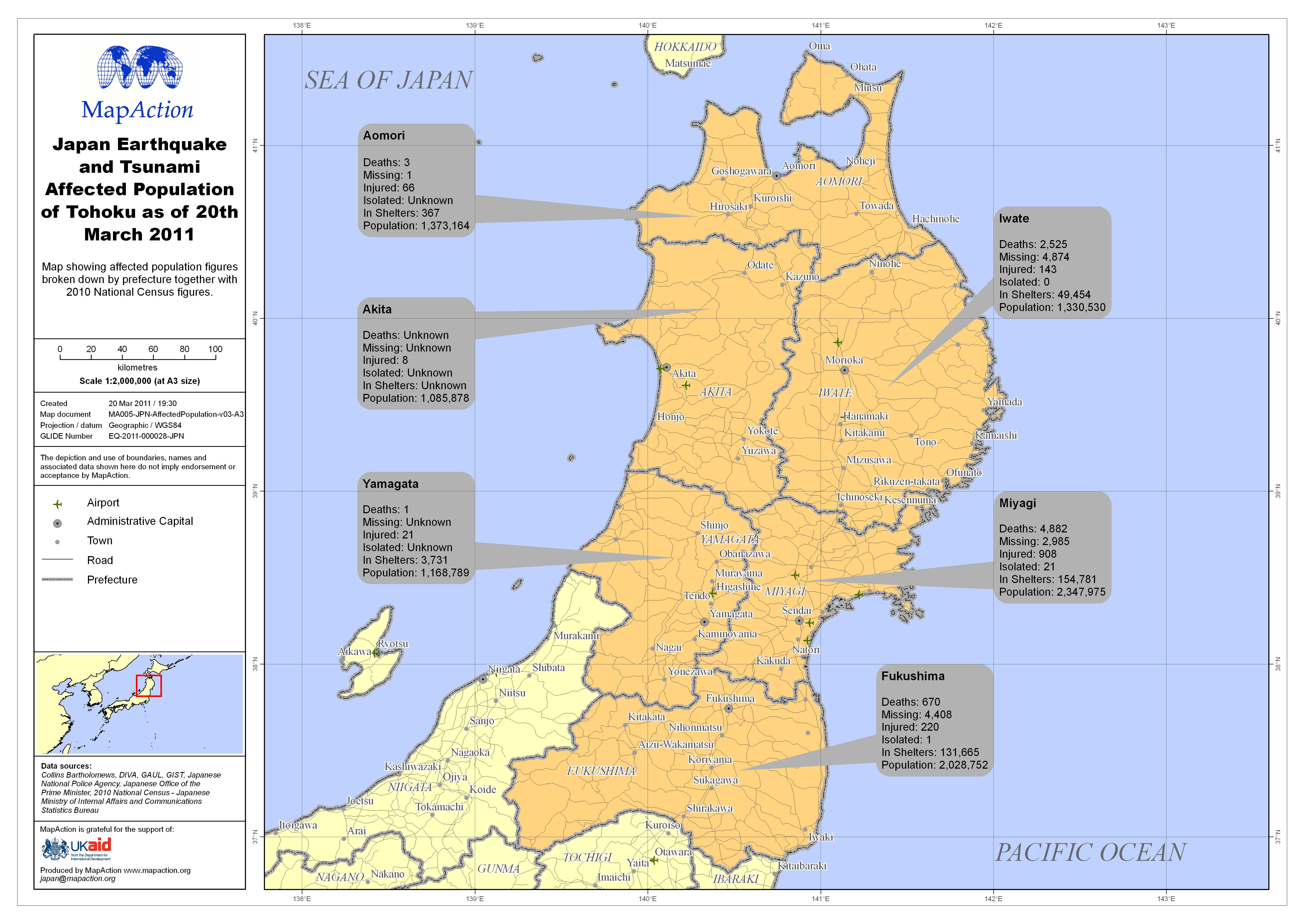
Map showing affected population figures broken down by prefecture together with 2010 National Census figures.
Source: Japan Earthquake and Tsunami Affected Population of Tohoku as of 20th March 2011
Additional Information
| Field | Value |
|---|---|
| Data last updated | July 4, 2016 |
| Metadata last updated | July 4, 2016 |
| Created | July 4, 2016 |
| Format | JPEG |
| License | License not specified |
| Has views | True |
| Id | 2ad380be-4d39-4126-b8a4-19278bbd073e |
| On same domain | True |
| Package id | 7b297f18-c9d6-47bd-8f48-a7a9f8f1ae02 |
| Revision id | 97402c3e-dcfd-49de-a647-52af8c77de82 |
| State | active |
| Url type | upload |