giaj_topographic_sheet_574130_shiogama.jpg
From the dataset abstract
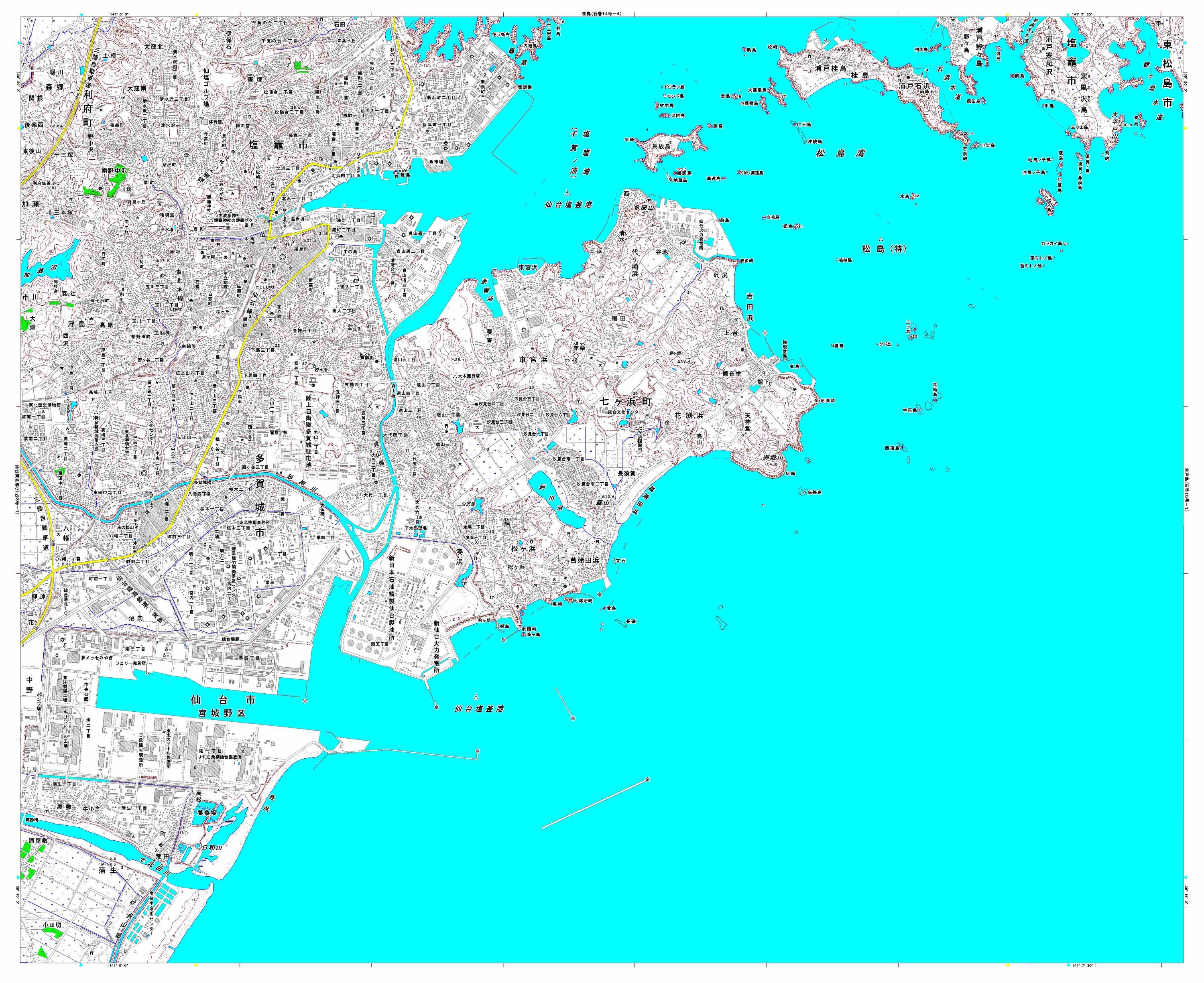
Detailed topographic mapping, scale 1:25,000. Each sheet covers approximately 11 x 9 km. For use only in disaster relief activities, by kind permission of Geospatial Information Authority...
Source: Japan Earthquake: 1:25,000 Topographic Sheet 574130 Shiogama
Additional Information
| Field | Value |
|---|---|
| Data last updated | July 4, 2016 |
| Metadata last updated | July 4, 2016 |
| Created | July 4, 2016 |
| Format | JPEG |
| License | License not specified |
| Has views | True |
| Id | 43a9310c-6410-4111-80ad-981d8eab83dd |
| On same domain | True |
| Package id | d0ef0e19-c2f6-4a82-bcd0-6576427d32c9 |
| Revision id | effe59d6-9dc4-416f-a383-ce3be5421a7d |
| State | active |
| Url type | upload |