MA204-LBY-HotSpots-V02-Landscape-A3-300dpi.jpg
From the dataset abstract
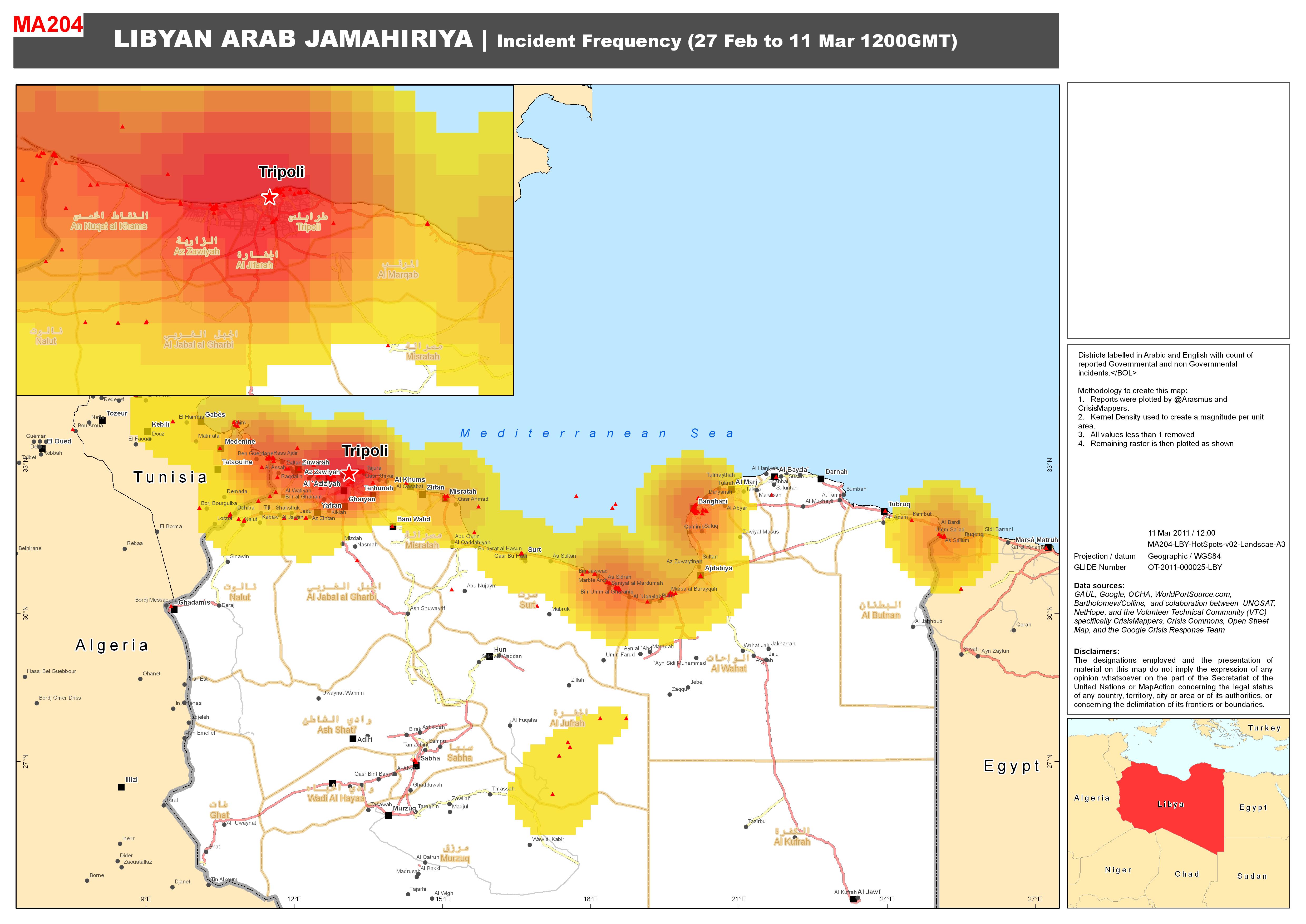
Districts labelled in Arabic and English with count of reported Government and non Governmental incidents. Methodology to crete this map - 1) Reports were plotted by @Arasmus and Crisis...
Source: Libya: Complex - Incident Frequency (27 Feb to 11 Mar 1200GMT)
Additional Information
| Field | Value |
|---|---|
| Data last updated | July 4, 2016 |
| Metadata last updated | July 4, 2016 |
| Created | July 4, 2016 |
| Format | JPEG |
| License | License not specified |
| Has views | True |
| Id | e5d93fa5-cba3-4fdb-aa2d-910f2c738228 |
| On same domain | True |
| Package id | 4ab37250-14f4-4f75-8c8e-d06948acafe5 |
| Revision id | 017f4c2e-f03f-46b1-9a75-21a2dad9acef |
| State | active |
| Url type | upload |