MA011-LCA-Shelter-A3-v04-300dpi.jpg
From the dataset abstract
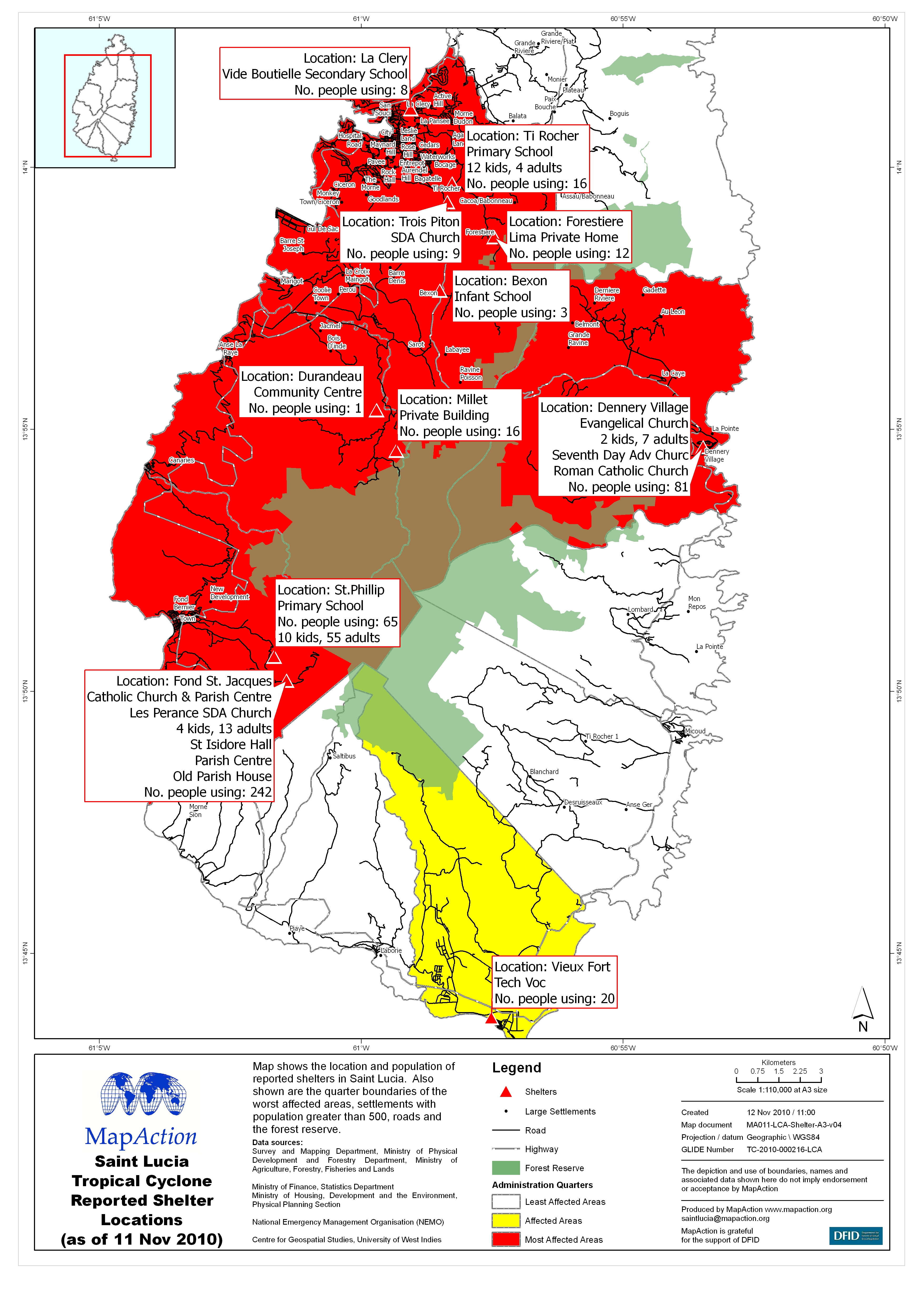
Map shows the location and population of reported shelters in Saint Lucia. Also shown are the quarter boundaries of the worst affected areas, settlements with population greater than 500,...
Source: Saint Lucia Tropical Cyclone Reported Shelter Locations (as of 11 Nov 2010)
Additional Information
| Field | Value |
|---|---|
| Data last updated | July 4, 2016 |
| Metadata last updated | July 4, 2016 |
| Created | July 4, 2016 |
| Format | JPEG |
| License | License not specified |
| Has views | True |
| Id | c8429696-07bf-4369-a4c2-3c2677f41abd |
| On same domain | True |
| Package id | 377893d0-e333-4314-b89e-ab486656e85f |
| Revision id | c655fc84-1f9a-4aa0-a478-db17b9b033ea |
| State | active |
| Url type | upload |