MA016G-LCA-TransportSectorDamage_MapBook-A3-v01 ...
From the dataset abstract
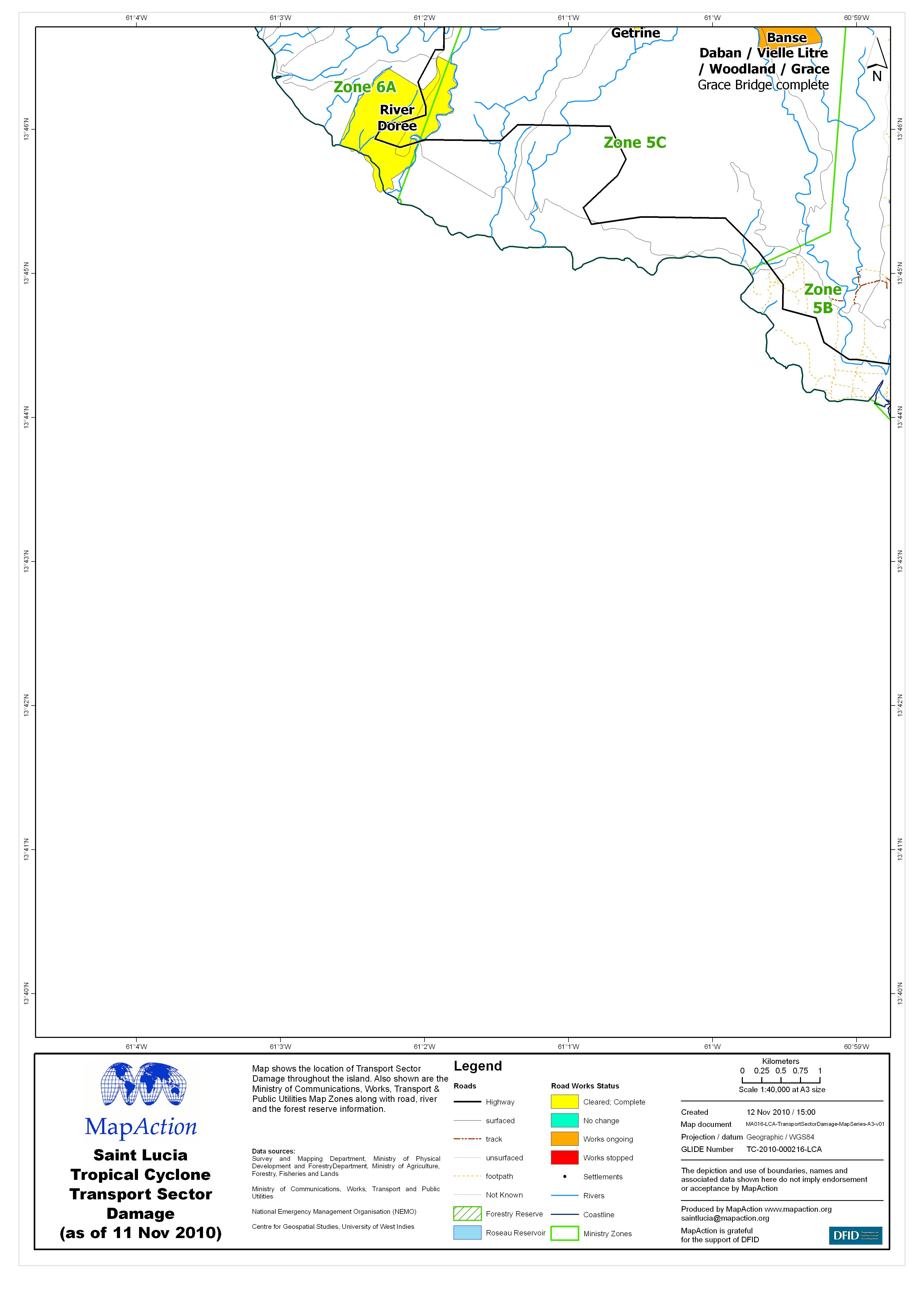
Map shows the location of Transport Sector Damage throughout the island. Also shown are the Ministry of Communications, Works, Transport & Public Utilities Map Zones along with road,...
Source: Saint Lucia Tropical Cyclone Transport Sector Damage (as of 11 Nov 2010) - Map MA016G
Additional Information
| Field | Value |
|---|---|
| Data last updated | July 4, 2016 |
| Metadata last updated | July 4, 2016 |
| Created | July 4, 2016 |
| Format | JPEG |
| License | License not specified |
| Has views | True |
| Id | 0342987f-7392-4efe-b8ba-4bfd23986db4 |
| On same domain | True |
| Package id | 8821a02d-8382-4b05-93fe-46a901181c4c |
| Revision id | 8c827cf2-2925-47a8-b317-eeff5944d26e |
| State | active |
| Url type | upload |