MA011-LCA-Shelter-A3-v01-300dpi.jpg
From the dataset abstract
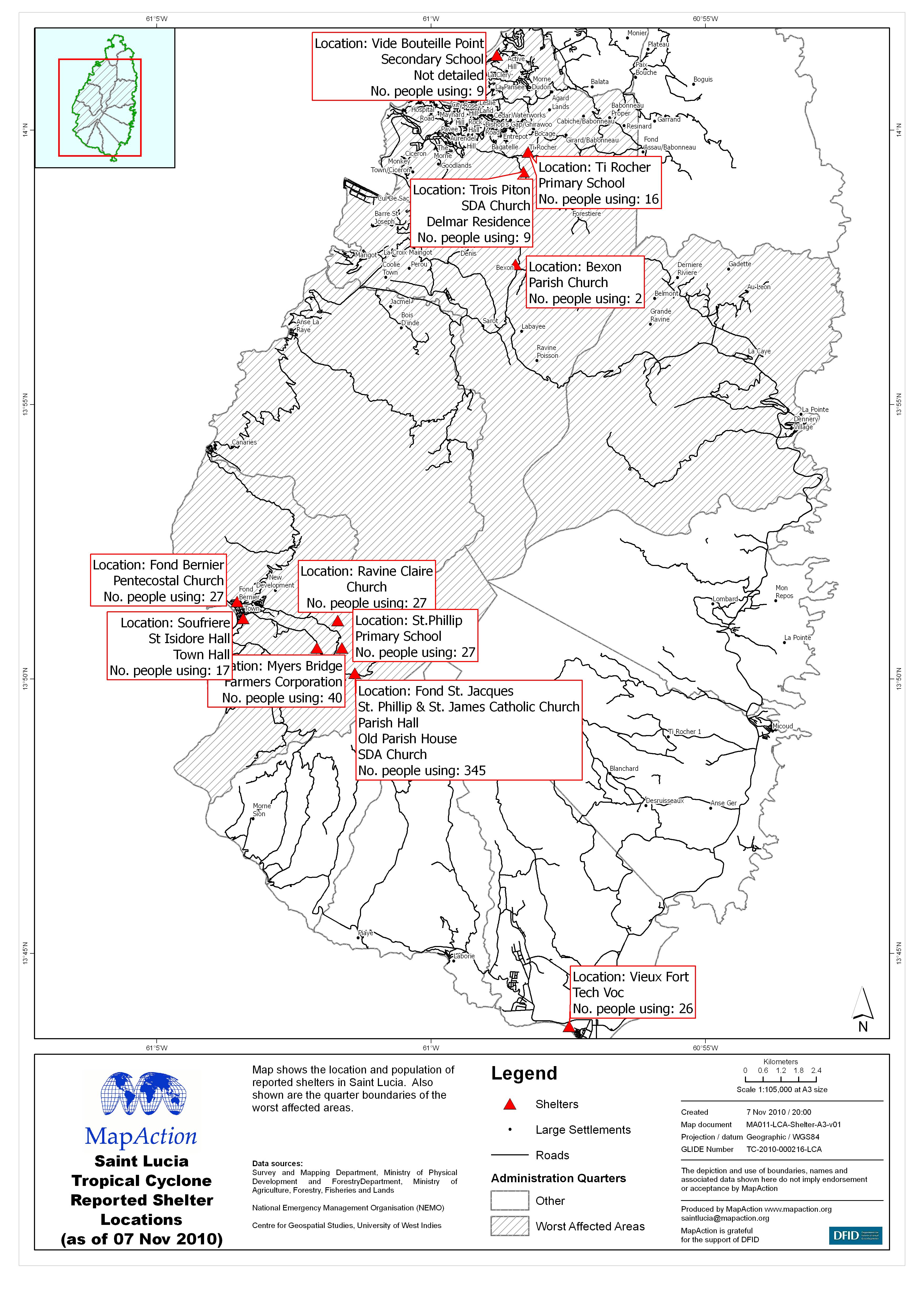
Map shows the location and population of reported shelters in Saint Lucia. Also shown are the quarter boundaries of the worst affected areas.
Source: Saint Lucia Tropical Cyclone Reported Shelter Locations (as of 07 Nov 2010)
Additional Information
| Field | Value |
|---|---|
| Data last updated | July 4, 2016 |
| Metadata last updated | July 4, 2016 |
| Created | July 4, 2016 |
| Format | JPEG |
| License | License not specified |
| Has views | True |
| Id | de7de580-dc4a-49a5-a9ea-c3f061a1b94e |
| On same domain | True |
| Package id | 37531938-675d-4016-920c-4eb9f21e52cb |
| Revision id | f614e5ba-6f73-41b0-b8ba-e86aa4cf8468 |
| State | active |
| Url type | upload |