MA008-LCA-LandSlide Areas-A3-v01-300dpi.jpg
From the dataset abstract
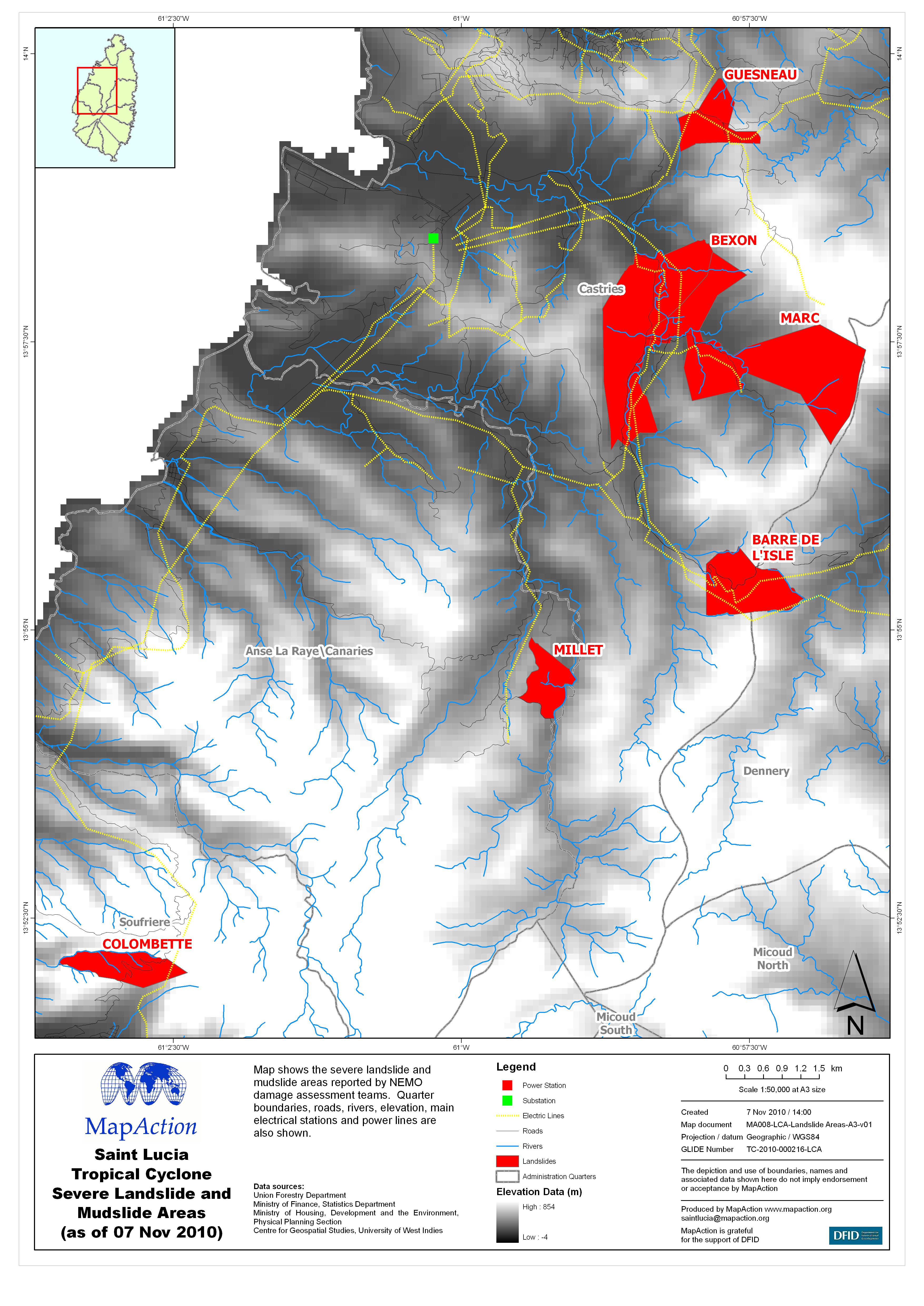
Map shows the severe landslide and mudslide areas reported by NEMO damage assessment teams. Quarter boundaries, roads, rivers, elevation, main electrical stations and power lines are also...
Source: Saint Lucia Tropical Cyclone Severe Landslide and Mudslide Areas (as of 07 Nov 2010)
Additional Information
| Field | Value |
|---|---|
| Data last updated | July 4, 2016 |
| Metadata last updated | July 4, 2016 |
| Created | July 4, 2016 |
| Format | JPEG |
| License | License not specified |
| Has views | True |
| Id | 5f1eb952-e325-470f-b7cd-cee45ae33992 |
| On same domain | True |
| Package id | 31344c40-9d84-422d-bb7c-280f5dd5d574 |
| Revision id | 1ef6ae9f-c416-4c6f-8dda-315ccf84367c |
| State | active |
| Url type | upload |