MA003-LCA-Fond St Jacques ...
From the dataset abstract
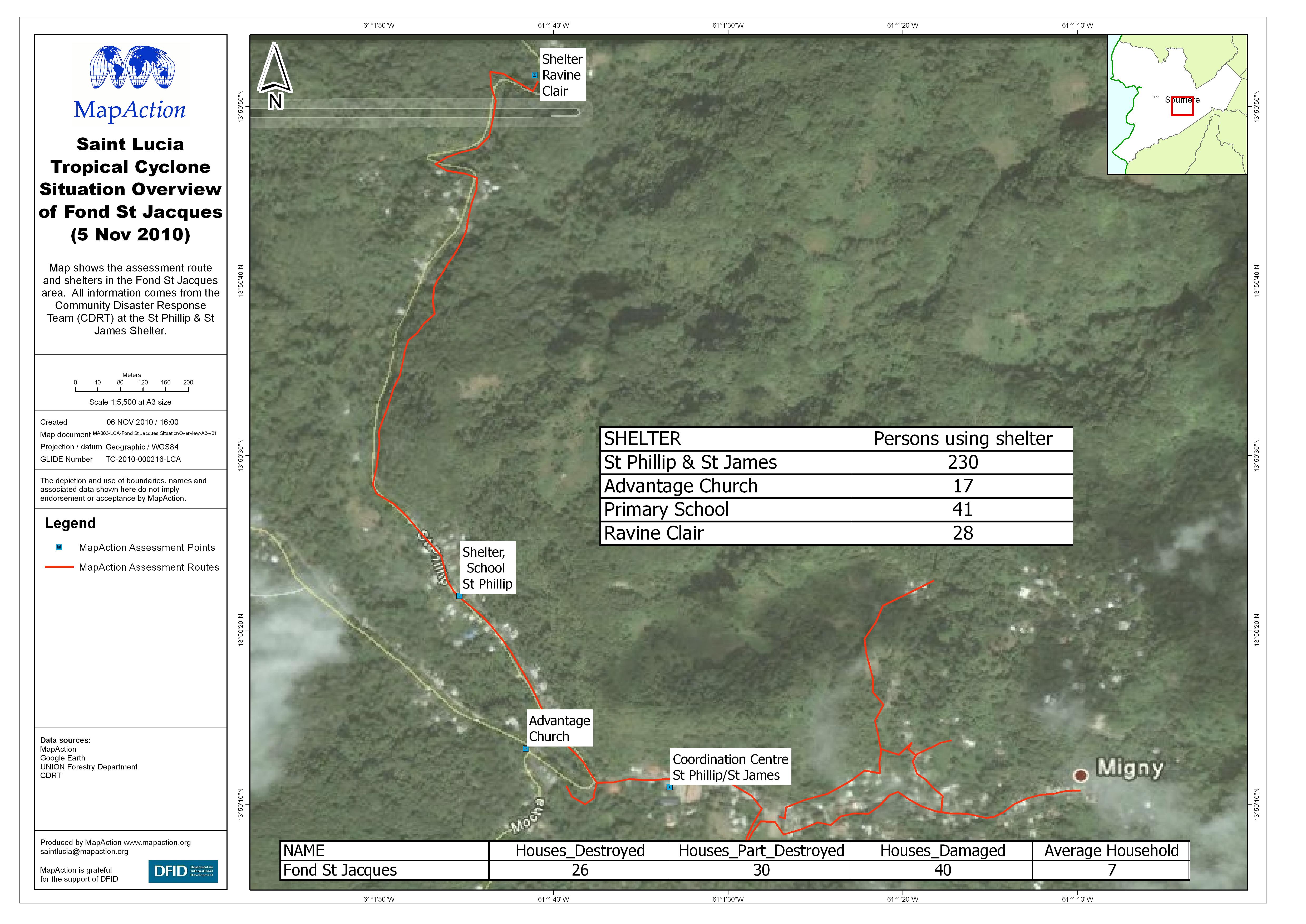
Map shows the assessment route and shelters in the Fond St Jacques area. All information comes from the Community Disaster Response Team (CDRT) at the St Phillip & St James Shelter.
Source: Saint Lucia Tropical Cyclone Situation Overview of Fond St Jacques (5 Nov 2010)
Additional Information
| Field | Value |
|---|---|
| Data last updated | July 4, 2016 |
| Metadata last updated | July 4, 2016 |
| Created | July 4, 2016 |
| Format | JPEG |
| License | License not specified |
| Has views | True |
| Id | b24fb6d3-f0b9-4a7c-975e-86454ee07f29 |
| On same domain | True |
| Package id | 1329bf05-3b0f-422c-9a58-3d044d17b52a |
| Revision id | bc983bc7-ae1c-42e7-b8a8-9d219ddf4e78 |
| State | active |
| Url type | upload |