MA001-LCA-SituationOverview-A3-v01-300dpi.jpg
From the dataset abstract
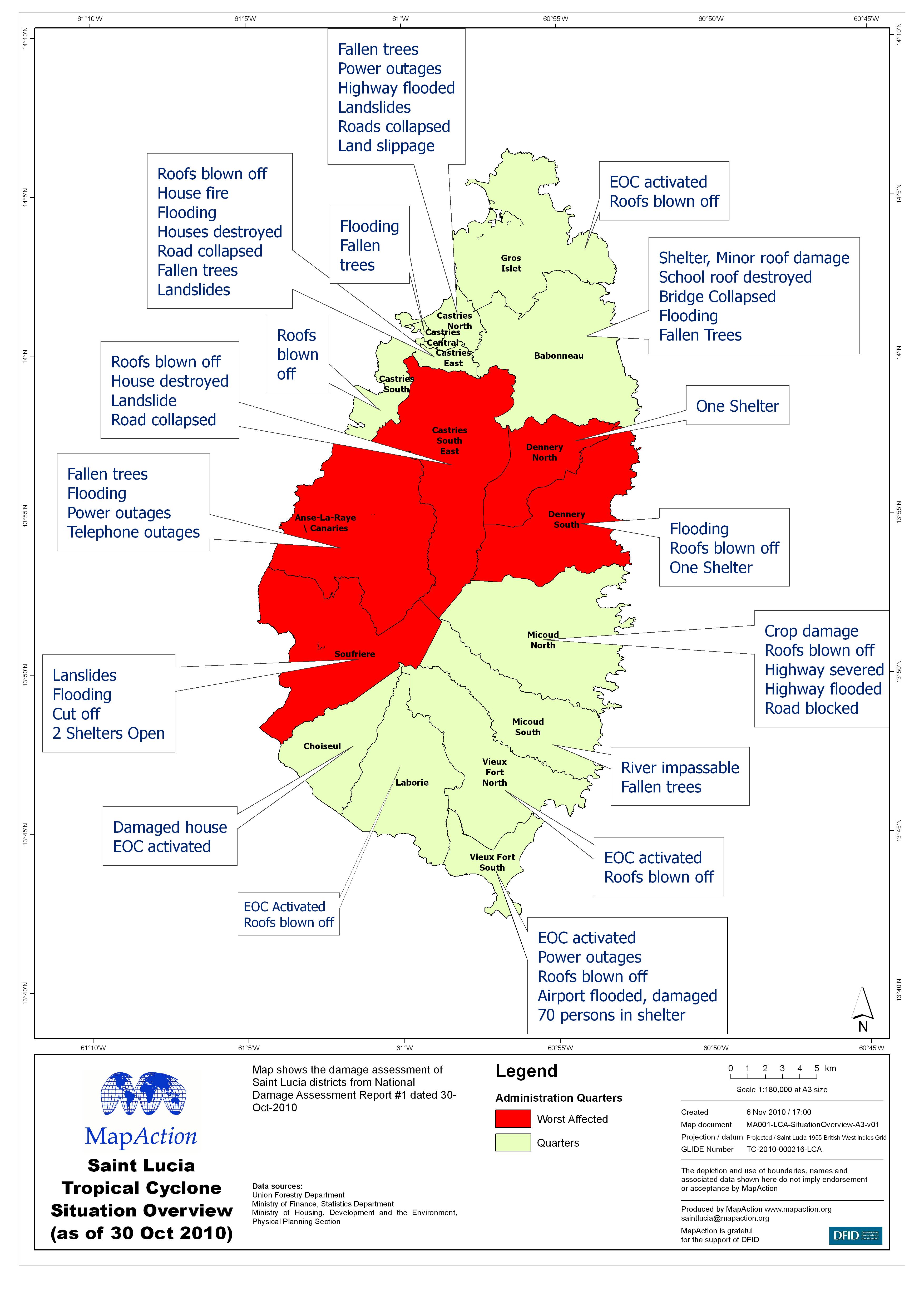
Map shows the damage assessment of Saint Lucia districts from National Damage Assessment Report #1 dated 30-Oct-2010
Source: Saint Lucia Tropical Cyclone Situation Overview (as of 30 Oct 2010)
Additional Information
| Field | Value |
|---|---|
| Data last updated | July 4, 2016 |
| Metadata last updated | July 4, 2016 |
| Created | July 4, 2016 |
| Format | JPEG |
| License | License not specified |
| Has views | True |
| Id | 2087a4f0-b58a-4f7e-9a54-c1563b3f377e |
| On same domain | True |
| Package id | 5cc6874c-2a7c-47bf-99f9-e69af1ca9ecb |
| Revision id | 3b38addc-73e1-49e9-93ee-a9122d369de2 |
| State | active |
| Url type | upload |