SAFER_A1_Mapsheet_Situationmap_Area1_T12_V2_75p ...
From the dataset abstract
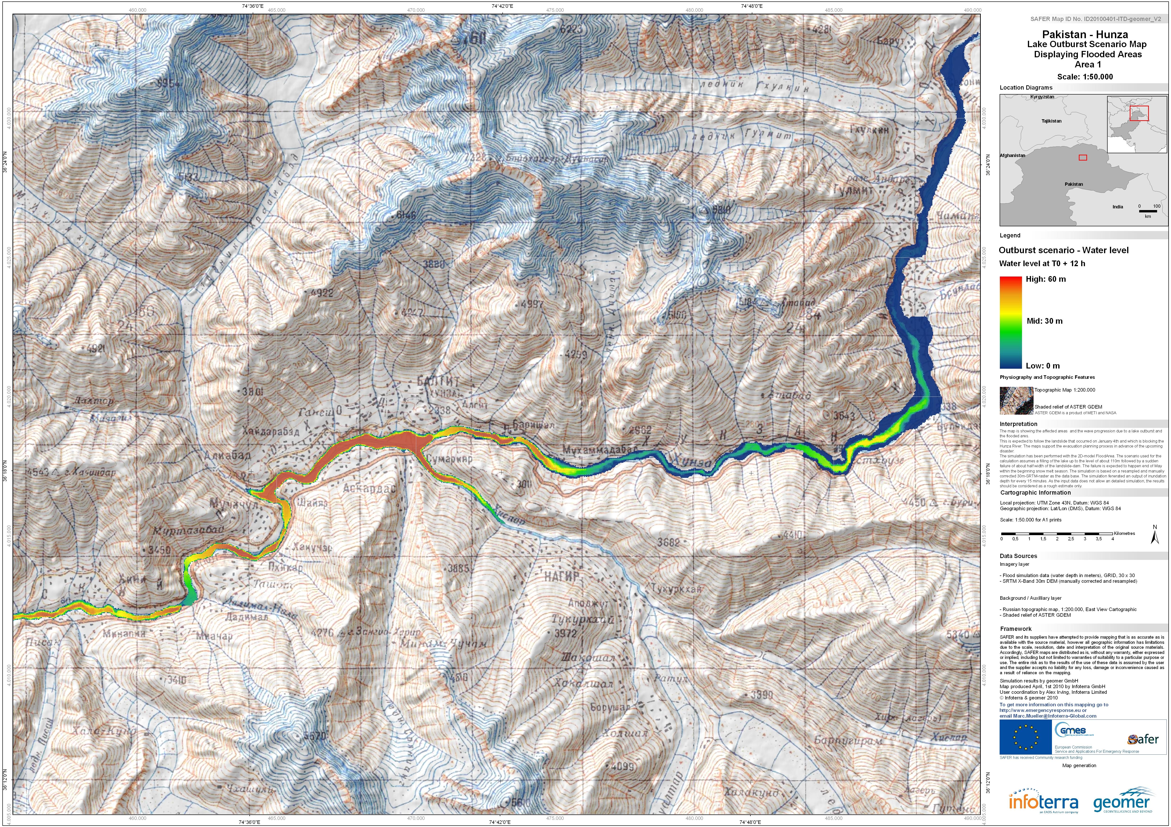
The map is showing the affected areas and the wave progression due to a lake outburst and flooded area.This is expected to follow the landslide that occured on January 4th and which is...
Source: Pakistan - Hunza: Lake Outburst Scenario Map Displaying Flooded Areas. Area 1. T+12.
Additional Information
| Field | Value |
|---|---|
| Data last updated | July 4, 2016 |
| Metadata last updated | July 4, 2016 |
| Created | July 4, 2016 |
| Format | JPEG |
| License | License not specified |
| Has views | True |
| Id | 928033f9-f16c-4603-8561-e1c60ad7f4f3 |
| On same domain | True |
| Package id | 90f2d3b9-f3a6-4ed7-9bb2-428f0011ebd9 |
| Revision id | 7b2ab52b-48a2-4a56-8789-bd0b3bc78751 |
| State | active |
| Url type | upload |