SAFER_A1_Mapsheet_Situationmap_Area2_T42_V2_75p ...
From the dataset abstract
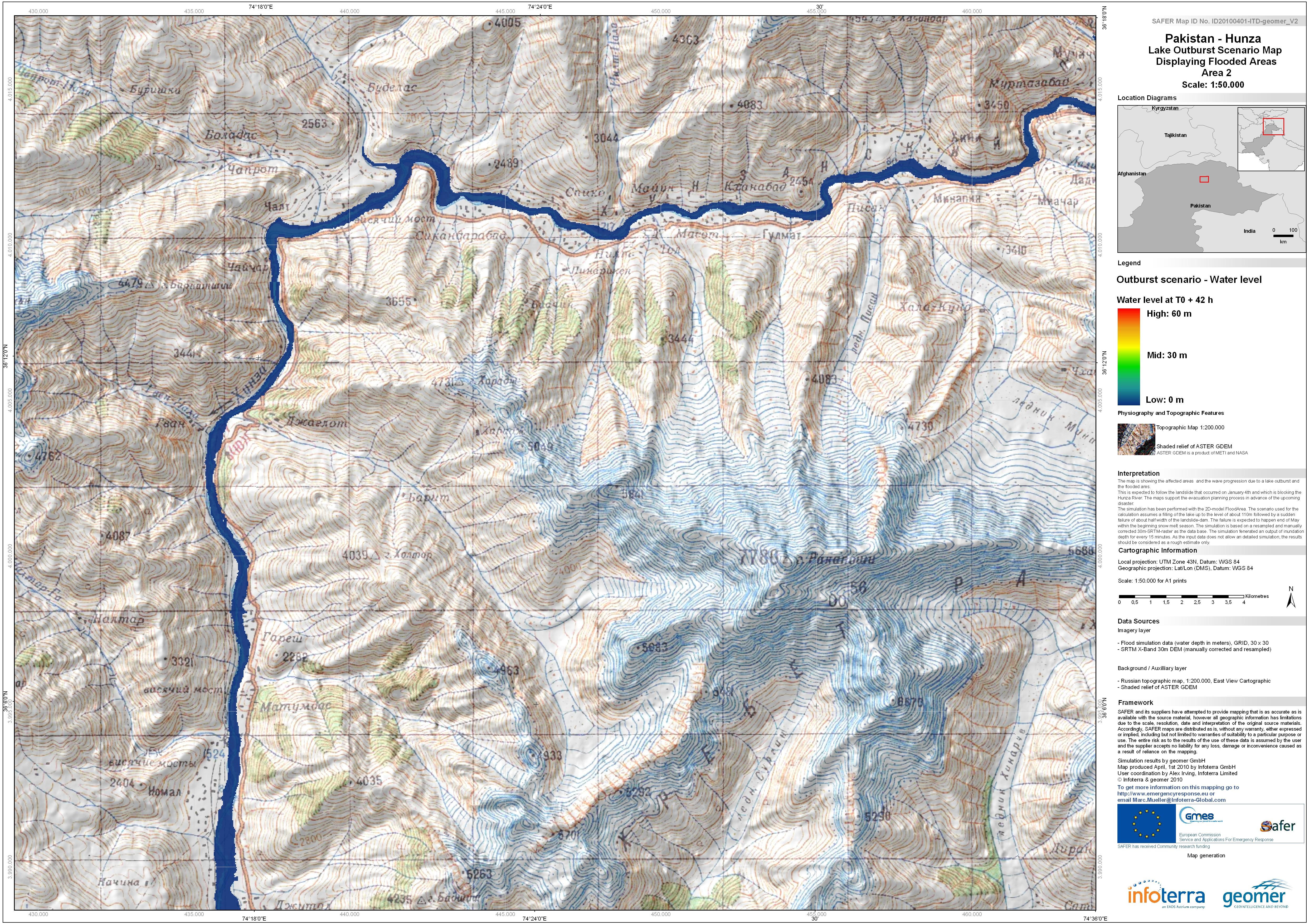
The map is showing the affected areas and the wave progression due to a lake outburst and flooded area.This is expected to follow the landslide that occured on January 4th and which is...
Source: Pakistan - Hunza: Lake Outburst Scenario Map Displaying Flooded Areas. Area 2. T+42.
Additional Information
| Field | Value |
|---|---|
| Data last updated | July 4, 2016 |
| Metadata last updated | July 4, 2016 |
| Created | July 4, 2016 |
| Format | JPEG |
| License | License not specified |
| Has views | True |
| Id | dbf04941-7907-4531-8734-e30f32fddad9 |
| On same domain | True |
| Package id | 34e5af0f-3429-4034-9886-d1cdd65f86c2 |
| Revision id | ba263b0d-5970-4099-99a4-91a948512117 |
| State | active |
| Url type | upload |