thumbnail.png
From the dataset abstract
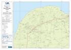
General orientation map series showing UN locations, roads data, field hospitals and Communes.
Source: Haiti Reference Map - Léogâne
Additional Information
| Field | Value |
|---|---|
| Data last updated | July 28, 2016 |
| Metadata last updated | July 28, 2016 |
| Created | July 28, 2016 |
| Format | PNG |
| License | License not specified |
| Has views | True |
| Id | 60801e0d-bf4f-4982-be4b-1c977935d2b4 |
| On same domain | True |
| Package id | 26e1ab4e-fefb-4bb8-a817-bd5d1d4e6448 |
| Position | 2 |
| Revision id | 5a06f8fb-0843-453f-ad86-dbaf4f303dd8 |
| State | active |
| Url type | upload |