MA114_hti_leoganetowndetail_v2.jpg
From the dataset abstract
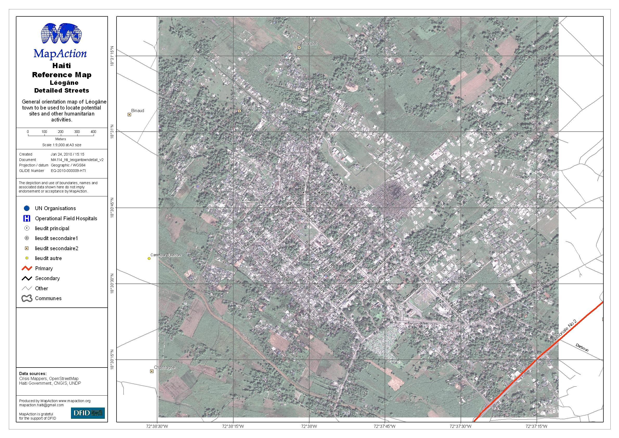
General map of Léogâne town, with some street names, for navigation, locating potential sites, and other humanitarian activities.
Source: Haiti: Léogâne Street Map
Additional Information
| Field | Value |
|---|---|
| Data last updated | July 4, 2016 |
| Metadata last updated | July 4, 2016 |
| Created | July 4, 2016 |
| Format | JPEG |
| License | License not specified |
| Has views | True |
| Id | eeca2649-4b0a-45ad-b03b-ba966f371a31 |
| On same domain | True |
| Package id | 493aabd1-9f60-49f2-a0d6-710a0aa145c9 |
| Revision id | 1965cddf-12e0-4be4-aeaf-957687fe2ade |
| State | active |
| Url type | upload |