MA109-ref-PadangPariaman-A3-v01-300dpi.jpg
From the dataset abstract
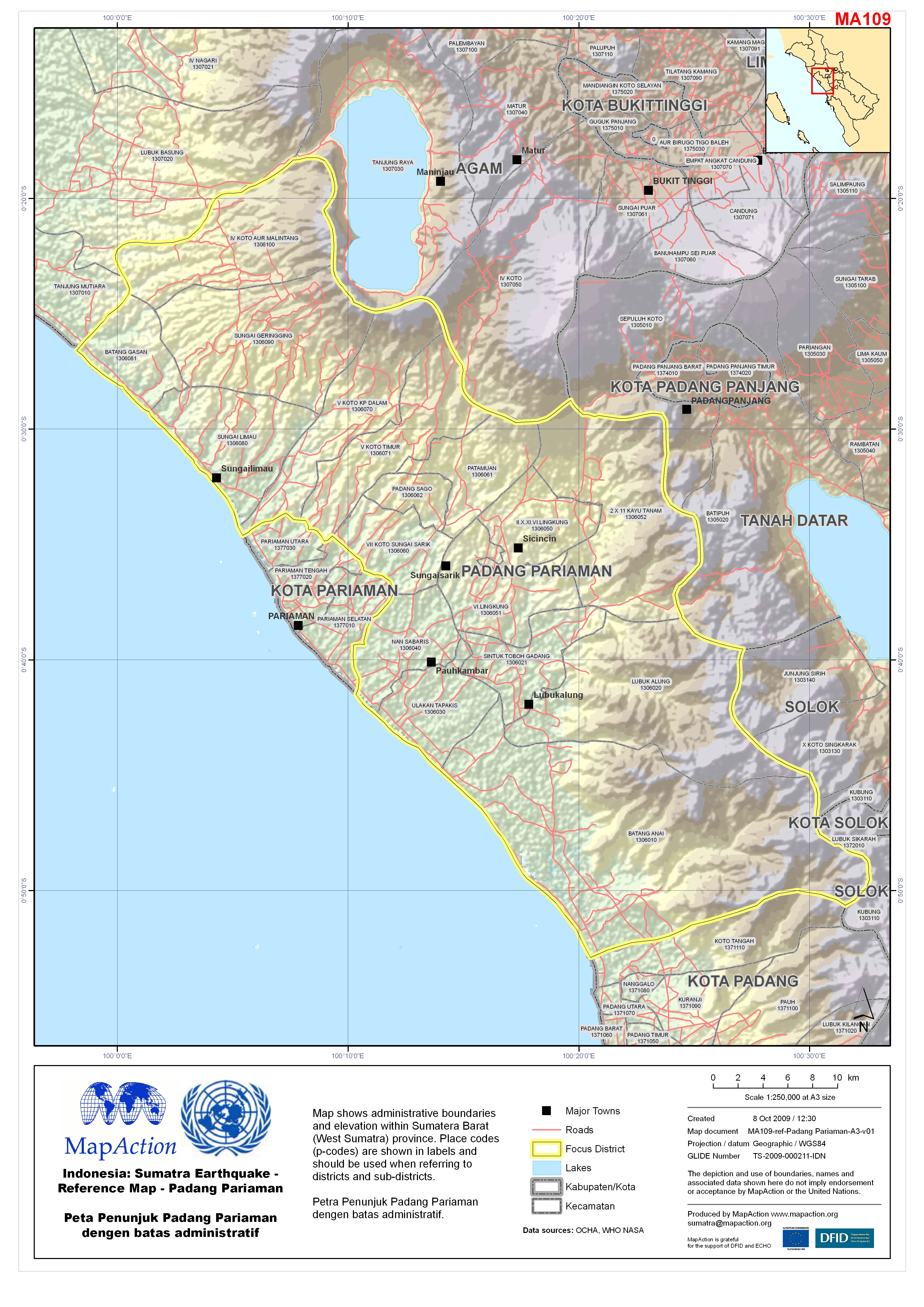
Map shows administrative boundaries and elevation within Sumatera Barat (West Sumatra) province. Place codes (p-codes) are shown in labels and should be used when referring to districts...
Additional Information
| Field | Value |
|---|---|
| Data last updated | July 4, 2016 |
| Metadata last updated | July 4, 2016 |
| Created | July 4, 2016 |
| Format | JPEG |
| License | License not specified |
| Has views | True |
| Id | 1b130af7-9503-44ca-bbab-bb19bf9d0196 |
| On same domain | True |
| Package id | 1b8ad0c7-7c62-422d-aaa9-25eaf9f0ec38 |
| Revision id | f51a6d35-f6ce-4003-9c08-11231c5ab76f |
| State | active |
| Url type | upload |