MA024-WASH-3W-6Oct09-A3-v02-300dpi.jpg
From the dataset abstract
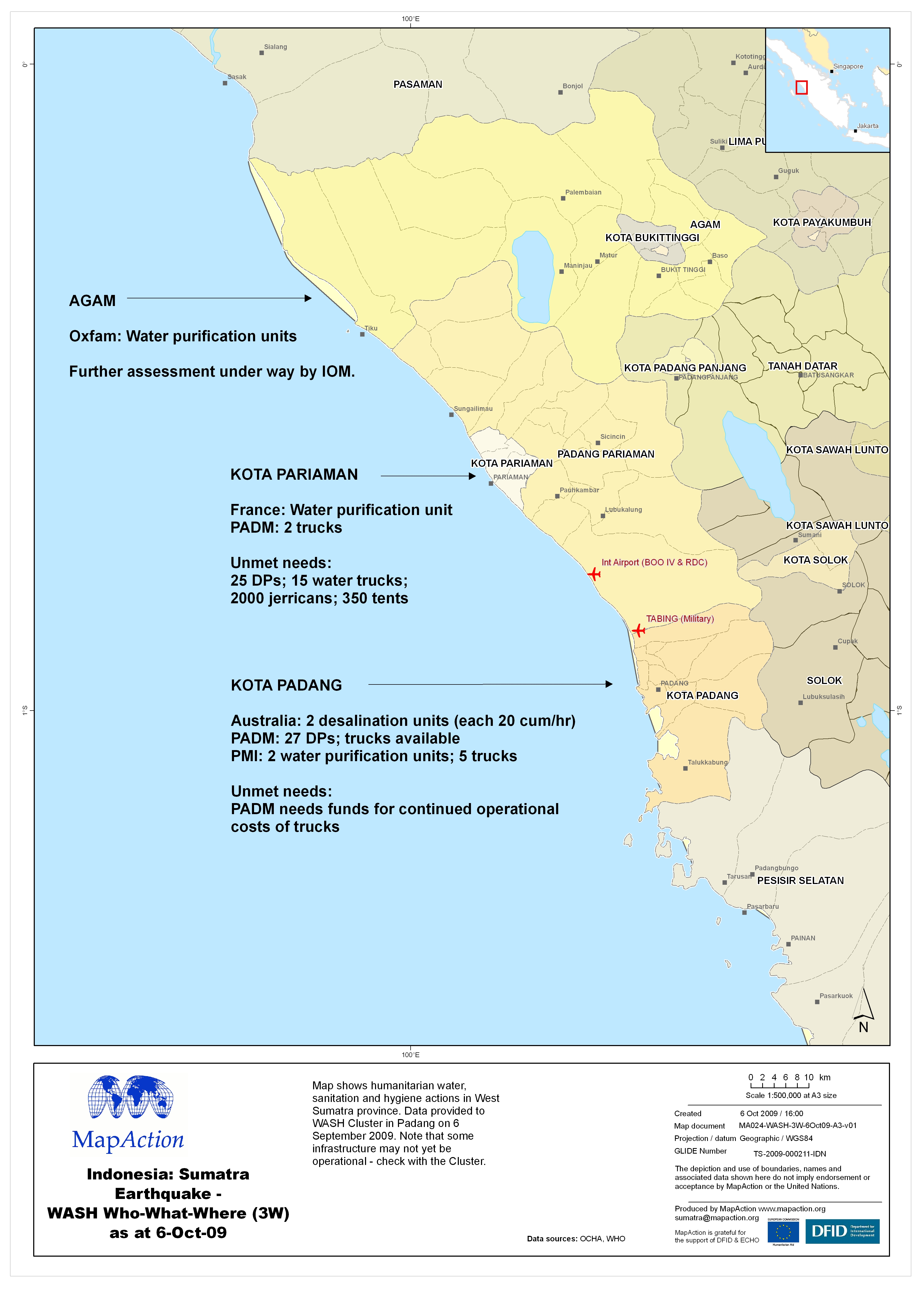
Map shows humanitarian water, sanitation and hygiene actions in West Sumatra province. Data provided to WASH Cluster in Padang on 6 September 2009. Note that some infrastructure may not...
Source: Indonesia: Sumatra Earthquake - WASH Who-What-Where (3W) as at 6-Oct-09
Additional Information
| Field | Value |
|---|---|
| Data last updated | July 4, 2016 |
| Metadata last updated | July 4, 2016 |
| Created | July 4, 2016 |
| Format | JPEG |
| License | License not specified |
| Has views | True |
| Id | 3675d13a-306e-47da-9618-635ca4cdcf26 |
| On same domain | True |
| Package id | 1331855c-0548-4d5d-8c8a-7bef1009fe03 |
| Revision id | ace5b9ba-05ec-4efa-9dcf-f2b59c0c99ef |
| State | active |
| Url type | upload |