thumbnail.png
From the dataset abstract
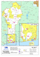
Military or civilian fire stations in Benin. The map shows also where fire stations have recently closed or are planned. Note that Civilian fire stations are all run with NGO and commune...
Source: Benin: Flooding - Fire Stations (as at 20 July 2009)
Additional Information
| Field | Value |
|---|---|
| Data last updated | July 28, 2016 |
| Metadata last updated | July 28, 2016 |
| Created | July 28, 2016 |
| Format | PNG |
| License | License not specified |
| Has views | True |
| Id | 4fd10801-5710-4124-8206-f85b60152c27 |
| On same domain | True |
| Package id | 517e7f25-9921-49cb-a9fd-5a2ee5327342 |
| Position | 2 |
| Revision id | e731e514-7579-4c72-827a-681bcfabbe56 |
| State | active |
| Url type | upload |