MA010-Benin-PopDensity-v01-A3-P-300dpi.jpg
From the dataset abstract
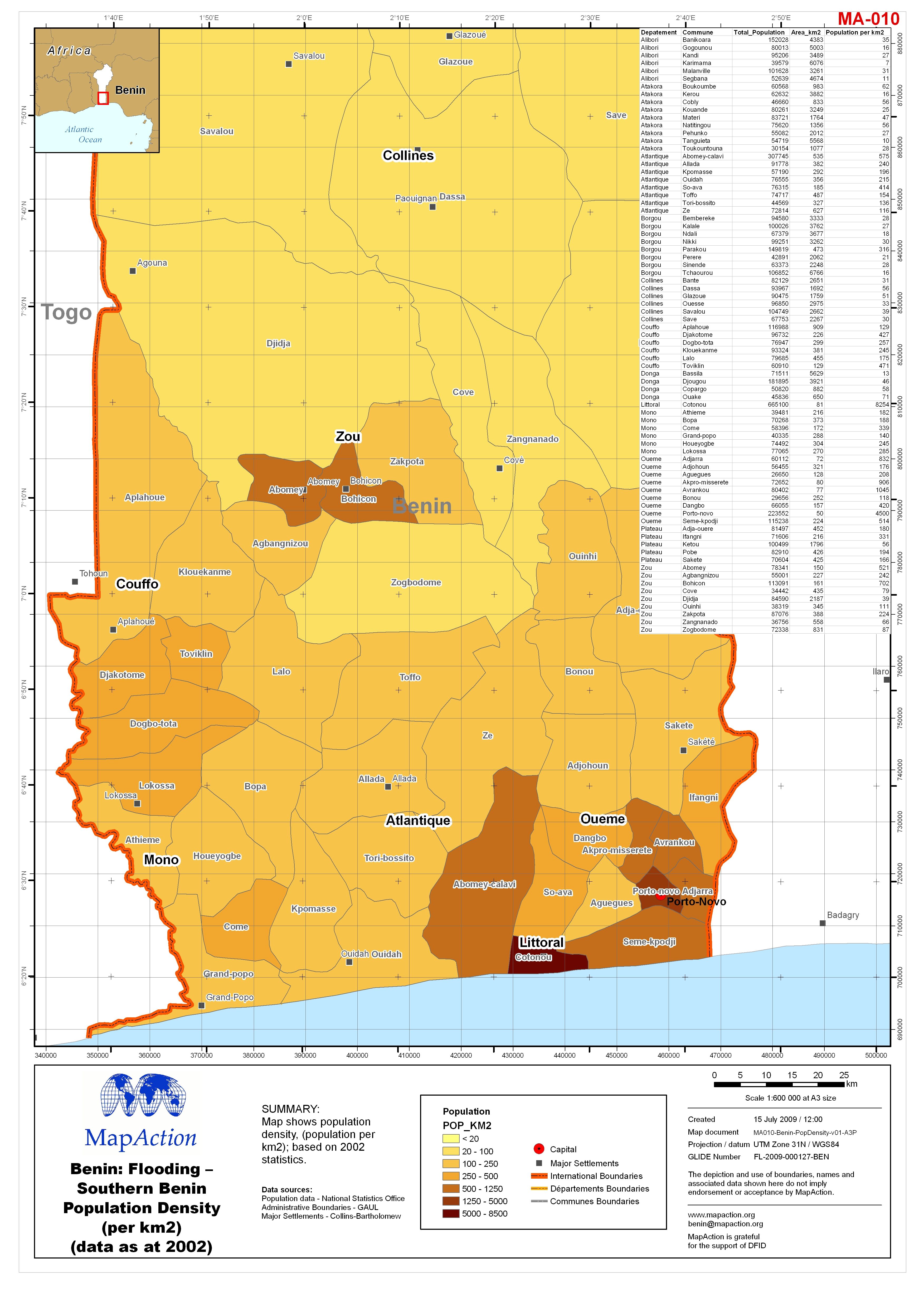
Map shows population density, (population per km2); based on 2002 statistics.
Source: Benin: Flooding - Southern Benin Population Density (per km2) (data as at 2002)
Additional Information
| Field | Value |
|---|---|
| Data last updated | July 4, 2016 |
| Metadata last updated | July 4, 2016 |
| Created | July 4, 2016 |
| Format | JPEG |
| License | License not specified |
| Has views | True |
| Id | 1103e7d2-7d06-4908-aa4f-579b9c56a496 |
| On same domain | True |
| Package id | cd232313-f6ed-428c-81e2-38a23f04e267 |
| Revision id | fb917a20-498f-4b95-bc14-39ac70f42f3c |
| State | active |
| Url type | upload |
