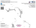
Skip to content
  • Log in

Latest maps and data

  • Cyclones: Fiji
  • Hurricanes: Guatemala
MapAction
  • Home
  • About us
    • Emergency response
    • Preparedness
    • Training
    • Our strategy
    • Our impact
    • Our values
    • Our team
    • Our funders
    • Our partners
    • Where we work
    • Our finances
    • Our supporters
    • Our history
    • Our governance
  • News
  • Blog
  • Maps and data
    • All maps and data
    • Example product catalogue
    • Other resources
  • Get Involved
    • Fundraise
    • Regular gifts
    • Corporate partnerships
    • Payroll giving
    • Ambassador programme
    • Trusts and foundations
    • Leave a gift in your will
    • Donation FAQs
    • Volunteer
    • Join us
    • Contact us
  • Donate
  • Locations
  • Events
    You are here:
  1. Home
  2. Maps and Data Home
  3. The Bahamas: Hurricane Dorian, ...
  • Datasets
  • About

1 dataset found

Licenses: License not specified Themes: Health Early Recovery Environmental Aspects Formats: JPEG

Filter Results
  • Who What Where activities / presence in affected area - Multi-cluster: As of ...

    Who, What, Where for Coordination - Multi-Cluster
    • JPEG
    • PDF
bhs-2019-09

The Bahamas: Hurricane Dorian, September 2019

Hurricane Dorian made landfall on the islands of Abaco and Grand Bahama in Northwest Bahamas. This storm has developed over the previous days into a slow moving and very... read more

Followers
0
Datasets
1
Event RSS

MapAction

  • Home page
  • About us
  • Our impact
  • Get Involved
  • Donate
  • Donation FAQs
  • Volunteer
  • Contact us
  • Privacy and cookies

Newsletter

Subscribe to our regular email updates

Subscribe

Your details will not be passed on and you can unsubscribe at any time.

Fundraising Regulator Registered charity 1126727; registered company limited by guarantee 6611408 (England and Wales)

Copyright © MapAction