-
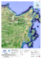
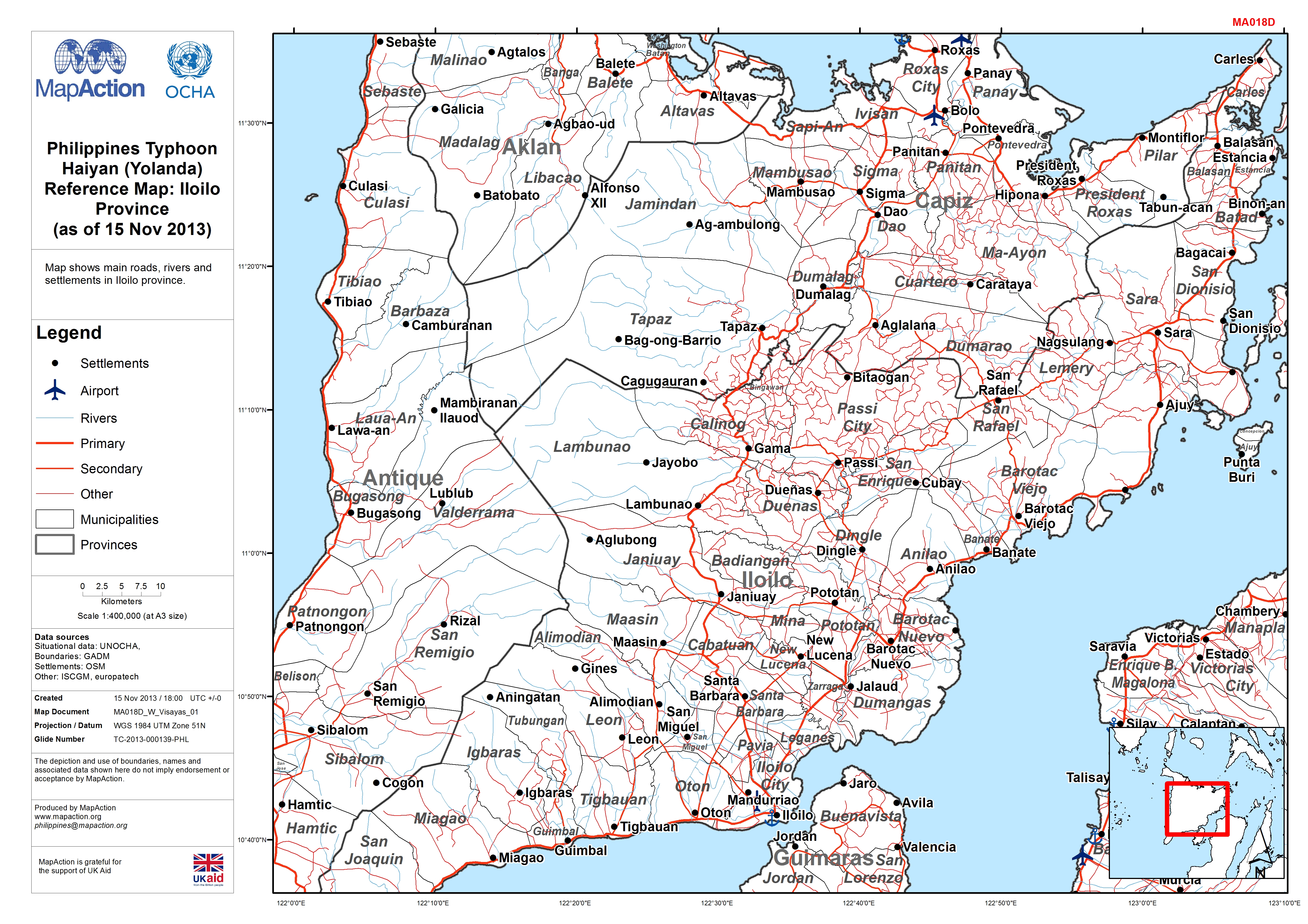
Philippines Typhoon Haiyan (Yolanda) Reference Map: Iloilo Province (as of 15...
Map shows main roads, rivers and settlements in Iloilo province. -

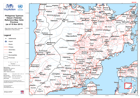
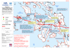
Philippines Typhoon Haiyan (Yolanda ) 3Ws (15-Nov-2013)
Map shows general locations of agencies. Information has been taken from sit reps, social media and VOSOCC and assessment group meeting. -
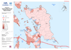
Philippines Typhoon Haiyan (Yolanda) Population Density and Medical Facilities
Map shows populaiton density and medical facilities. -

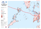
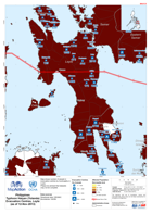
Philippines Typhoon Haiyan (Yolanda) Storm Surge and Medical Facilities
Map shows predicted storm surge levels based on actual storm track, and medical facilities. -
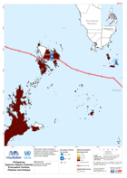
Philippines Typhoon Haiyan (Yolanda) Population density and Medical Facilities
Map shows population density and medical facilities. -
Philippines Typhoon Haiyan (Yolanda) Storm surge and Medical Facilities
Map shows predicted storm surge and medical facilities. -

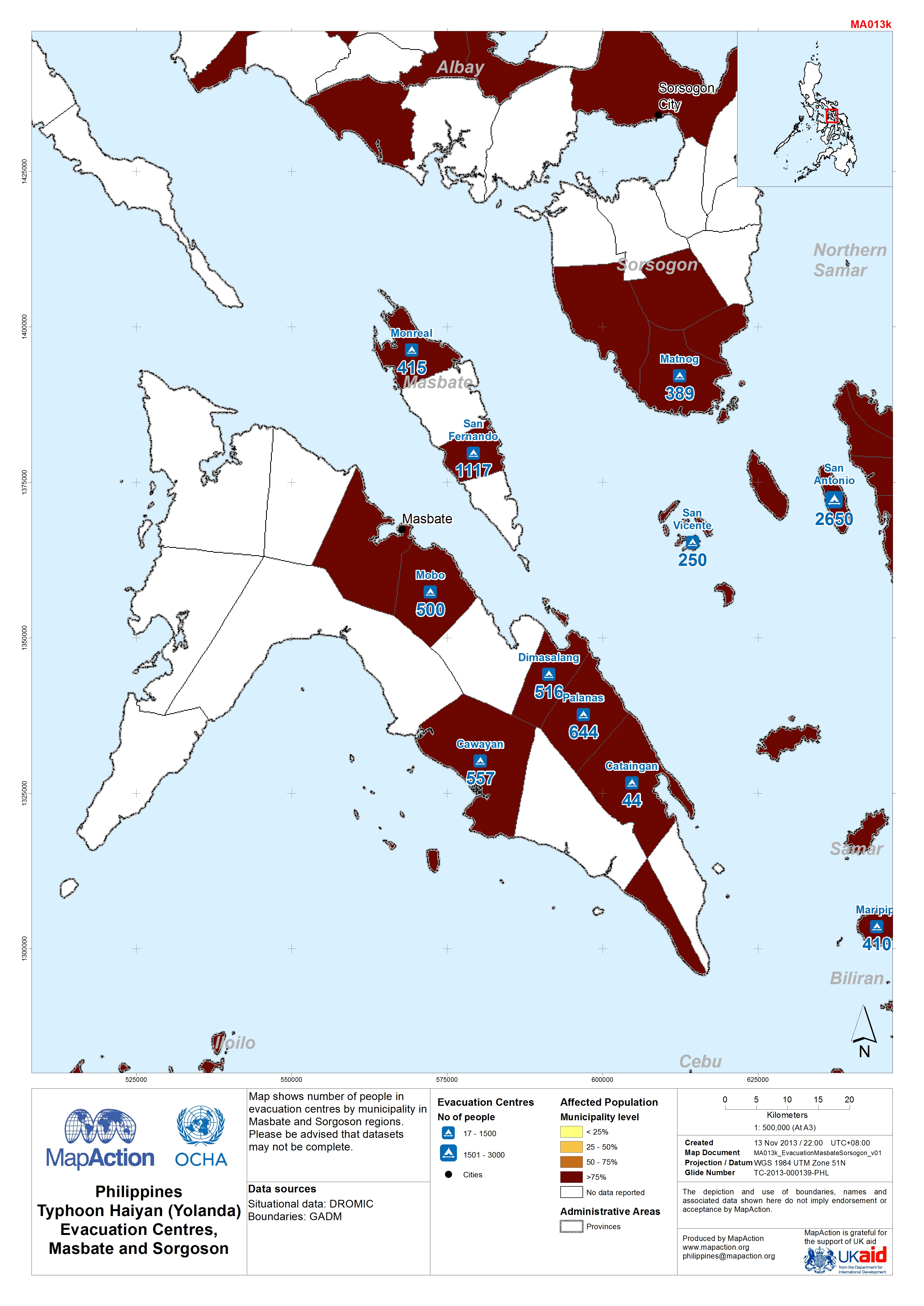
Philippines Typhoon Haiyan (Yolanda) Evacuation Centres in Masbate and Sorgos...
Map shows number of people in evacuation centres by municipality in Masbate and Sorgoson regions.Please be advised that datasets may not be complete. -
Philippines Typhoon Haiyan (Yolanda) Evacuation Centres in Palawan and Antiqu...
Map shows number of people in evacuation centres by municipality in Palawan and Antique regions.Please be advised that datasets may not be complete. -
Philippines Typhoon Haiyan (Yolanda) Evacuation Centres in Western Visayas (a...
Map shows number of people in evacuation centres by municipality in Western Visayas. Please be advised that datasets may not be complete. -

Philippines Typhoon Haiyan (Yolanda) Evacuation Centres in Central Visayas (a...
Map shows populations in evacuation centres by municipality in Central Visayas. Please be advised that datasets may not be complete. -

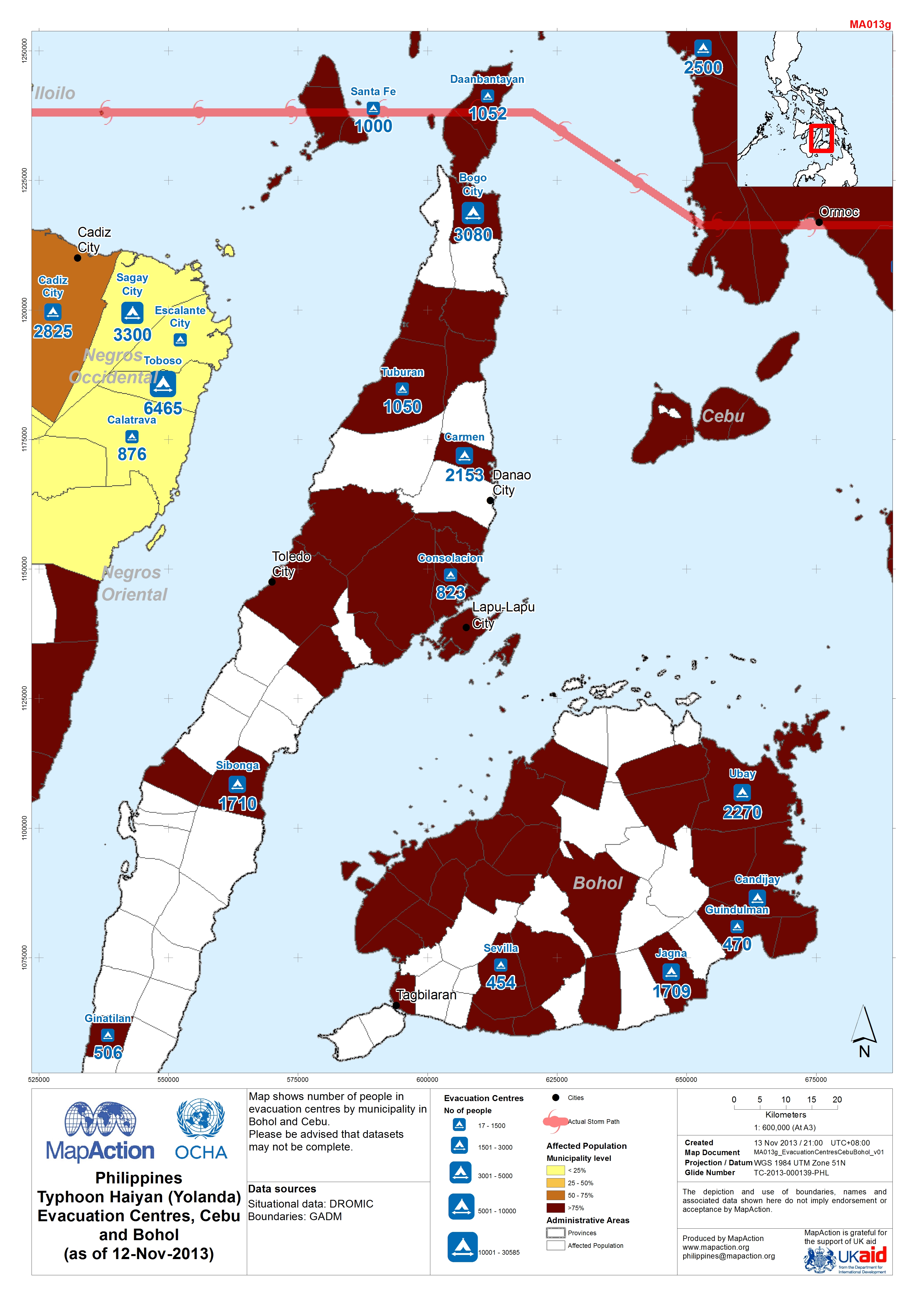
Philippines Typhoon Haiyan (Yolanda) Evacuation Centres in Cebu and Bohol (as...
Map shows number of people in evacuation centres by municipality in Bohol and Cebu. Please be advised that datasets may not be complete. -
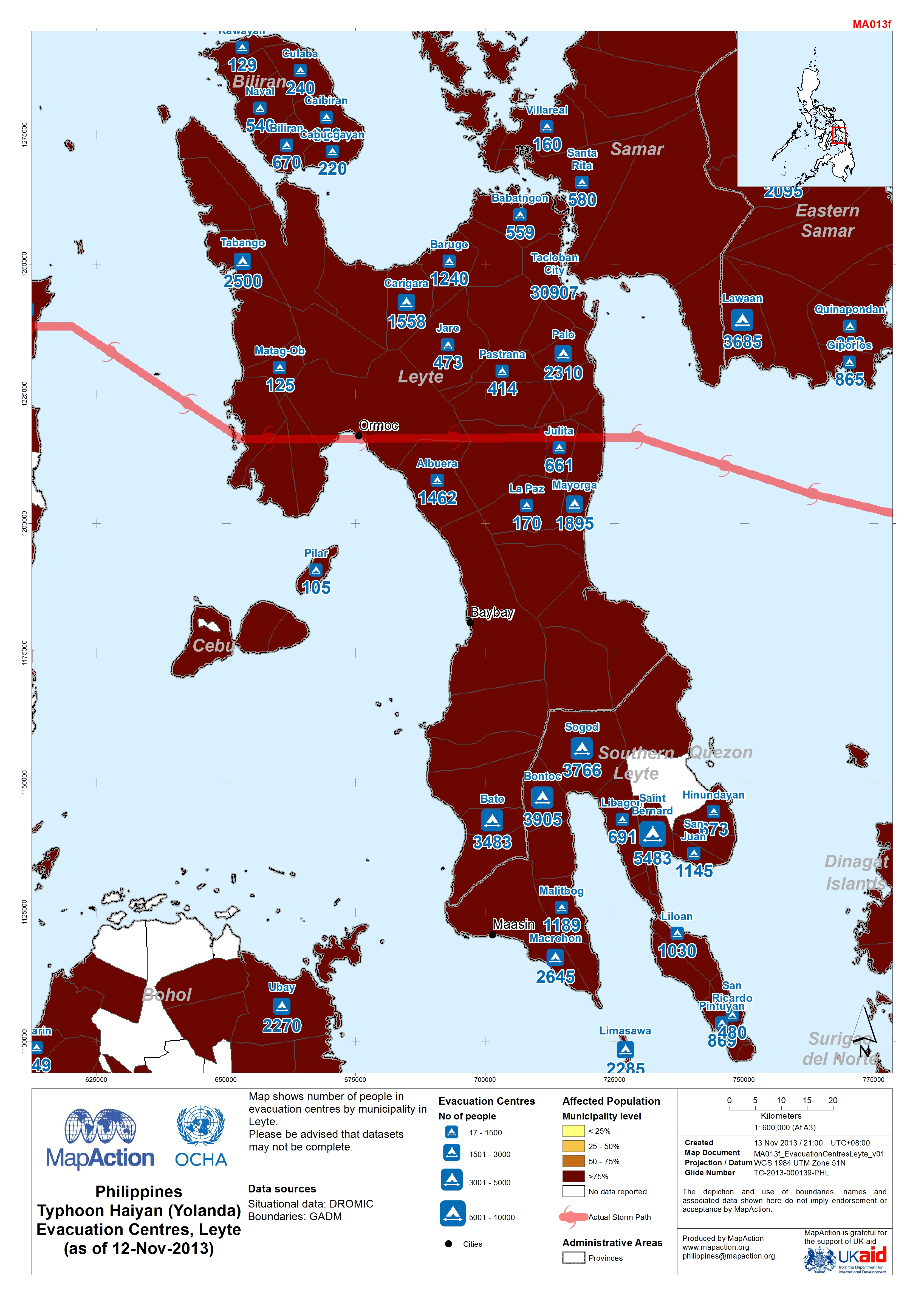
Philippines Typhoon Haiyan (Yolanda) Evacuation Centres in Leyte (as of 12 No...
Map shows number of people in evacuation centres by municipality in Leyte. Please be advised that datasets may not be complete. -
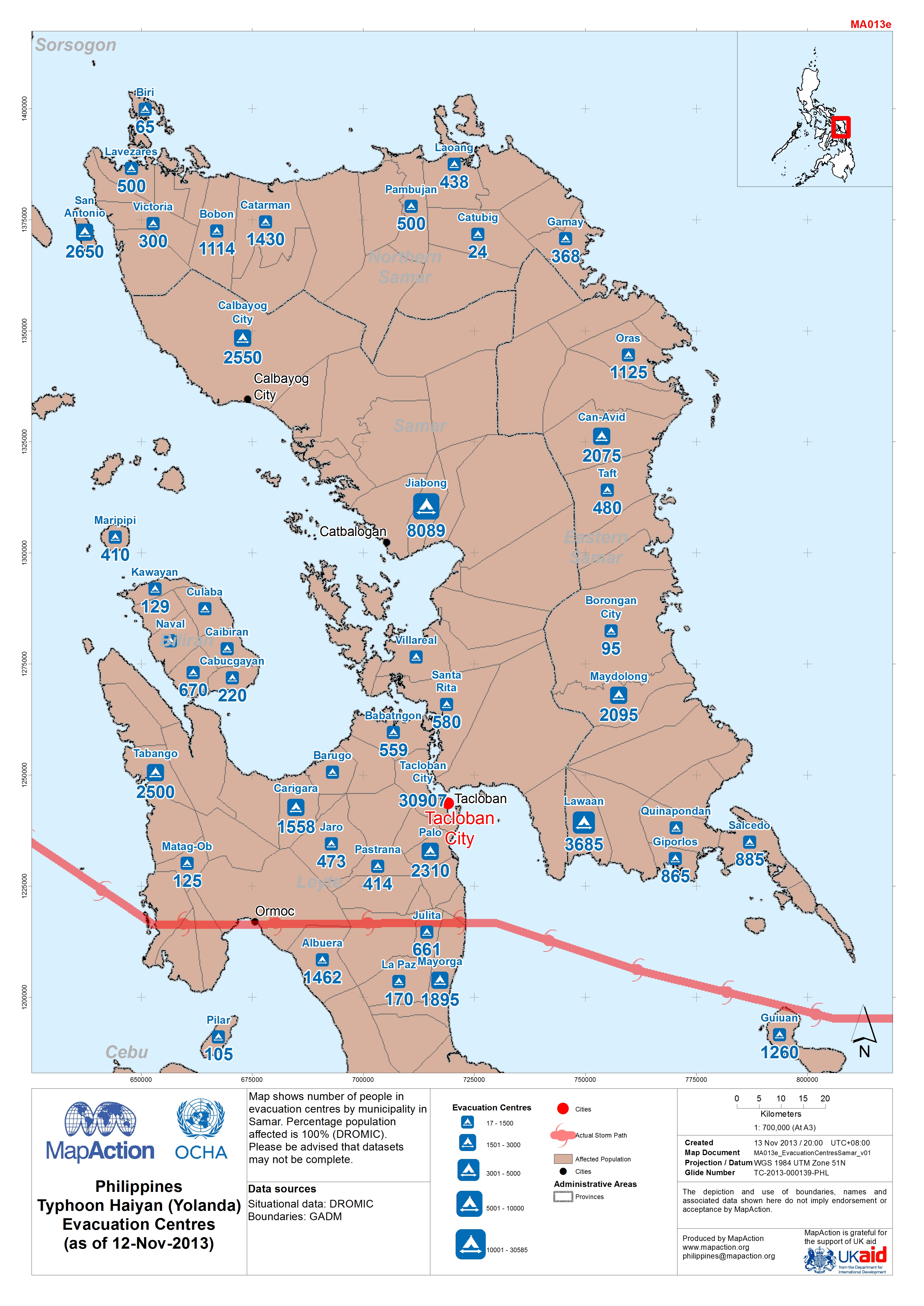
Philippines Typhoon Haiyan (Yolanda) Evacuation Centres in Samar (as of 12-No...
Map shows number of people in evacuation centres by municipality in Samar. Percentage population affected is 100% (DROMIC).Please be advised that datasets may not be complete. -
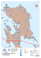
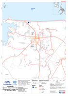
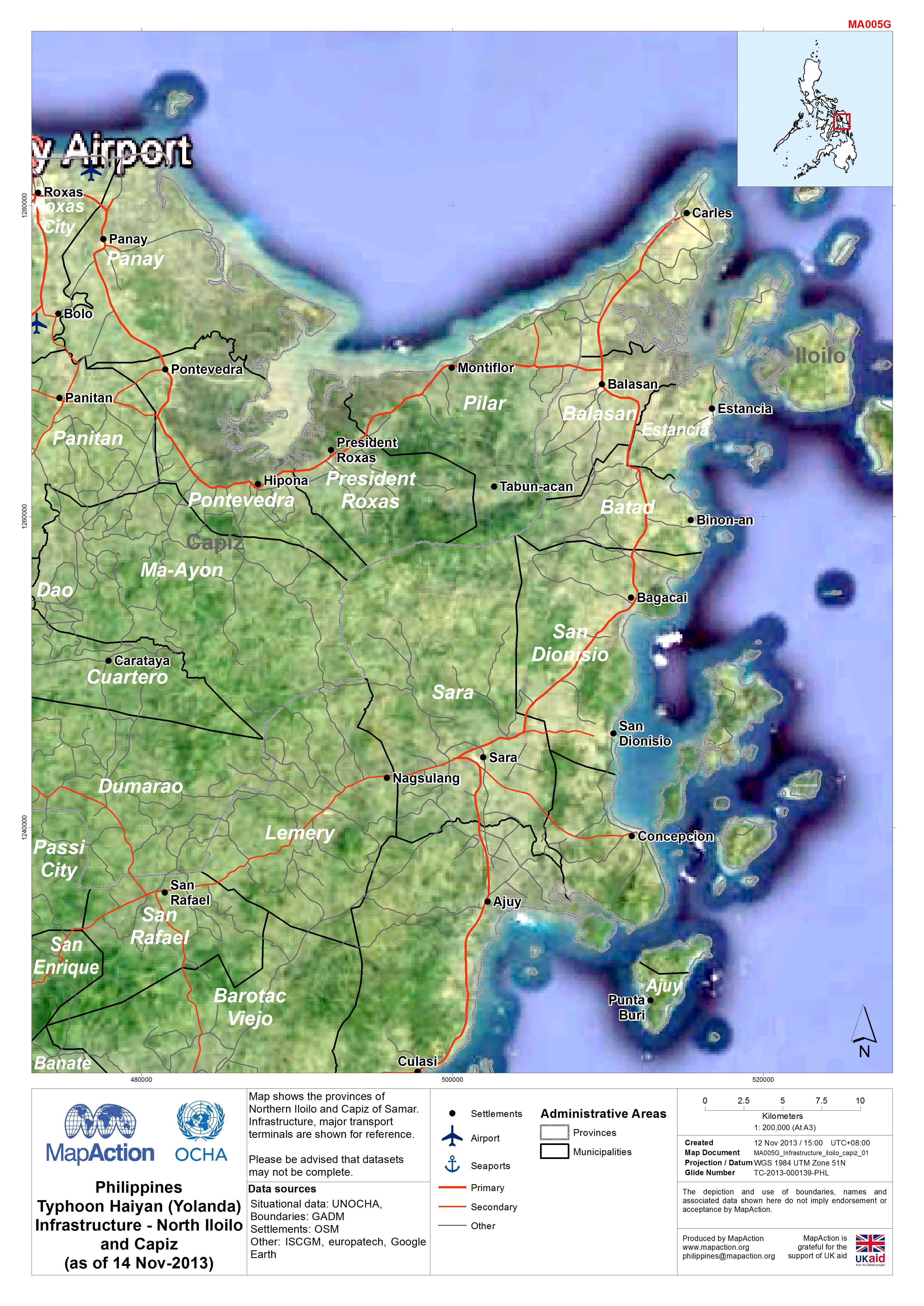
Philippines Typhoon Haiyan (Yolanda) Infrastructure - North Iloilo and Capiz ...
Map shows the provinces of Northern Iloilo and Capiz of Samar. Infrastructure, major transport terminals are shown for reference.Please be advised that datasets may not be... -
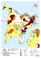
Philippines Typhoon Haiyan (Yolanda) Situational Information (as of 14-Nov-20...
Map shows situational information from NDRRMC sit rep 18. information on blocked roads and power disruption.Information may not be available for all areas. -

Philippines Typhoon Haiyan (Yolanda) Infrastructure - Tacloban City Centre (a...
Map shows Tacloban City. Infrastructure, major transport terminals, buildings and major types of land use are shown for reference.Please be advised that datasets may not be... -

Philippines Typhoon Haiyan (Yolanda) Infrastructure - Busuanga Island (as of ...
Map shows Busuanga Island a focus on Coron. Road, settlements and some land use are shown. In Coron hotels, schools and public buildings are highlighted.Please be aware that... -
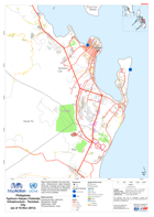
Philippines Typhoon Haiyan (Yolanda) Infrastructure - Roxas City (as of 10 No...
Map shows Roxas City and near area. Roads are shown for reference, little other infrastructure data is available at this time.Please be advised that datasets may not be complete. -
Philippines Typhoon Haiyan (Yolanda) Infrastructure - Tacloban City (as of 10...
Map shows Tacloban City and near area. Infrastructure, major transport terminals, buildings and major types of land use are shown for reference.Please be advised that datasets... -

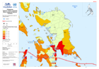
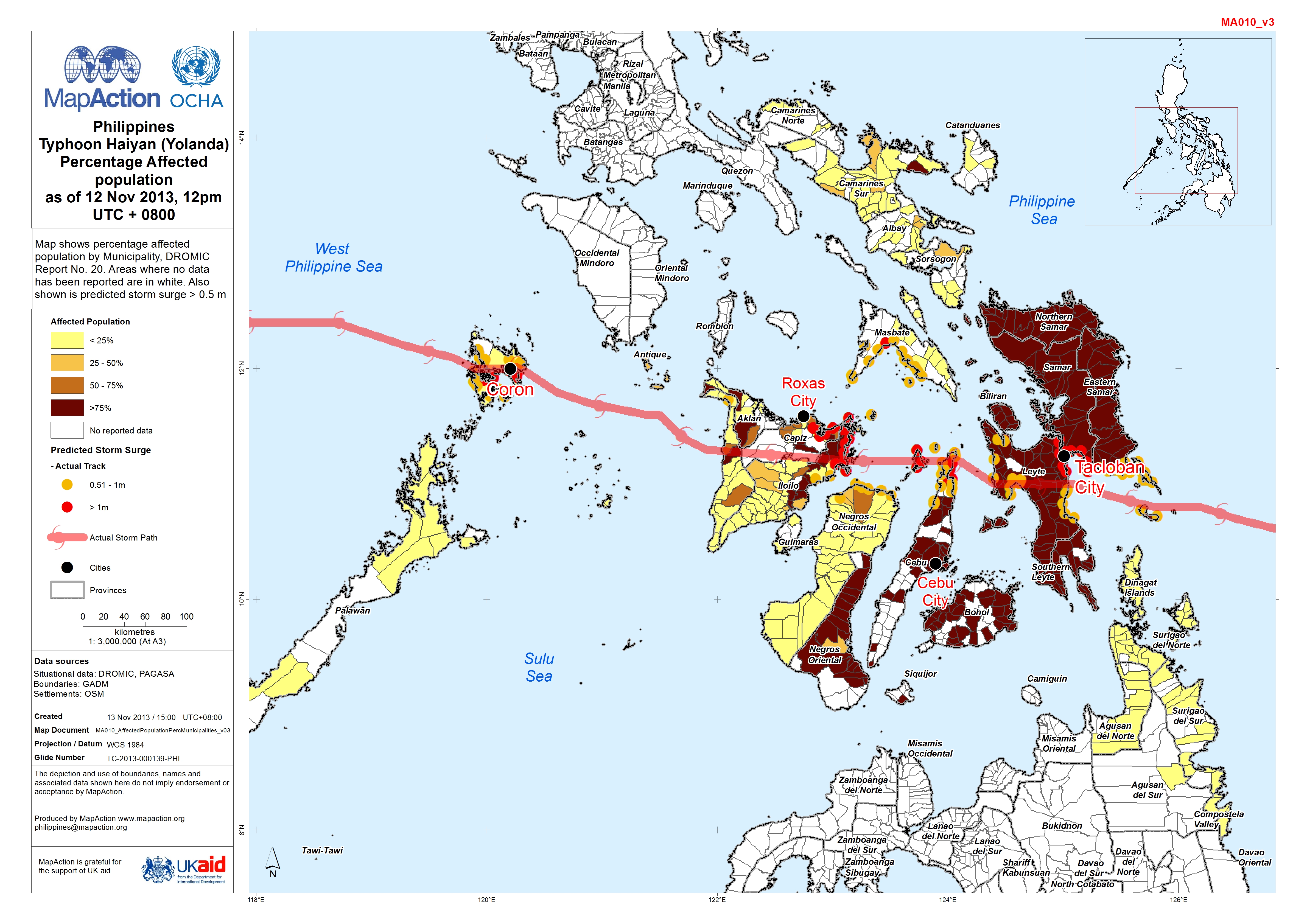
Philippines: Typhoon Haiyan (Yolanda) - Percentage Affected population as of ...
Map shows percentage affected population by Municipality, DROMIC Report No. 20. Areas where no data has been reported are in white. Also shown is predicted storm surge > 0.5 m