-
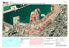
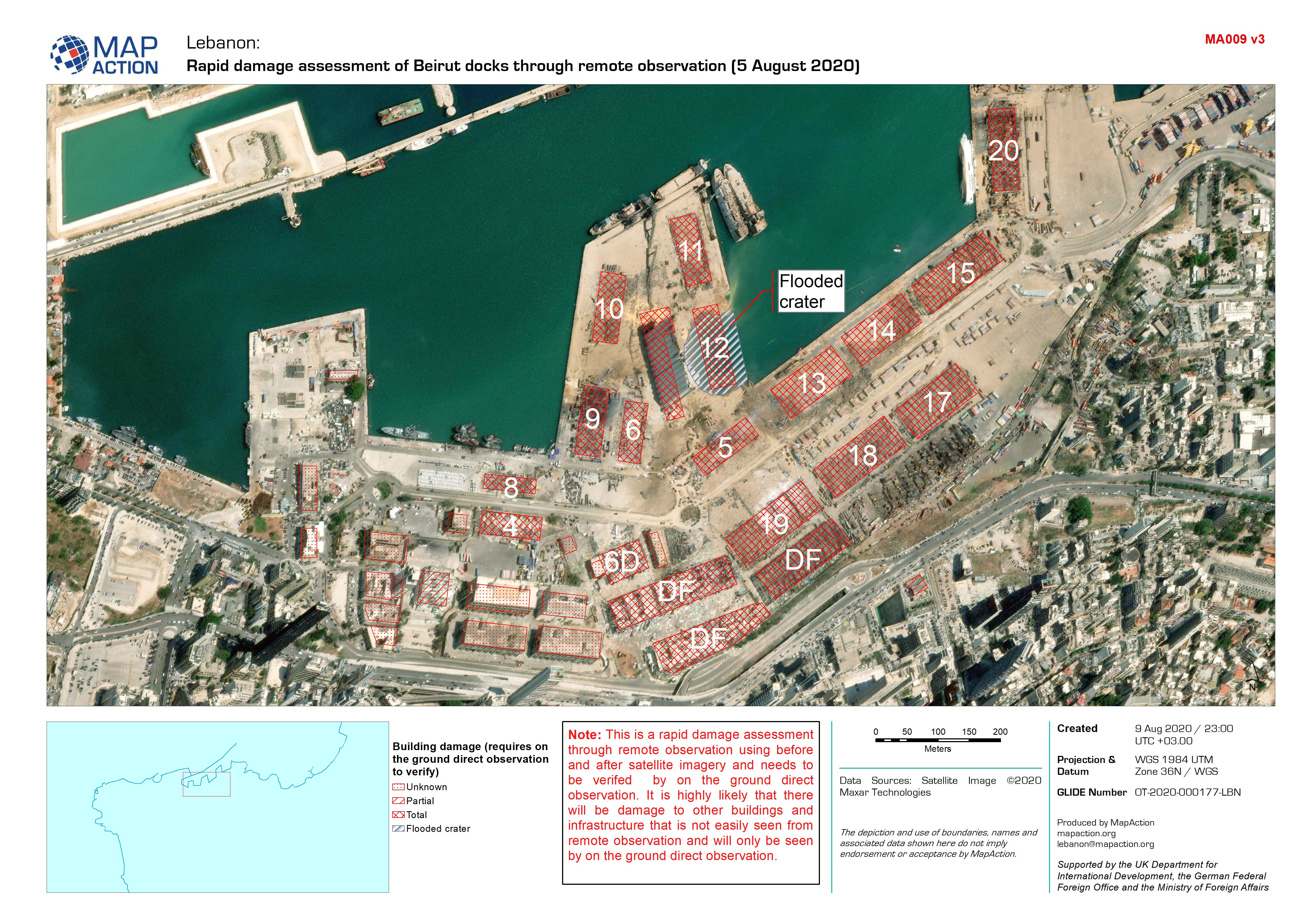
Rapid damage assessment of Beirut docks through remote observation (5 August ...
This dataset has no description
-
3D Visualisation of Beirut Port
Map shows building numbers used within Beirut port, on pre and post explosion imagery -

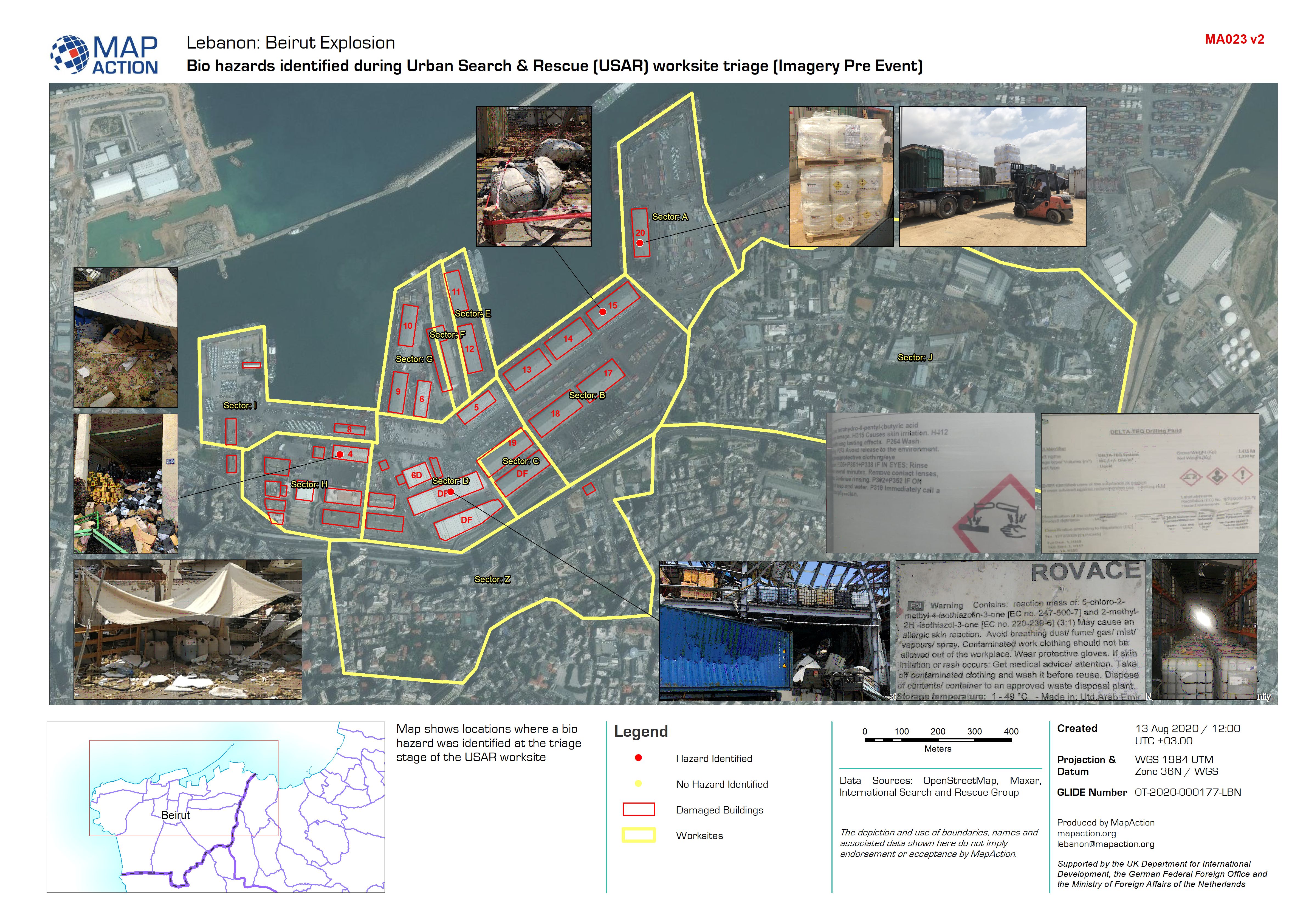
Bio hazards identified during Urban Search & Rescue (USAR) worksite triage (I...
Map shows locations where a bio hazard was identified at the triage stage of the USAR worksite -

Bio hazards identified during Urban Search & Rescue (USAR) worksite triage (I...
Map shows locations where a bio hazard was identified at the triage stage of the USAR worksite -

Rapid damage assessment of Beirut docks through remote observation (5 August ...
This dataset has no description
-
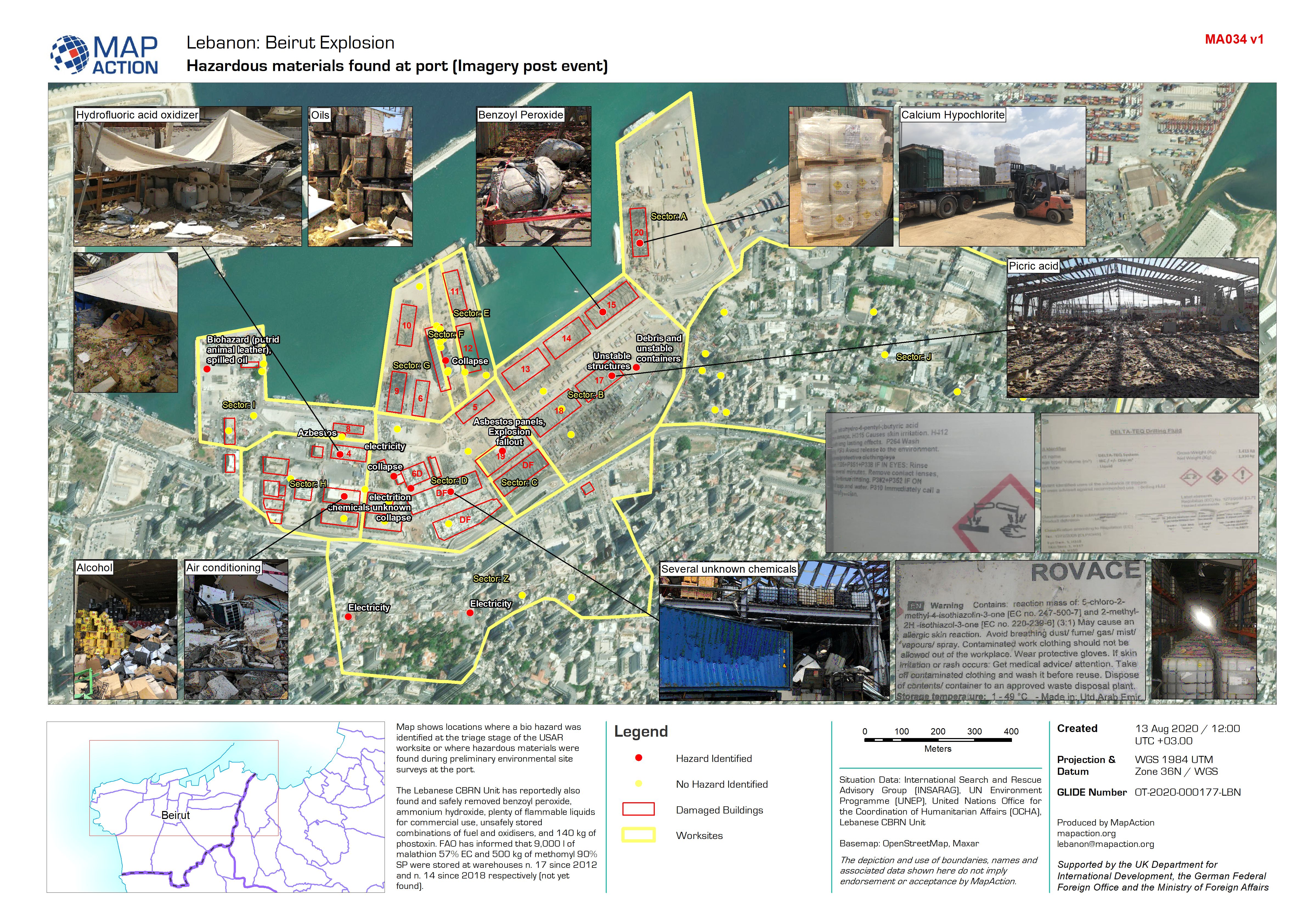
Hazardous materials found at port (Imagery post event)
Map shows locations where a bio hazard was identified at the triage stage of the USAR worksite or where hazardous materials were found during preliminary environmental site... -
Hazardous materials found at port (Imagery pre event)
Map shows locations where a bio hazard was identified at the triage stage of the USAR worksite or where hazardous materials were found during preliminary environmental site... -
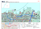
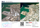
Reference map of Beirut docks, and explosion site
Reference map of Beirut docks, and explosion site -

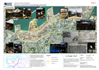
Migration Crisis - Reference map of most affected sub-districts
This is a reference map showing major roads and towns, as well as elevation data (30m SRTM) for select districts in the North West of the Syrian Arab Republic. Affected... -

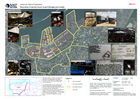
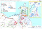
North West Syria Migration Crisis - Most Affected Sub-districts (as of 28 Apr...
This map shows a situational overview the most affected sub-districts in the North West of the Syrian Arab Republic. -
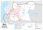
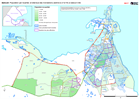
North West Syria Migration Crisis - Most Affected Districts (as of 28 Apr 2020)
This map shows a situational overview the most affected districts in the North West of the Syrian Arab Republic. -
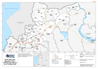
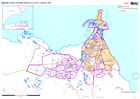
North West Syria Migration Crisis - Affected Sub-districts (as of 04 May 2020)
This map shows the affected sub-districts (administration level 3) in the Aleppo and Idleb governorate regions of the Syrian Arab Republic. -
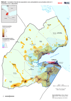
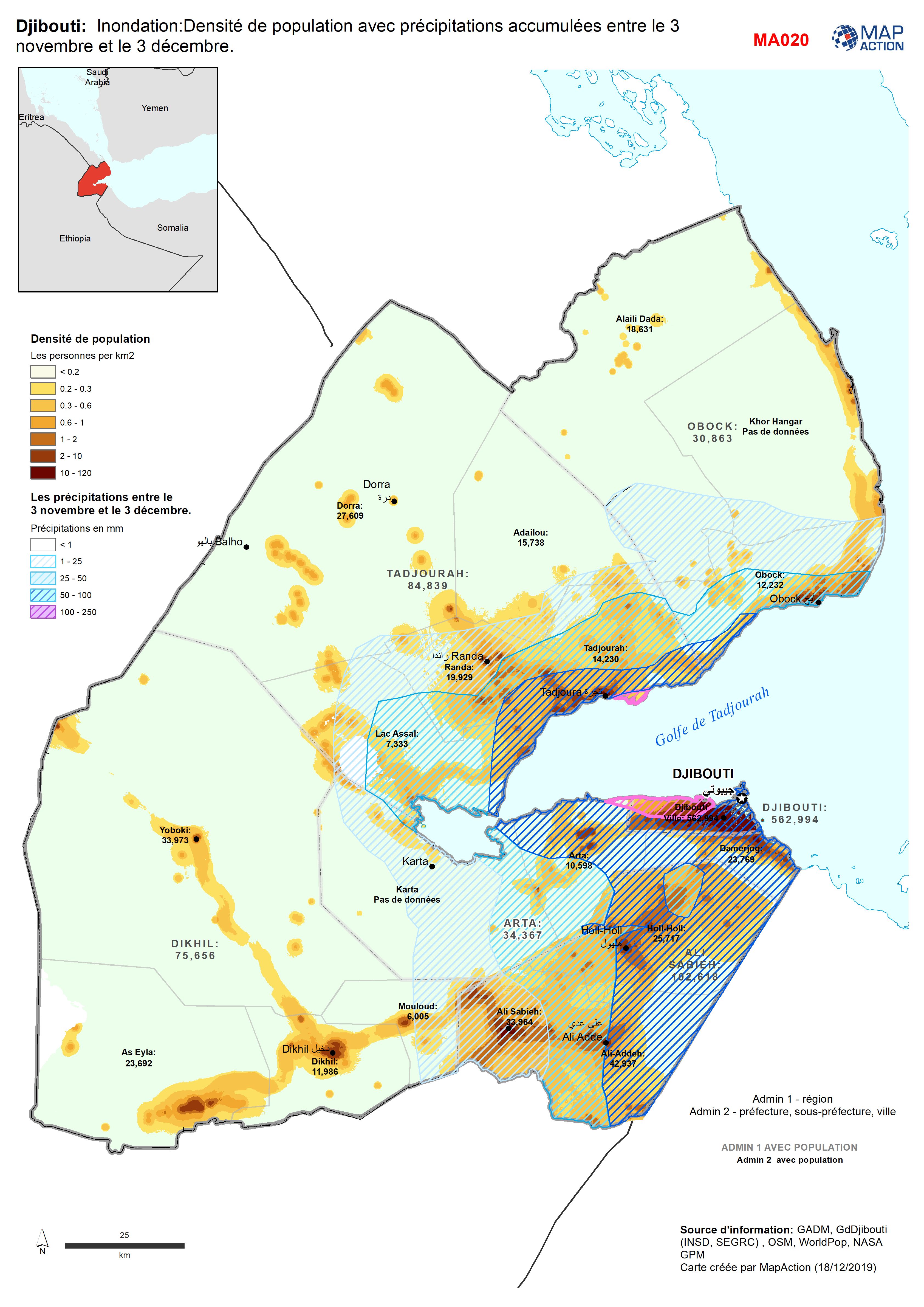
Djibouti: Inondation:Densité de population avec précipitations accumulées ent...
Population Density for 2018 with accumulated rainfall between 3 Nov - 3 Dec. -

Djibouti: - Building Stock possibly affected or not affected by flooding - Dj...
Djibouti - Floods - Buildings around Djibouti Ville. Map shows building footprints (single houses, blocks of houses or other buidings) and whether they are likely to have been... -
Djibouti: Key Building Locations in affected and non-affected zones - Djibout...
Djibouti - Floods - Key Buildings around Djibouti Ville. Map shows locations of key buidings from government and OSM sources and whether they are likely to have been affected... -
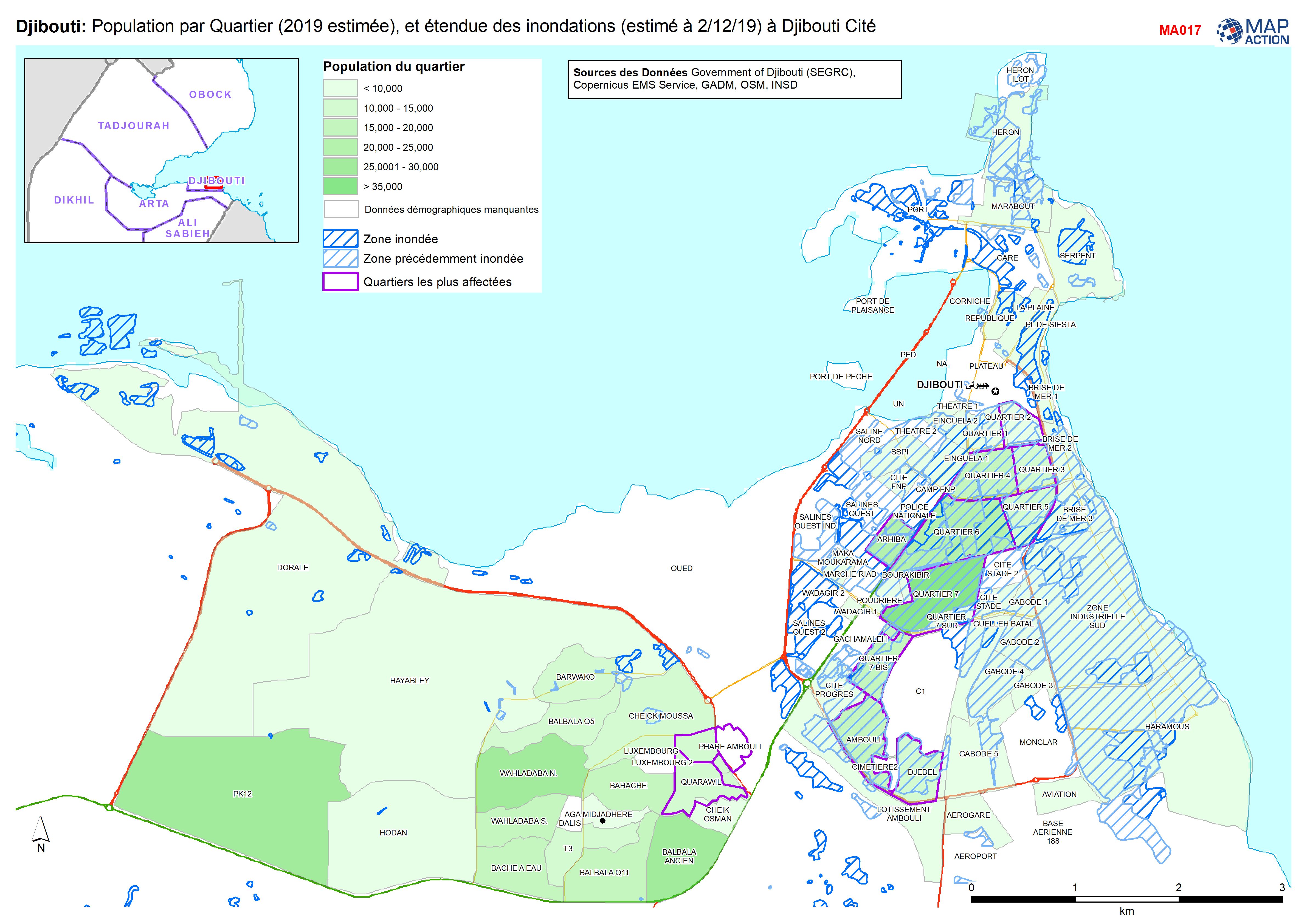
Djibouti: Population par Quartier (2019 estimée), et étendue des inondations ...
Population par Quartier (2019, estimée), et étendue des inondations (estimé à 2/12/19) à Djibouti Cité -

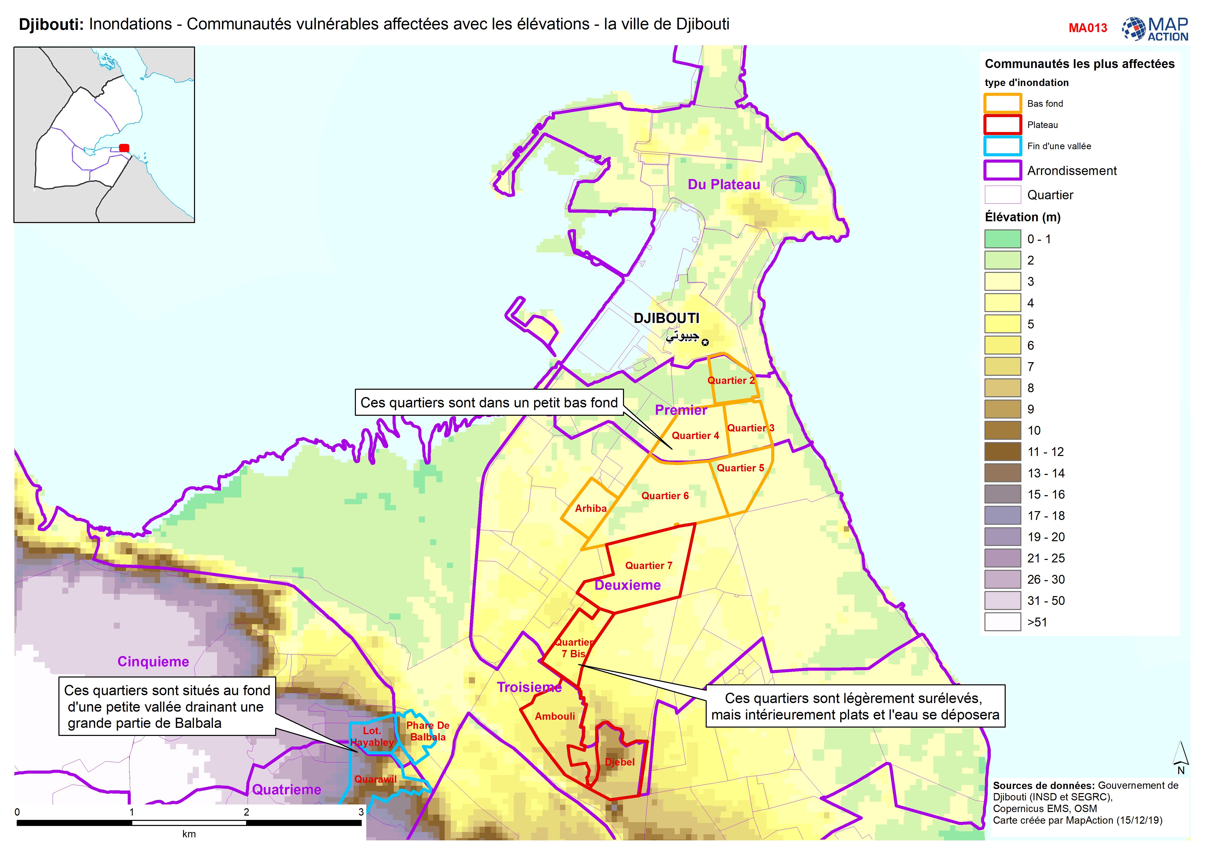
Djibouti: Inondations - Communautés vulnérables affectées avec les élévations...
Djibouti City - Map shows the most affected flooded communities, containing the most vulnerable populations, alongside elevation data to demonstrate the effects of elevation and... -

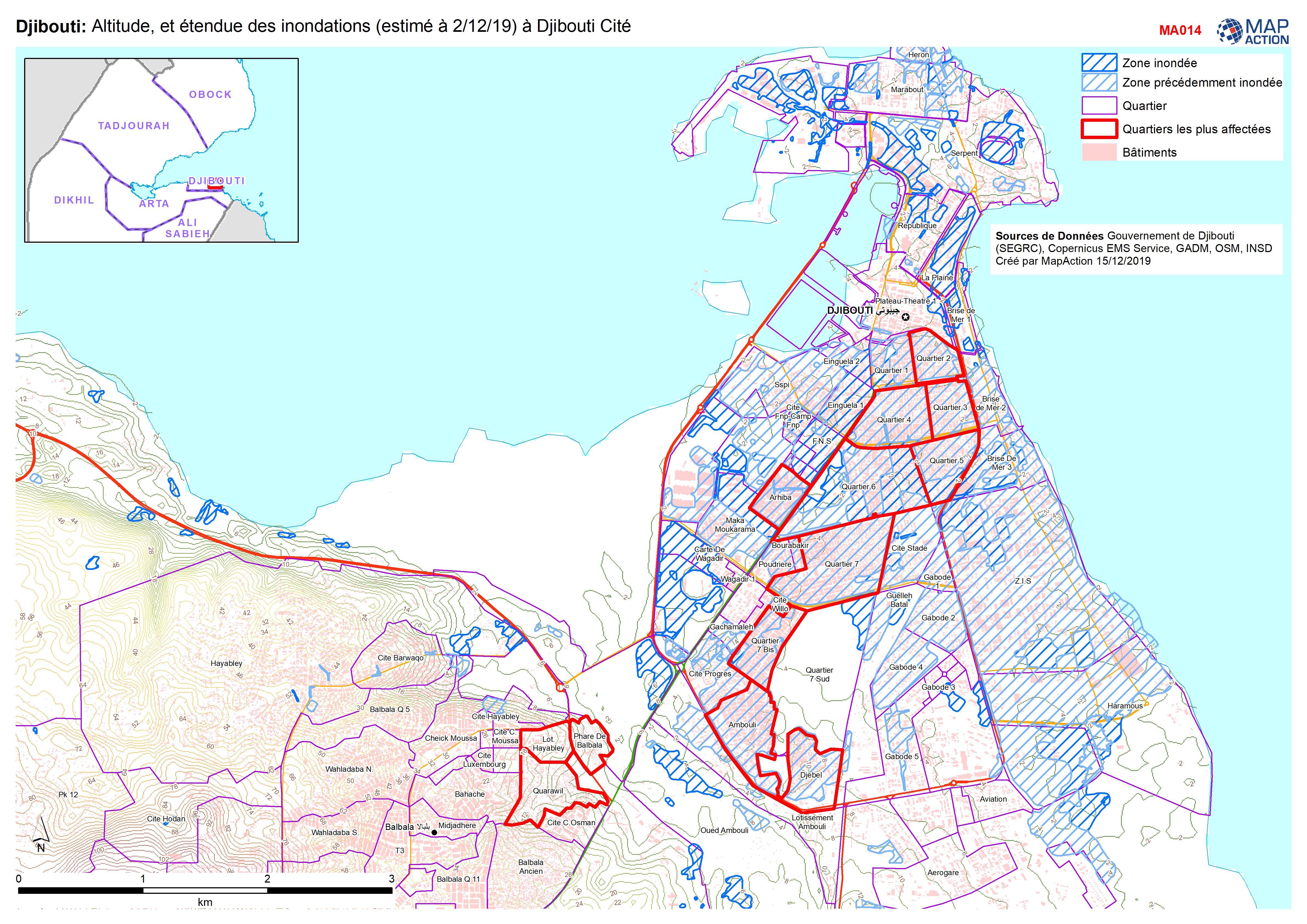
Djibouti: Altitude, et étendue des inondations (estimé à 2/12/19) à Djibouti ...
Flood extent and elevation in Djibouti city -

Djibouti: Floods - Affected Locations Countrywide and in Djibouti City
Country level map shows numbers of families affected in villages and towns across Central and South Djibouti (no reports from north) and by Quartiers in Djibouti City. Map for... -
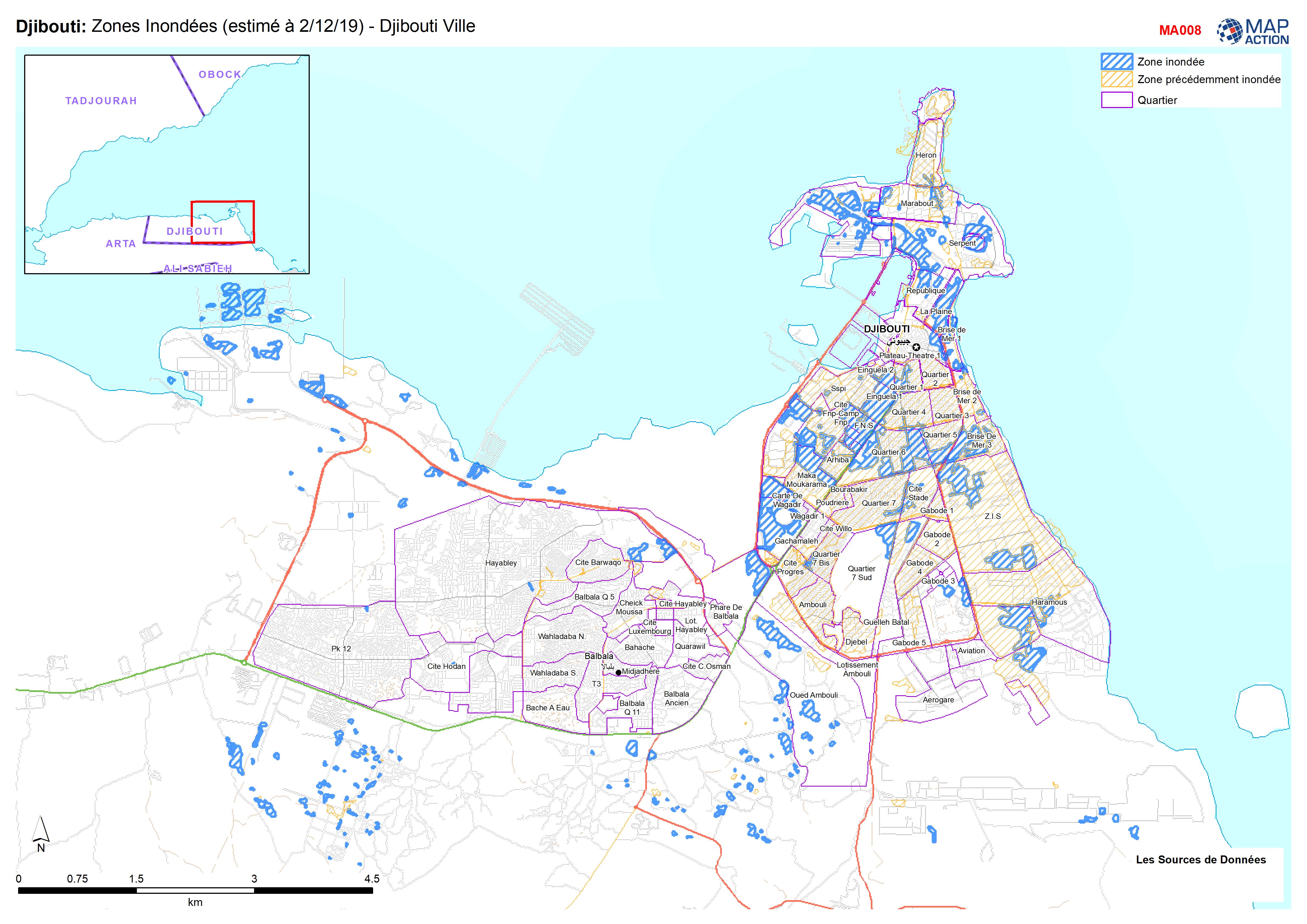
Djibouti: Zones Inondées (estimé à 2/12/19) - Djibouti Ville
Zones Inondées Djibouti Ville 2/12/91