-

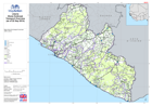
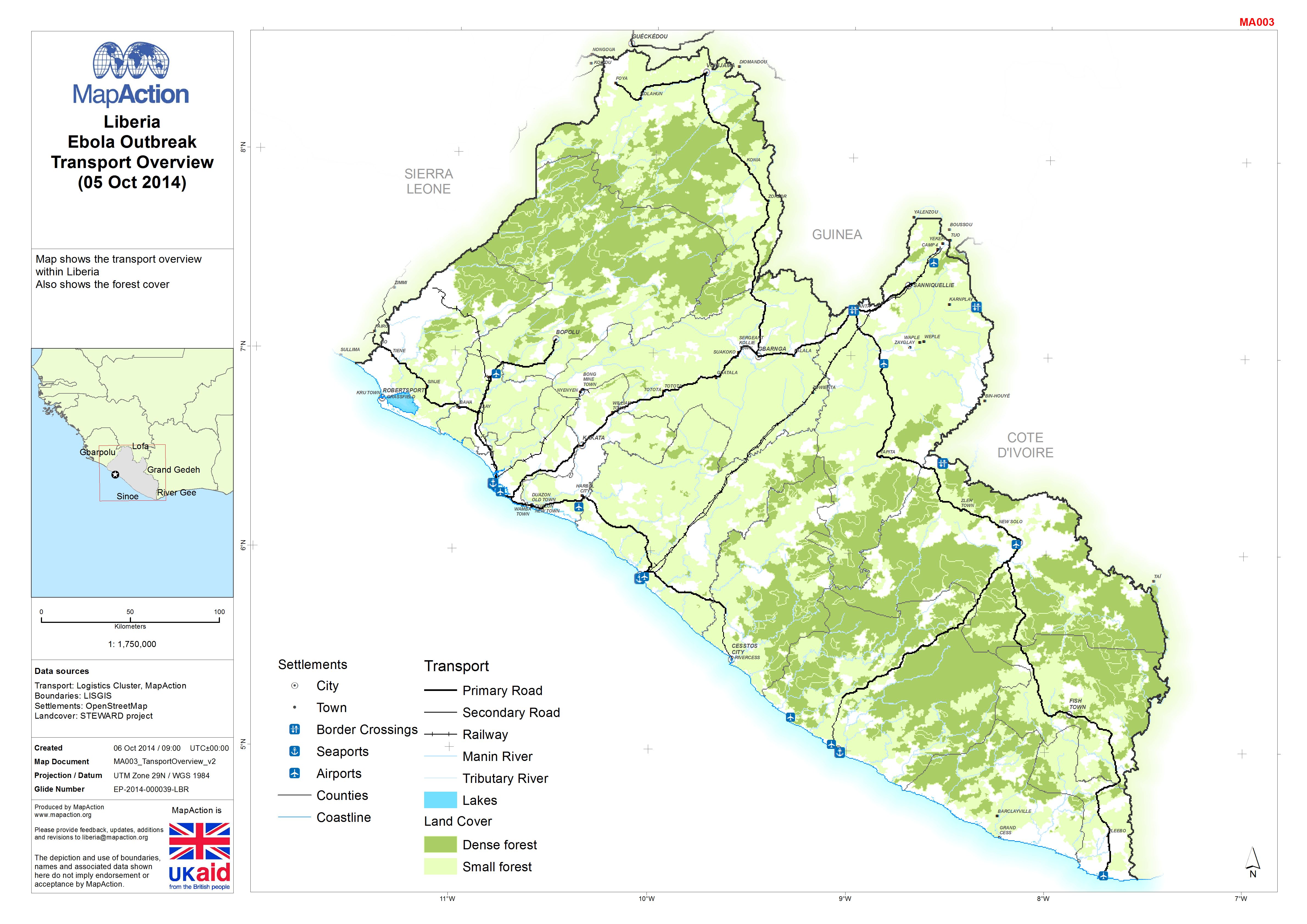
Liberia: Ebola Outbreak - Transport Overview(05 Oct 2014)
Map shows transport overview within Liberia. Also shows the forest cover. -
Liberia: Ebola Outbreak - Transport Overview(as of 22 Sep 2014)
Map shows the transport overview within Liberia. -
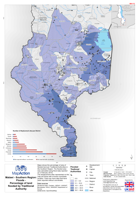
Malawi - Southern Region: Floods - Percentage of land flooded by Traditional ...
This dataset has no description
-
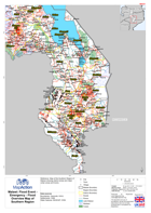
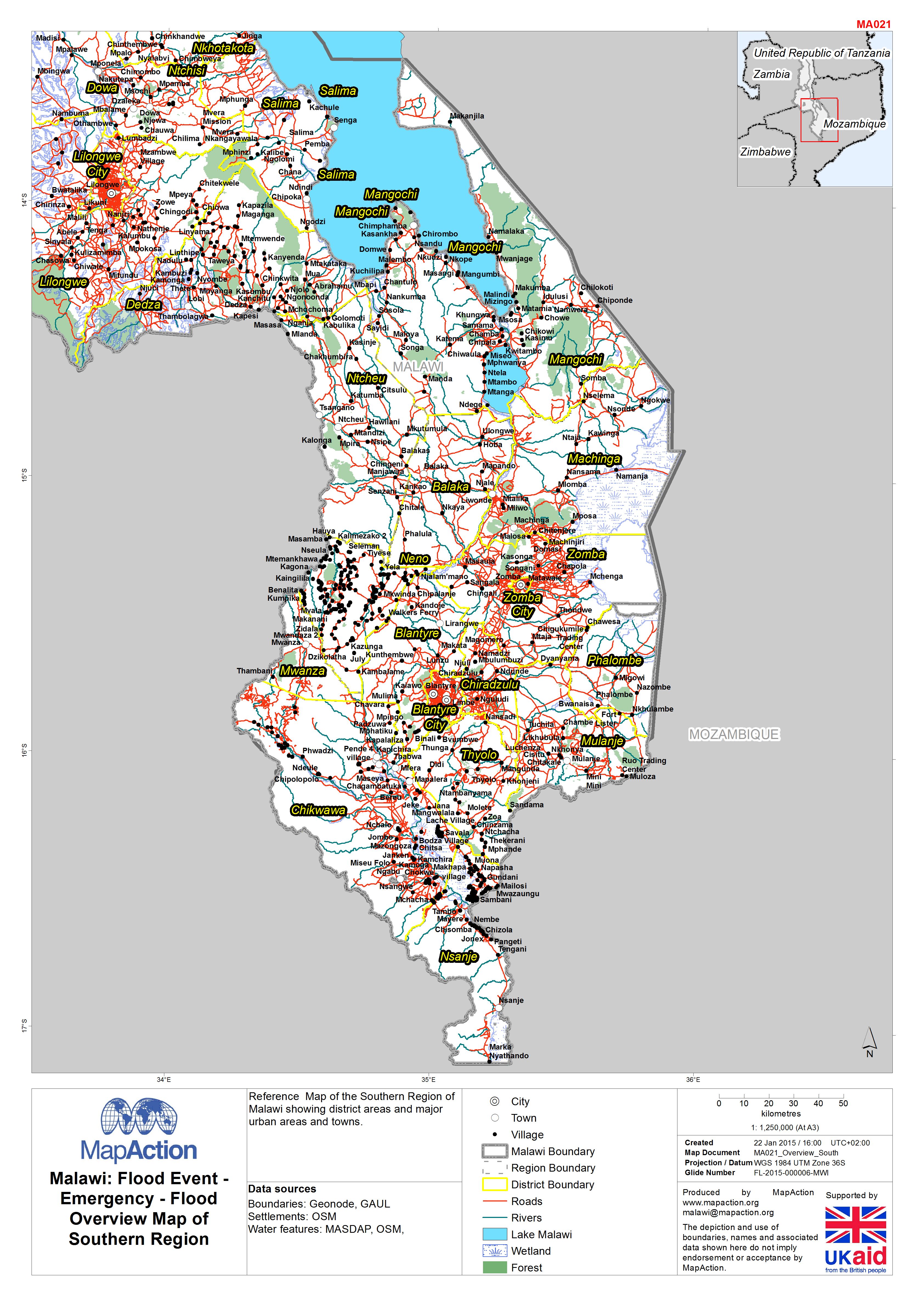
Malawi: Floods - Emergency - Flood Overview Map of Southern Region
Reference Map of the Southern Region of Malawi showing district areas and major urban areas and towns. -

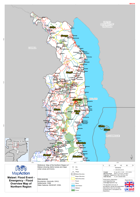
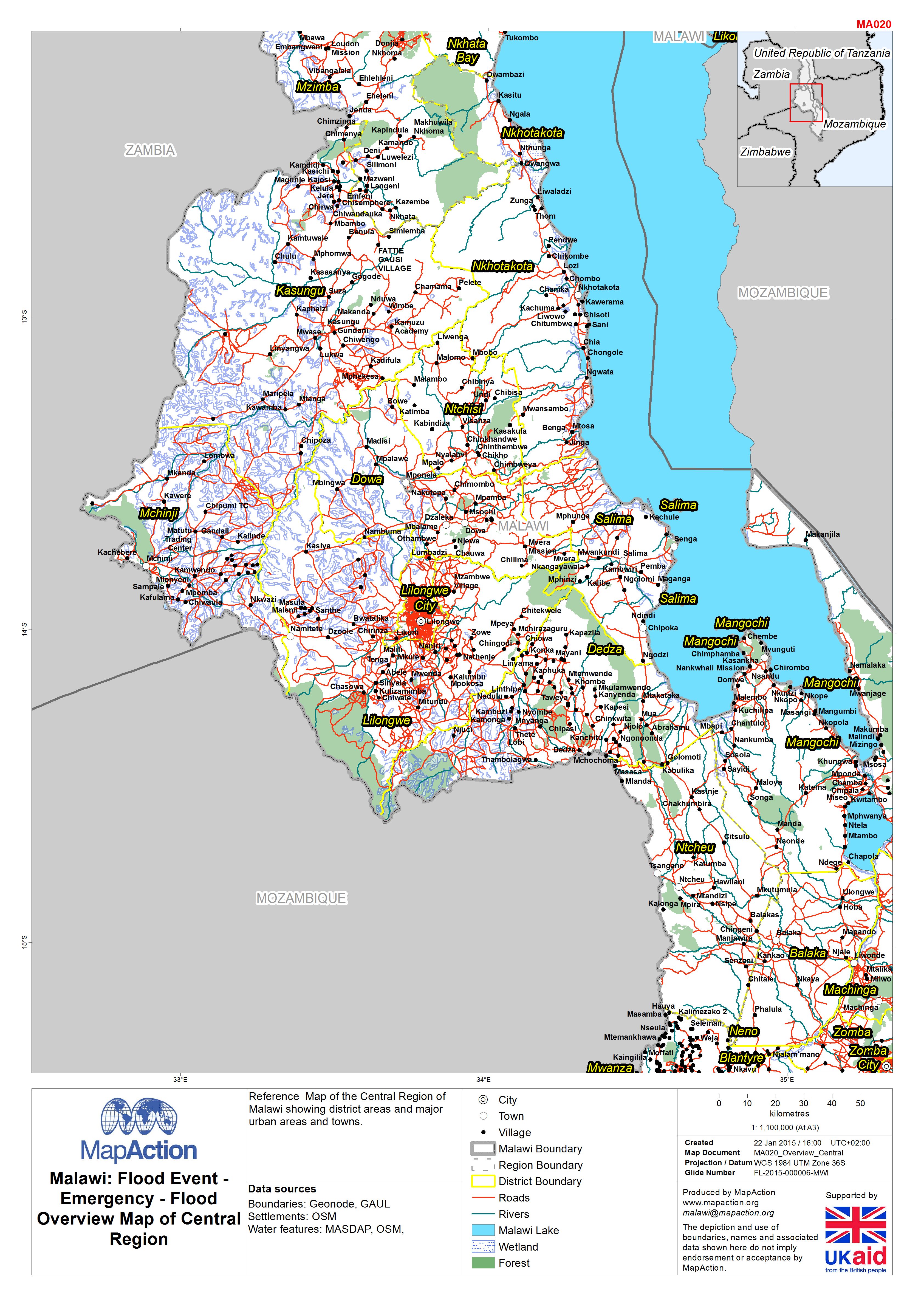
Malawi: Floods - Emergency - Flood Overview Map of Central Region
Reference Map of the Central Region of Malawi showing district areas and major urban areas and towns. -
Malawi: Floods - Emergency - Flood Overview Map of Northern Region
Reference Map of the Northern Region of Malawi showing district areas and major urban areas and towns. -

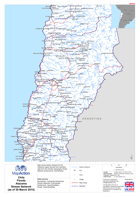
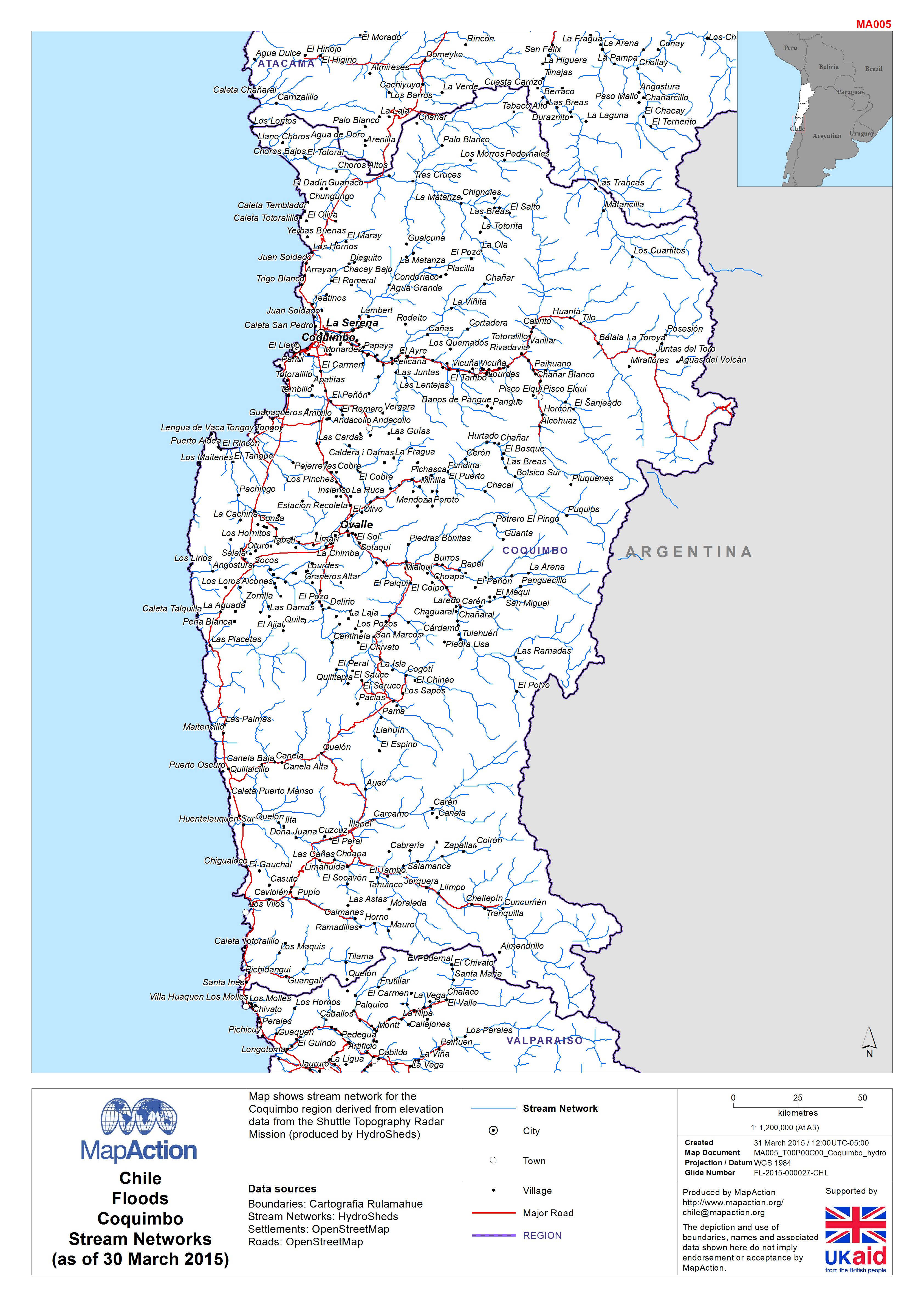
Chile: Floods - CoquimboStream Networks(as of 30 March 2015)
Map shows stream network for the Coquimbo region derived from elevation data from the Shuttle Topography Radar Mission (produced by HydroSheds) -
Chile: Floods - AtacamaStream Network(as of 30 March 2015)
Map shows stream network for the Atacama region derived from elevation data from the Shuttle Topography Radar Mission (produced by HydroSheds) -
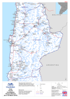
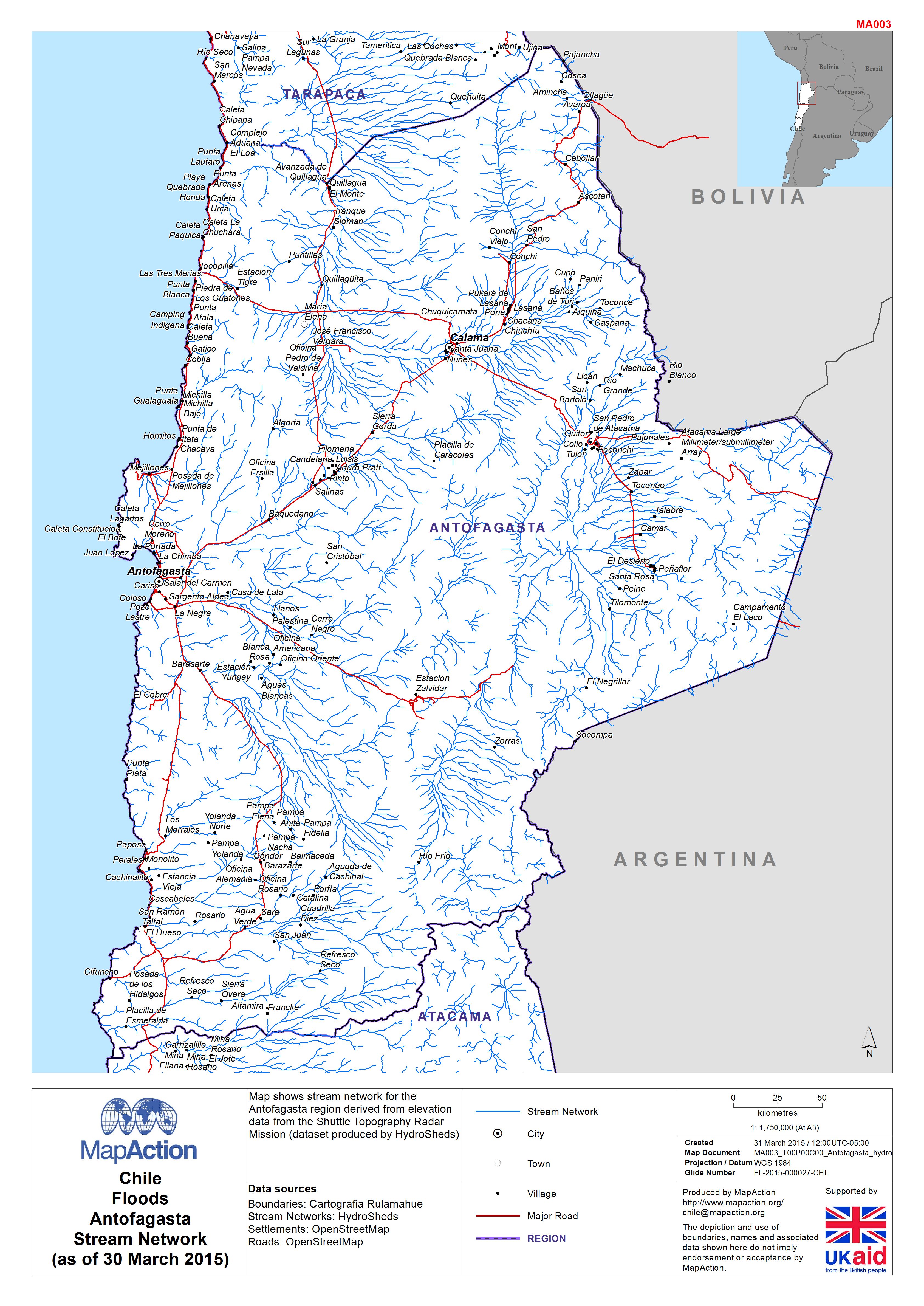
Chile: Floods - Antofagasta Stream Network(as of 30 March 2015)
Map shows stream network for the Antofagasta region derived from elevation data from the Shuttle Topography Radar Mission (dataset produced by HydroSheds) -

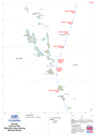
Vanuatu: Cyclone PAM - Assessment Field Maps - Penama (and Mere Lava) Sheet: ...
Large scale reference maps for assessment field teams -
Vanuatu: Cyclone PAM - Assessment Field Maps - Penama (and Mere Lava) Sheet: ...
Large scale reference maps for assessment field teams. -
Vanuatu: Cyclone PAM - Assessment Field Maps - Penama (and Mere Lava) Sheet: ...
Large scale reference maps for assessment field teams. -
Vanuatu: Cyclone PAM - Assessment Field Maps - Penama (and Mere Lava) Sheet: ...
Large scale reference maps for assessment field teams. -
Vanuatu: Cyclone PAM - Assessment Field Maps - Penama (and Mere Lava) Sheet: ...
Large scale reference maps for assessment field teams -
Vanuatu: Cyclone PAM - Assessment Field Maps - Penama (and Mere Lava) Sheet: ...
Large scale reference maps for assessment field teams. -
Vanuatu: Cyclone PAM - Assessment Field Maps - Penama (and Mere Lava) Sheet: ...
Large scale reference maps for assessment field teams. -
-

-
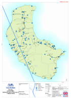
Vanuatu: Cyclone PAM - Reference map of Reference map of Tanna (as of 17 Marc...
Draft planning reference map -

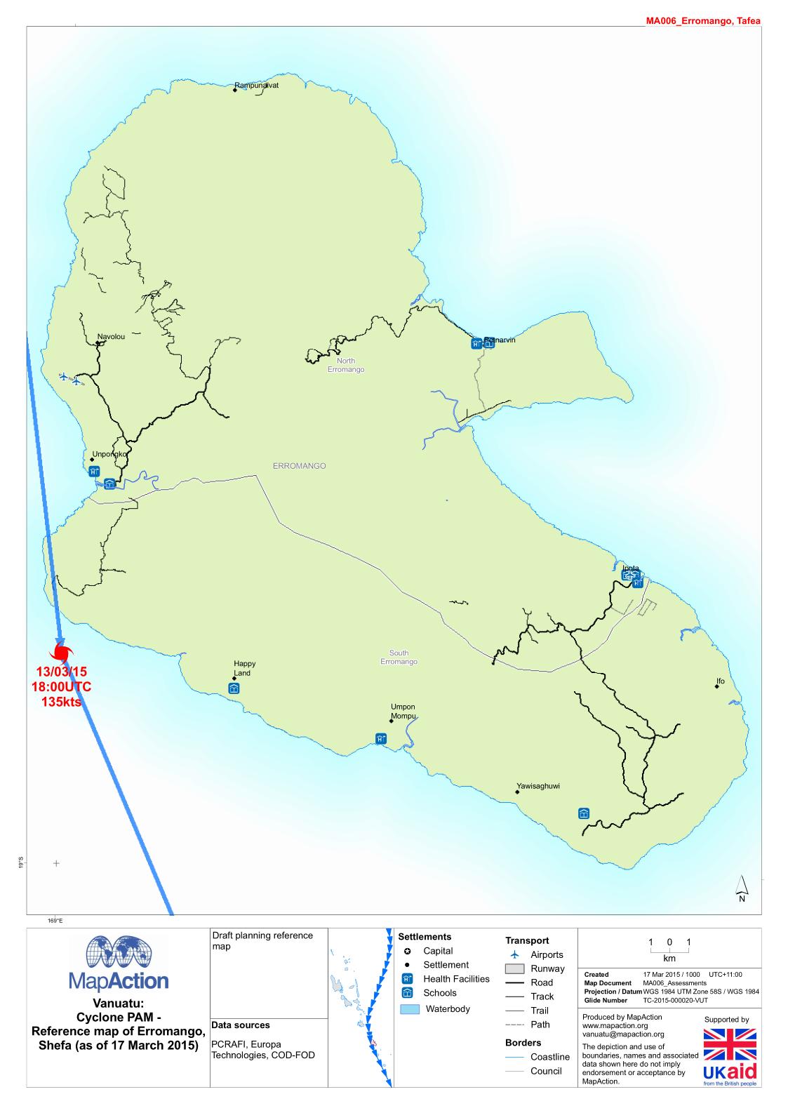
Vanuatu: Cyclone PAM - Reference map of Erromango, Shefa (as of 17 March 2015)
Draft planning reference map