-

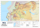
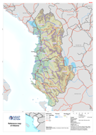
Guyana: Reference Map: Elevation
This reference map shows digital elevation data at 90m scale, with primary roads, airports and major settlements for Guyana. -
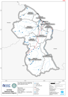
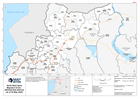
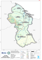
Guyana: Reference Map: Administrative Regions
This reference map shows administrative regions with primary roads, airports, and major settlements in Guyana. -

North West Syria Migration Crisis - Most Affected Sub-districts (as of 28 Apr...
This map shows a situational overview the most affected sub-districts in the North West of the Syrian Arab Republic. -
North West Syria Migration Crisis - Most Affected Districts (as of 28 Apr 2020)
This map shows a situational overview the most affected districts in the North West of the Syrian Arab Republic. -
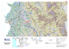
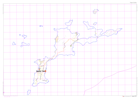
North West Syria Migration Crisis - Governorate Relief Map (as of 06 May 2020)
This is a reference map of the North West of the Syrian Arab Republic. The map shows major roads and settlements as well as eleveation data for the affected governorates of... -
North West Syria Migration Crisis - Affected Sub-districts (as of 04 May 2020)
This map shows the affected sub-districts (administration level 3) in the Aleppo and Idleb governorate regions of the Syrian Arab Republic. -

North West Syria Migration Crisis - Syria Governorates (as of 21 Apr 2020)
This is a reference map of the Syria Arab Republic, showing major towns, cities, main roads and administration governorates with associated pcodes. -
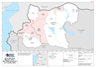
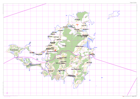
Guyana Reference Map: Administrative Regions
This reference map shows digital elevation data at 90m resolution, with primary roads, airports, major settlements and administrative regions for Guyana. -

-

-
-
-
-

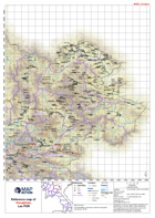
Reference map atlas of Lombok, Indonesia
A series of 1:75,000 reference maps covering the island of Lombok, Indonesia. -
OpenStreetMap of Saint Martin
Reference map of Saint Martin using Open Street Mapping provided by milvusmap.eu -
OpenStreetMap of Saint Barts
Reference map of Saint Barts using Open Street Mapping provided by milvusmap.eu -
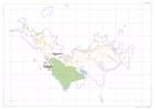
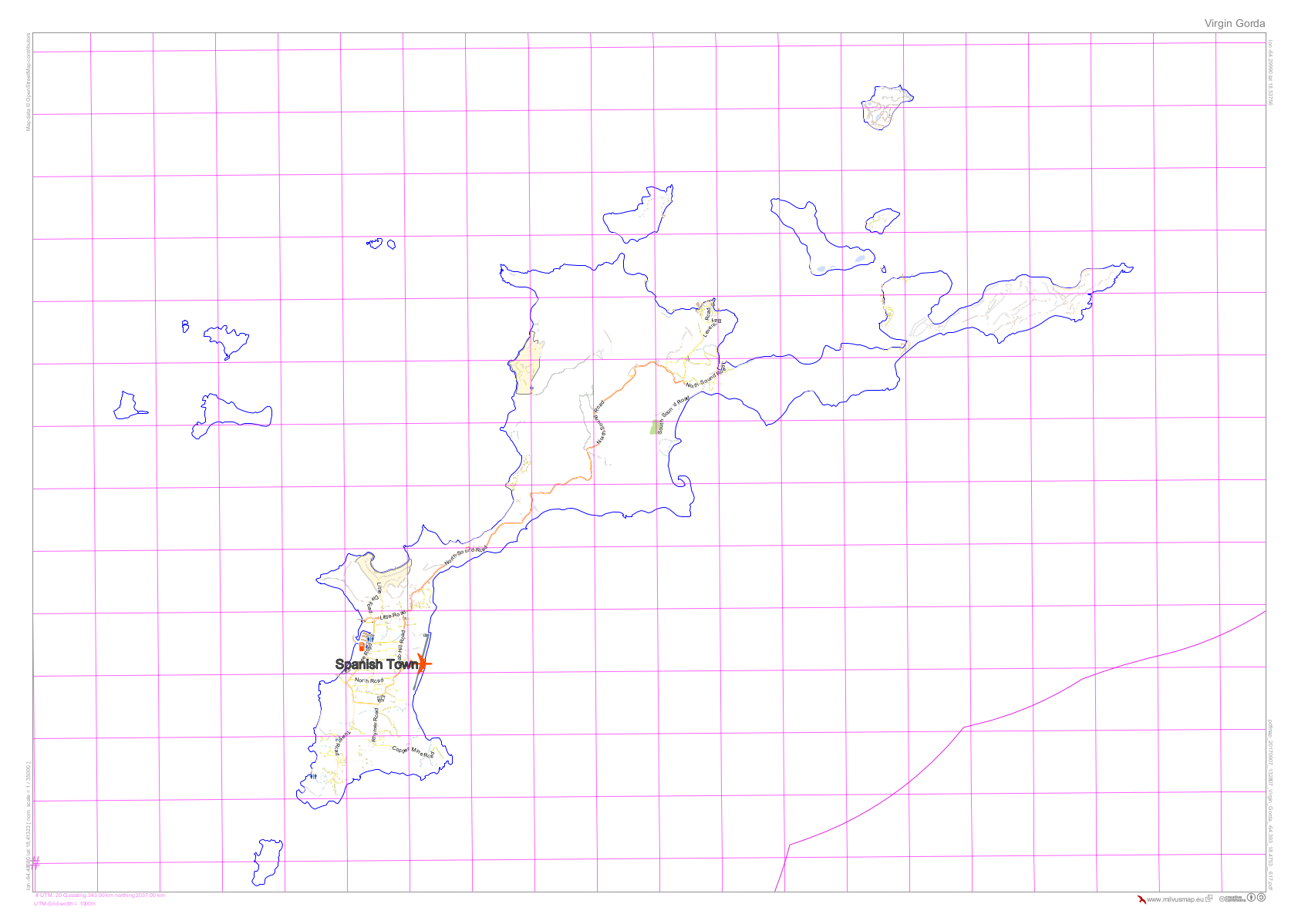
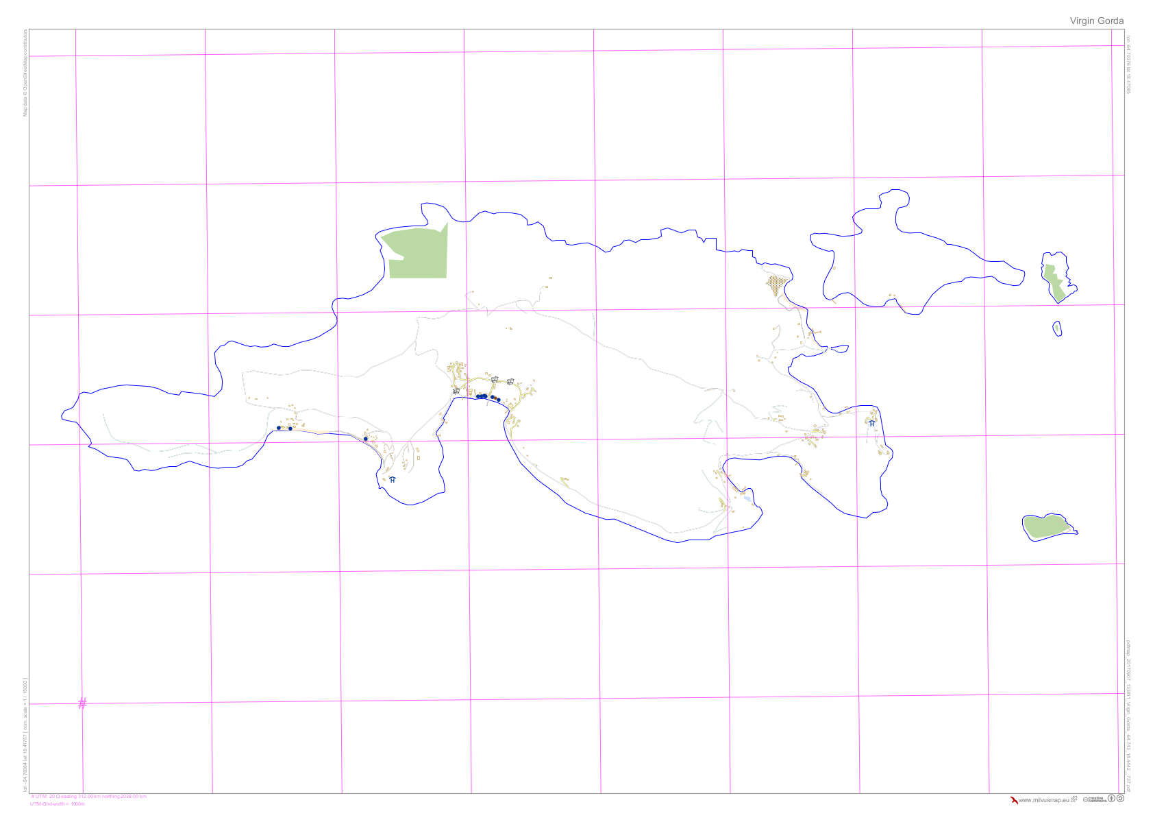
OpenStreetMap of Virgin Gorda (British Virgin Islands)
Reference map of Virgin Gorda (British Virgin Islands) using Open Street Mapping provided by milvusmap.eu -

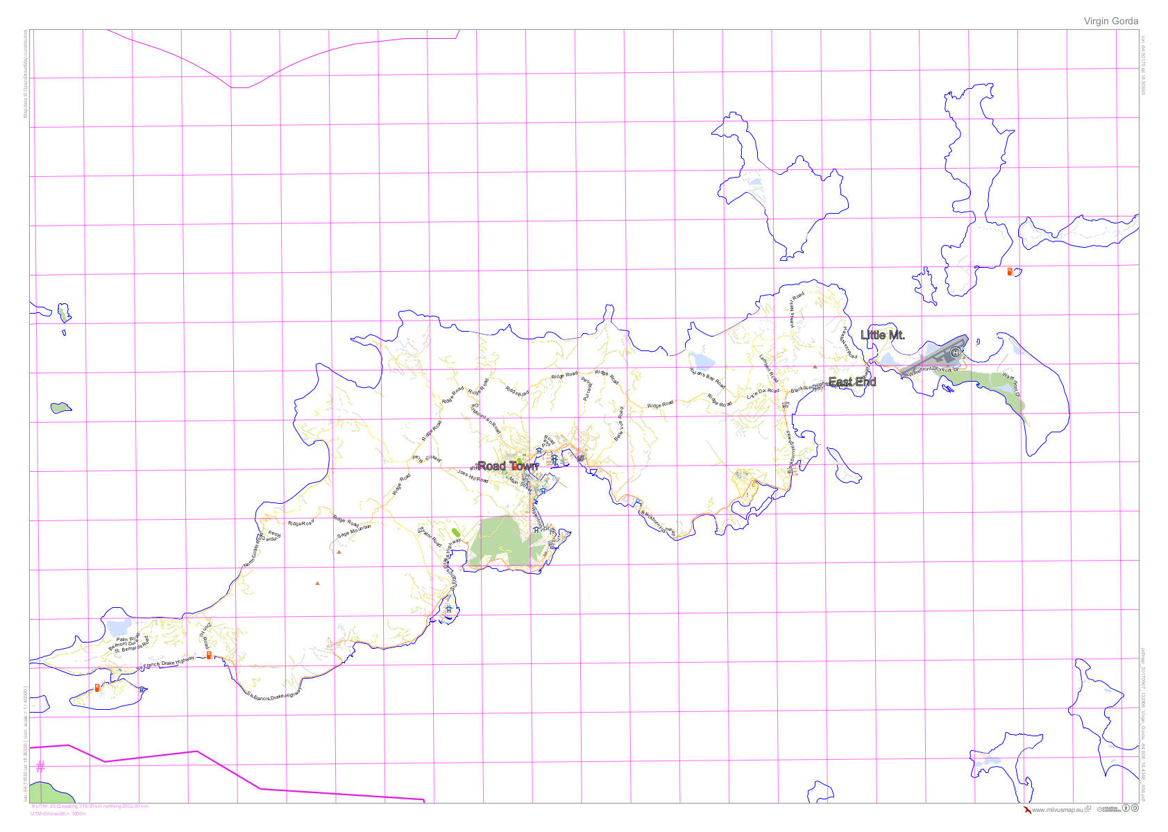
OpenStreetMap of Tortola (British Virgin Islands)
Reference map of Tortola (British Virgin Islands) using Open Street Mapping provided by milvusmap.eu -

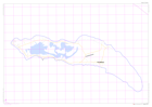
OpenStreetMap of Jost Van Dyke (British Virgin Islands)
Reference map of Jost Van Dyke (British Virgin Islands) using Open Street Mapping provided by milvusmap.eu -
OpenStreetMap of Anegada (British Virgin Islands)
Reference map of Anegada (British Virgin Islands) using Open Street Mapping provided by milvusmap.eu