-
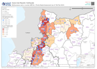
Multi-purpose cash or voucher (MPCA) - Priority Needs Assessment (as of 13th ...
Multi-purpose cash or voucher priority of REACH Surveys for NW Syria aggregated by Sub-District. Data coming from multiple sources as of Feb 13th 2023. -

Winterisation Support - Priority Needs Assessment (as of 13th Feb 2023)
Winterisation support priority of REACH Surveys for NW Syria aggregated by Sub-District. Data coming from multiple sources as of Feb 13th 2023. -
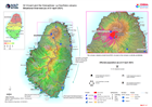
Situational Overview (as of 21 April 2021)
Map shows the situational overview of the current events and activities as a result of the ongoing eruption of the La Soufrière volcano. -

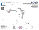
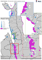
Ulua Basin: areas evacuated for Hurricane Iota, with El Cajón dam overspillin...
The Municipalities indicated were given mandatory evacuation ordres from low lying land near Ulua and Chameleco rivers pre hurricane Iota. Modelling of possible inundation from... -

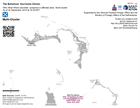
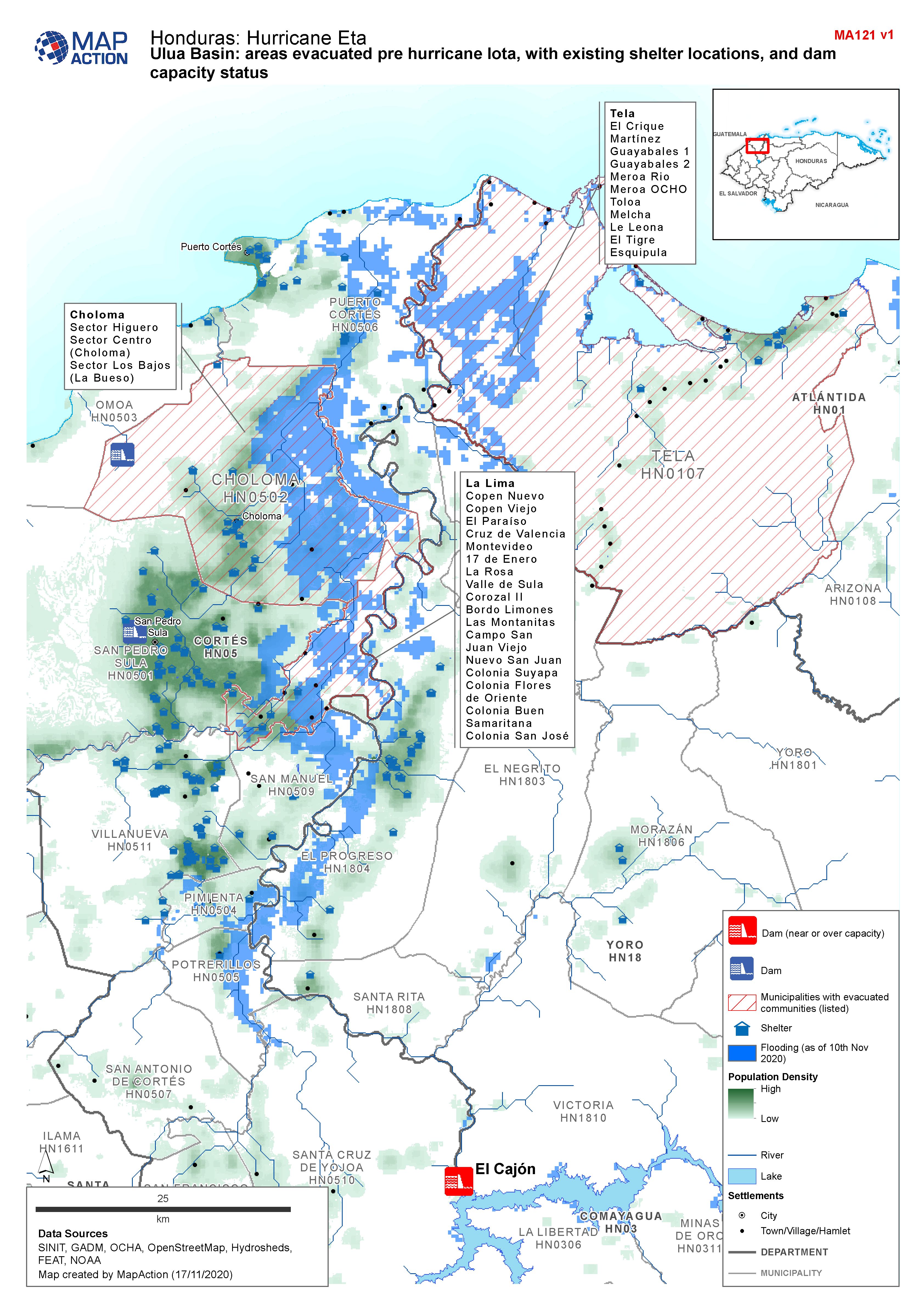
Honduras, Ulua Basin: areas evacuated pre Hurricane Iota, with existing shelt...
Map shows communities evacuated pre hurricane Iota, and existing shelter locations. Population density and capacity status of dams are also shown. -
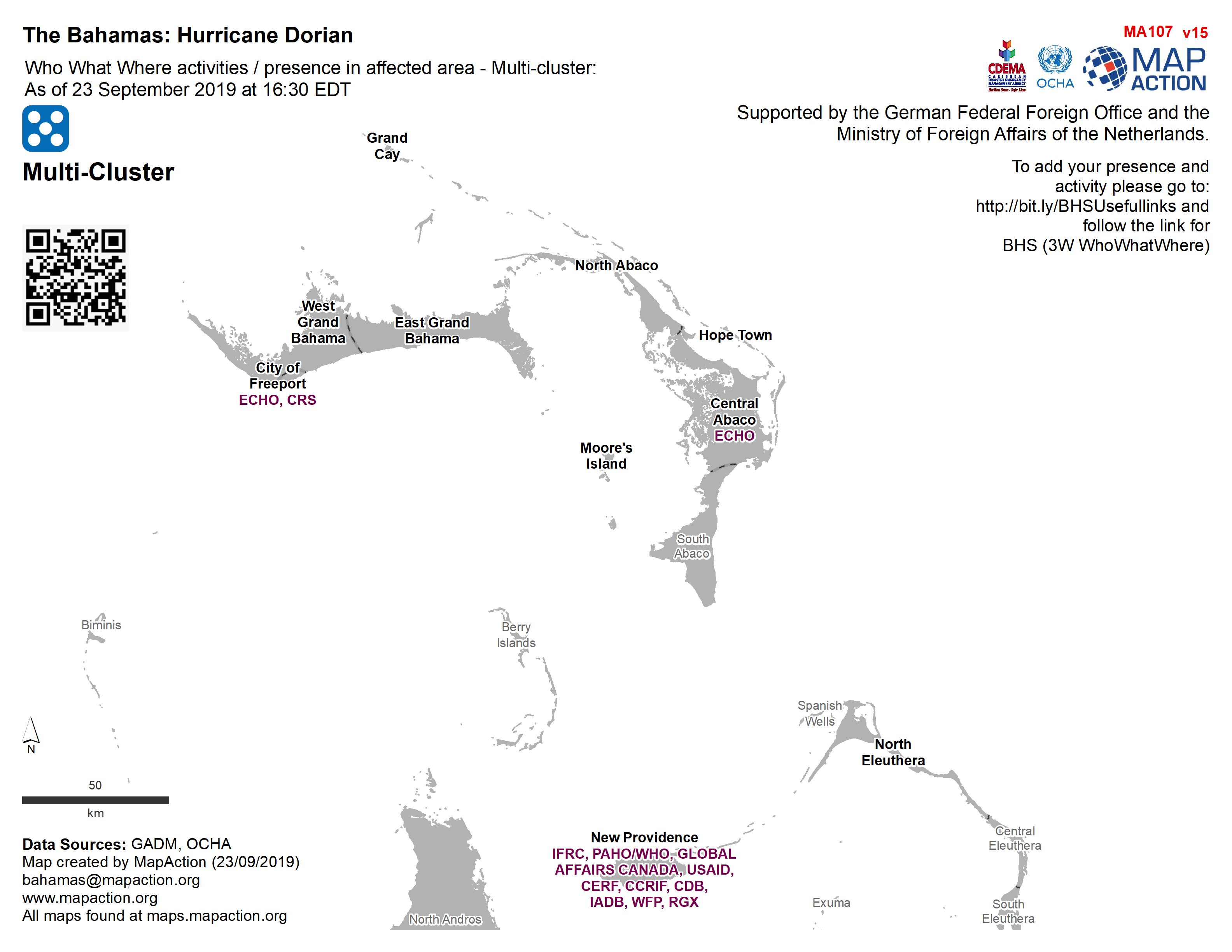
Who What Where activities / presence in affected area - Multi-cluster: As of ...
Who, What, Where for Coordination - Multi-Cluster -
Who What Where activities / presence in affected area - Multi-cluster: As of ...
Who, What, Where for Coordination - Multi-Cluster -
Central Sulawesi: IDP sites within modelled Liquefaction risk areas.
Map shows IDP sites as identified through analysis of Digital Globe imagery from 2nd - 5th October, and areas at risk of liquefaction as determined through the USGS preferred...