-

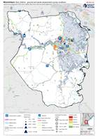
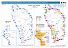
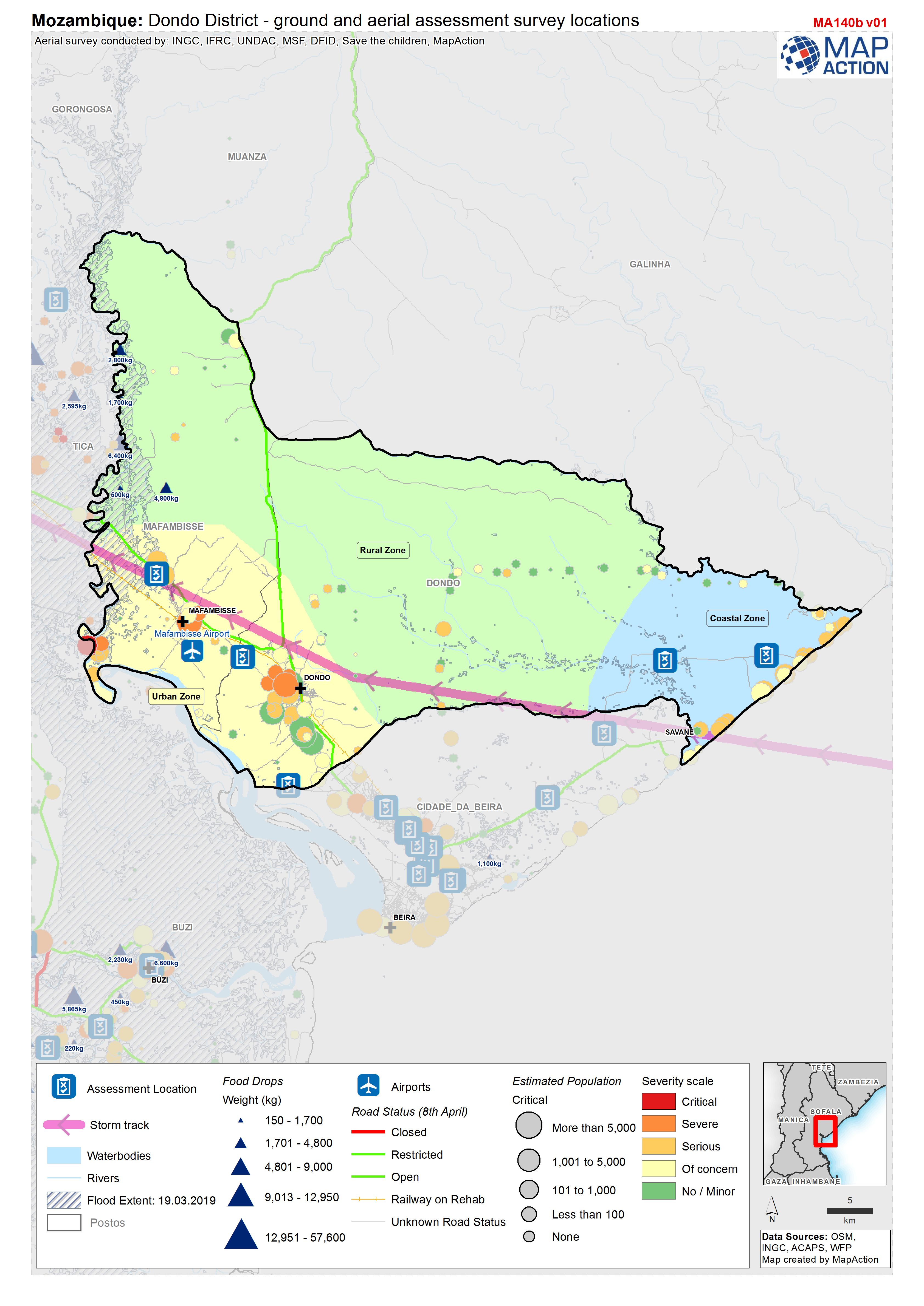
Mozambique: Dondo District - ground and aerial assessment survey locations
Location of ground and aerial assessment survey's within the district of Dondo. -
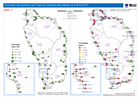
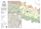
Mozambique: Buzi District - ground and aerial assessment survey locations
Location of ground and aerial assessment survey's within the district of Buzi. -
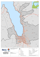
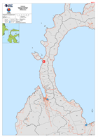
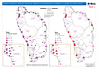
Indonesia Sulawesi Earthquake Administrative Village Boundaries: Palu
Map shows the administrative village (admin level 4) boundaries for the Palu Region of Central Sulawesi and road network. -
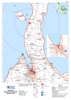
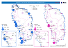
Indonesia Sulawesi Earthquake Donggala and Palu Infrastructure
Maps shows the main roads and settlements of the Pula and Donggala districts of Central Sulawesi, Indonesia -
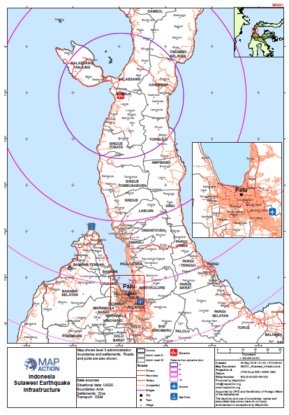
Sulawesi Earthquake - Infrastructure
Map shows level 3 admininstration boundaries and settlements. Roads and ports are also shown. -
Potable Water status: litres delivered in last 5 days and remaining days supp...
Map shows potable water distributions and remaining supplies up to 8th October 2017 -
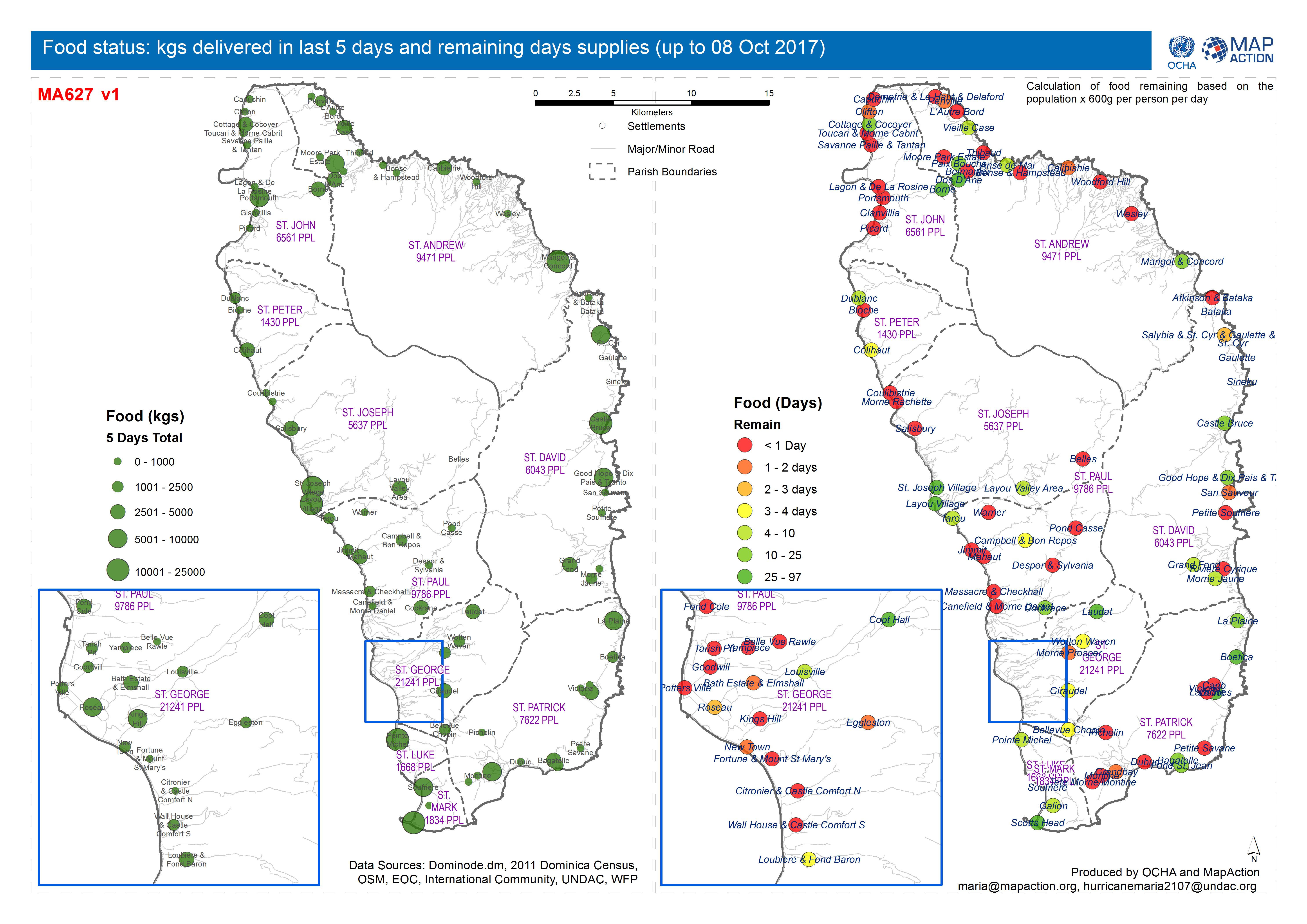
Food status: kgs delivered in last 5 days and remaining days supplies (up to ...
Map shows food status and gap analysis up to 8th October 2017 -
Tarpaulin Distribution: tarpaulins required per settlement and total tarpauli...
Map shows tarpaulin distribution and gap analysis up to 8th October 2017. -
DOMINICA: Food and water distributions (to end of 30 September 2017)
Map shows food and water distributions to the end of 30th September 2017 -

DOMINICA: CN, FR, NL, UK and VZ food and water distributions (as of 27 Septem...
Map shows food and water distributions on 27th September 2017 -
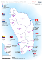
Dominica: Military Resources and Activity Areas (26-27 Sep 2017)
Shows the approx areas of response of the International Military Assets -
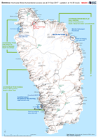
Dominica: Hurricane Maria humanitarian access (as at 21 Sep 2017 - update 4 a...
Map of humanitarian access, as reported to the EOC in Roseau up to 14.00 local time on 21 September. This map will change frequently as access conditions change and more... -
Philippines Typhoon Haiyan (Yolanda): Radio Stations in operation (06-Dec-2013)
Map shows radio stations that are currently operating with approximate coverage areas. -

Serbia: Floods - UNDAC Assessment of Logistics Capacity, 26 May 2014
UNDAC logistics capacity assessment mission, conducted 26/5/14. Refer to assessment report for results and full details. Route: Belgrade - Kolari - Pozarevac - Petrovac - Velika... -

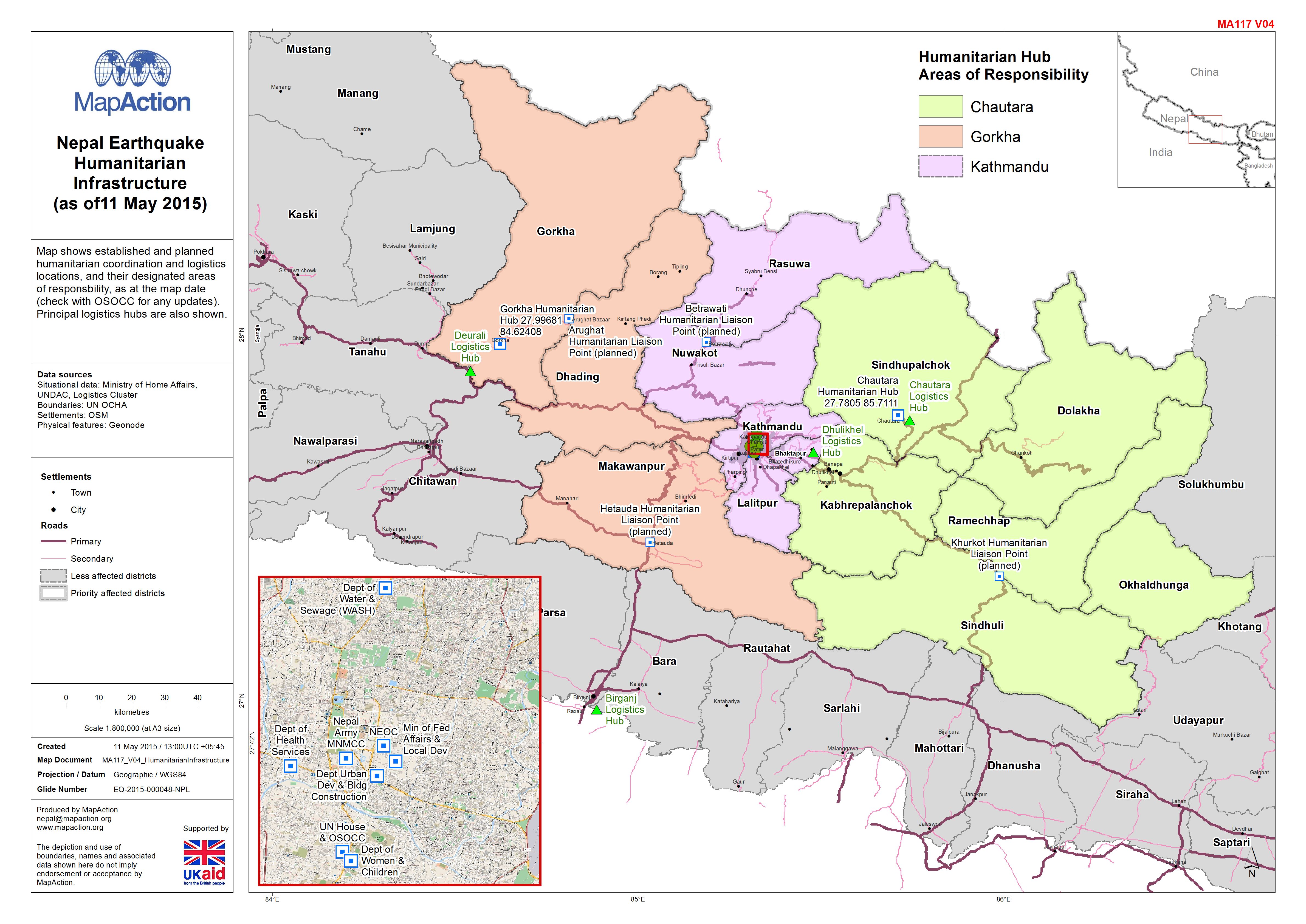
Nepal: Earthquake - Humanitarian Infrastructure(as of11 May 2015)
Map shows established and planned humanitarian coordination and logistics locations, and their designated areas of responsbility, as at the map date (check with OSOCC for any... -

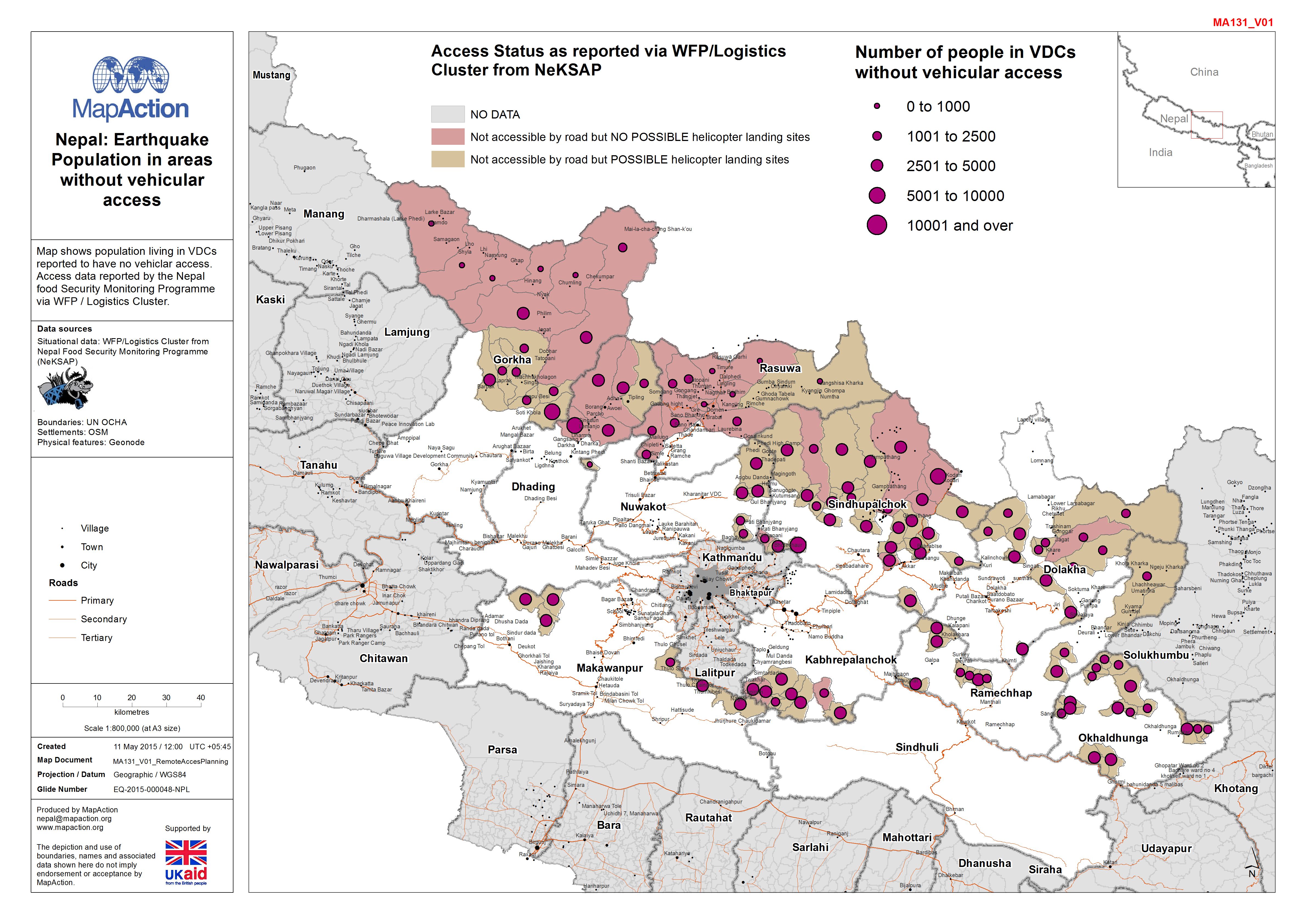
Nepal: Earthquake - Population in areas without vehicular access
Map shows population living in VDCs reported to have no vehiclar access. Access data reported by the Nepal food Security Monitoring Programme via WFP / Logistics Cluster. -

Nepal: Earthquake - Access overview (as of 8 May 2015)
This Mapbook shows access to VDCs as reported by WFP / Logistics Cluster. Multiple areas are covered in the document. -
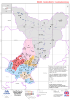
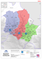
Nepal: Earthquake - Gorkha District - Coordination Information
Map shows the coordination zones (1-6) that have been set up by the local DDC and NGO's, these are primarily based on access for distribution. Sectors A, B and C are projected... -
Nepal: Earthquake - Humanitarian Infrastructure (as of 8 May 2015)
Map shows established and planned humanitarian coordination and logistics locations as at the map date (check with OSOCC for updates). Principle logistics hubs are also show.... -
Nepal: Earthquake - Sindhupalchok - Distribution Access (as at 6th May 2015)
Map shows the main DDRC distribution hubs and the areas served by each. Hatched VDCs are inaccessable by road.