-

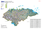
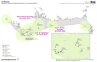
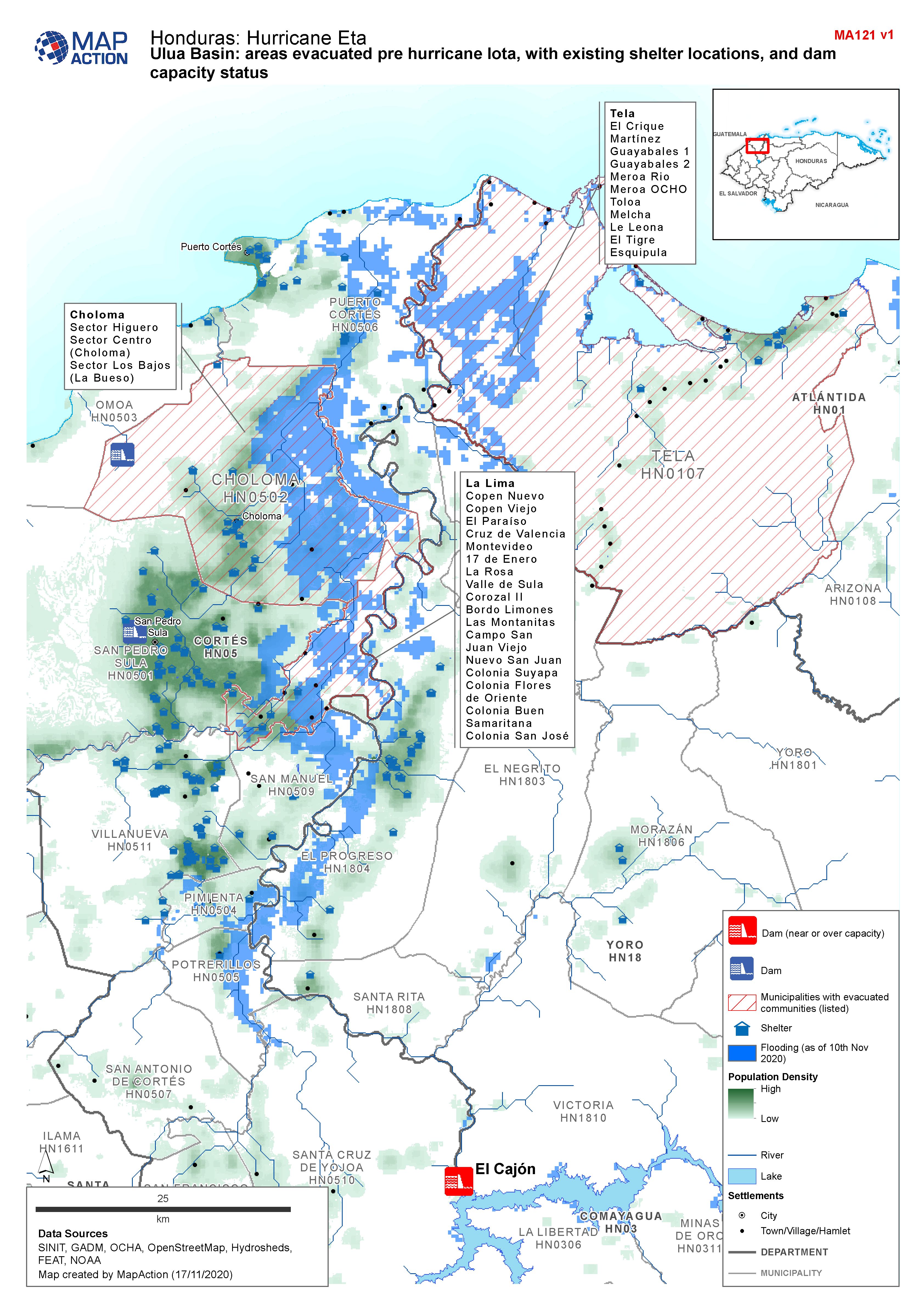
Honduras, Ulua Basin: areas evacuated pre Hurricane Iota, with existing shelt...
Map shows communities evacuated pre hurricane Iota, and existing shelter locations. Population density and capacity status of dams are also shown. -
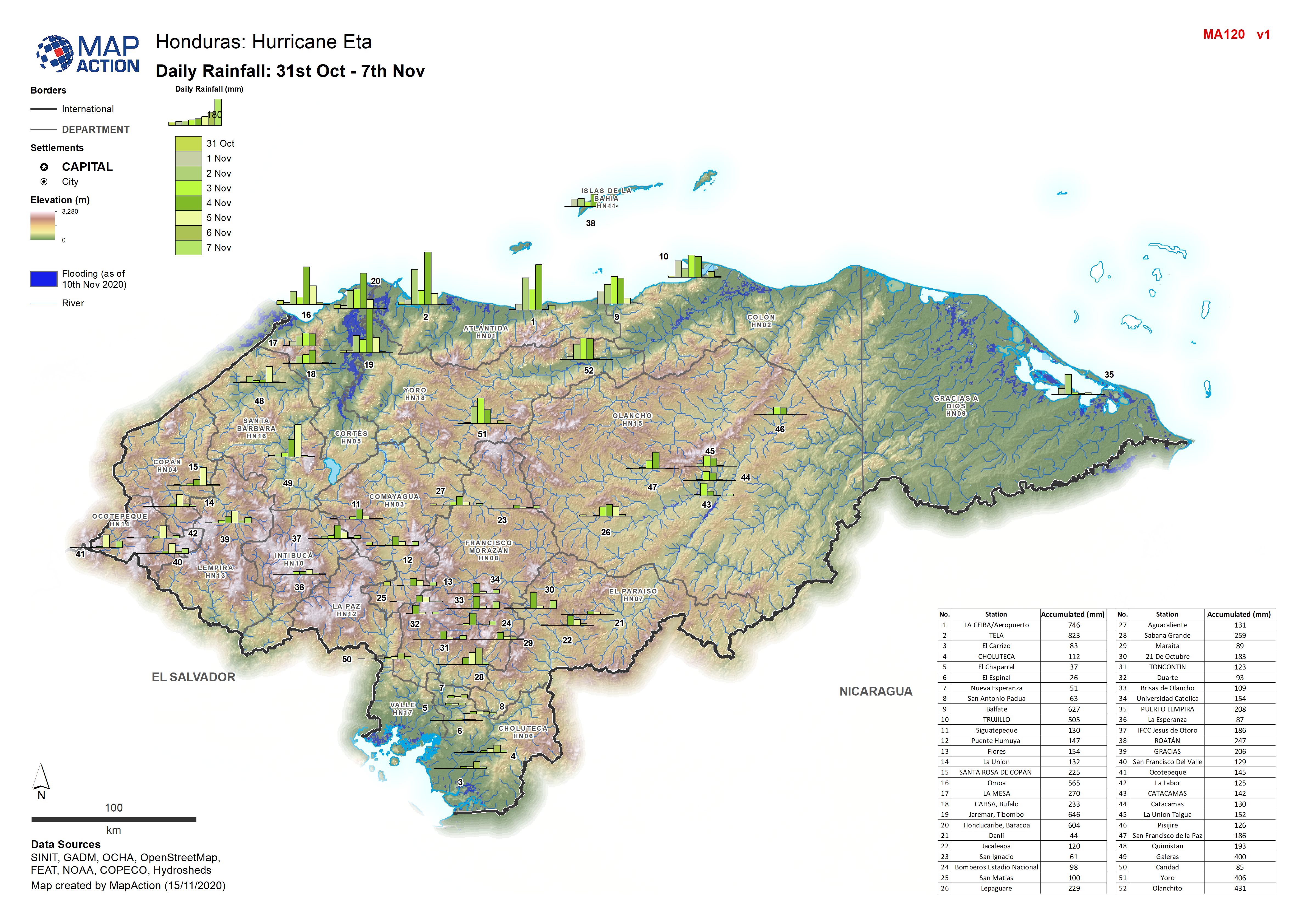
Honduras: Daily Rainfall: 31st Oct - 7th Nov 2020
Honduras: Daily Rainfall: 31st Oct - 7th Nov by weather station -
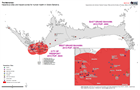
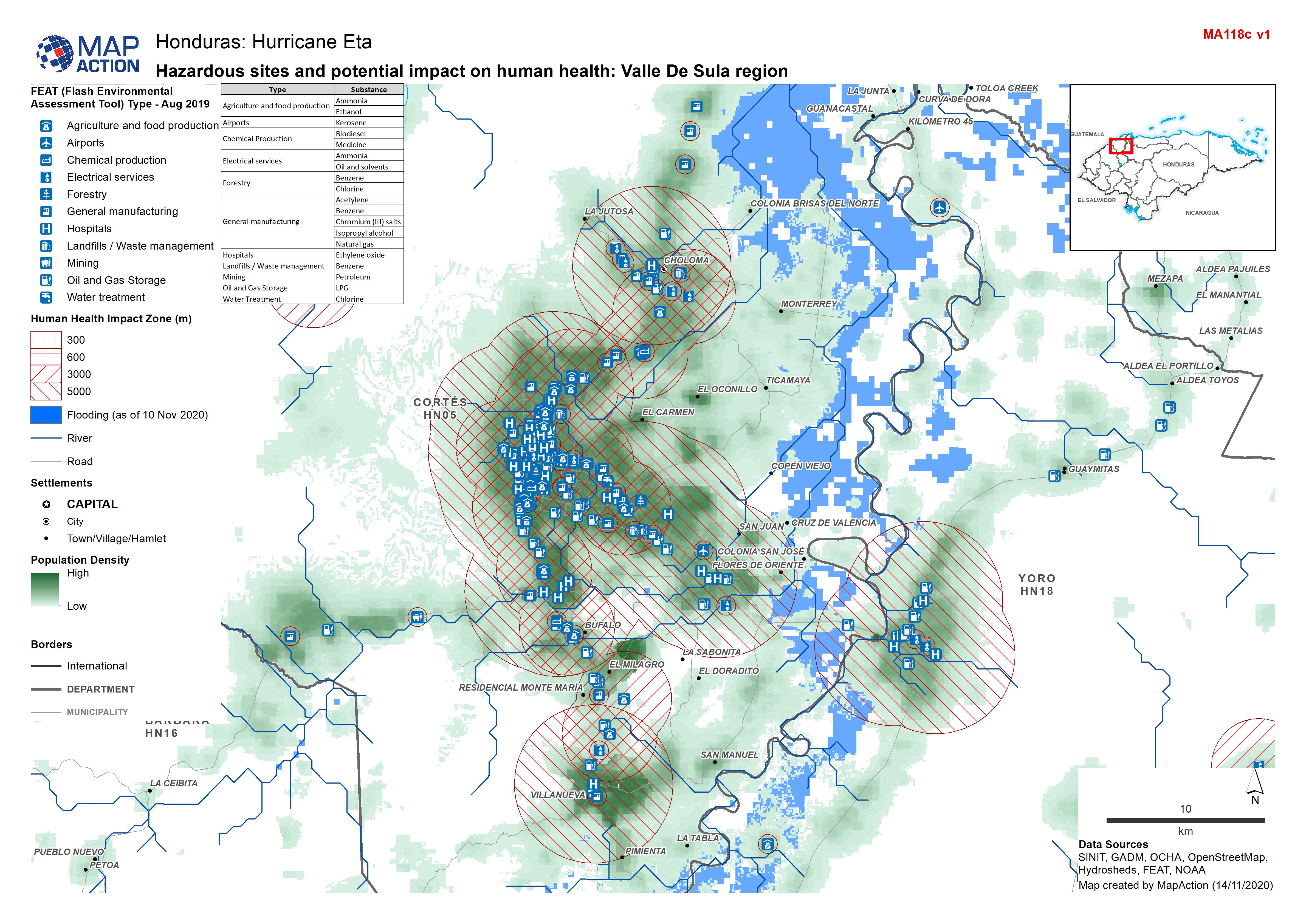
Honduras: Hazardous sites and potential impact on human health: Valle De Sula...
Honduras - Environmental Impact Zones (human health) from FEAT: Valle de Sula region (FEAT - Flash Environmental Assessment Tool) -

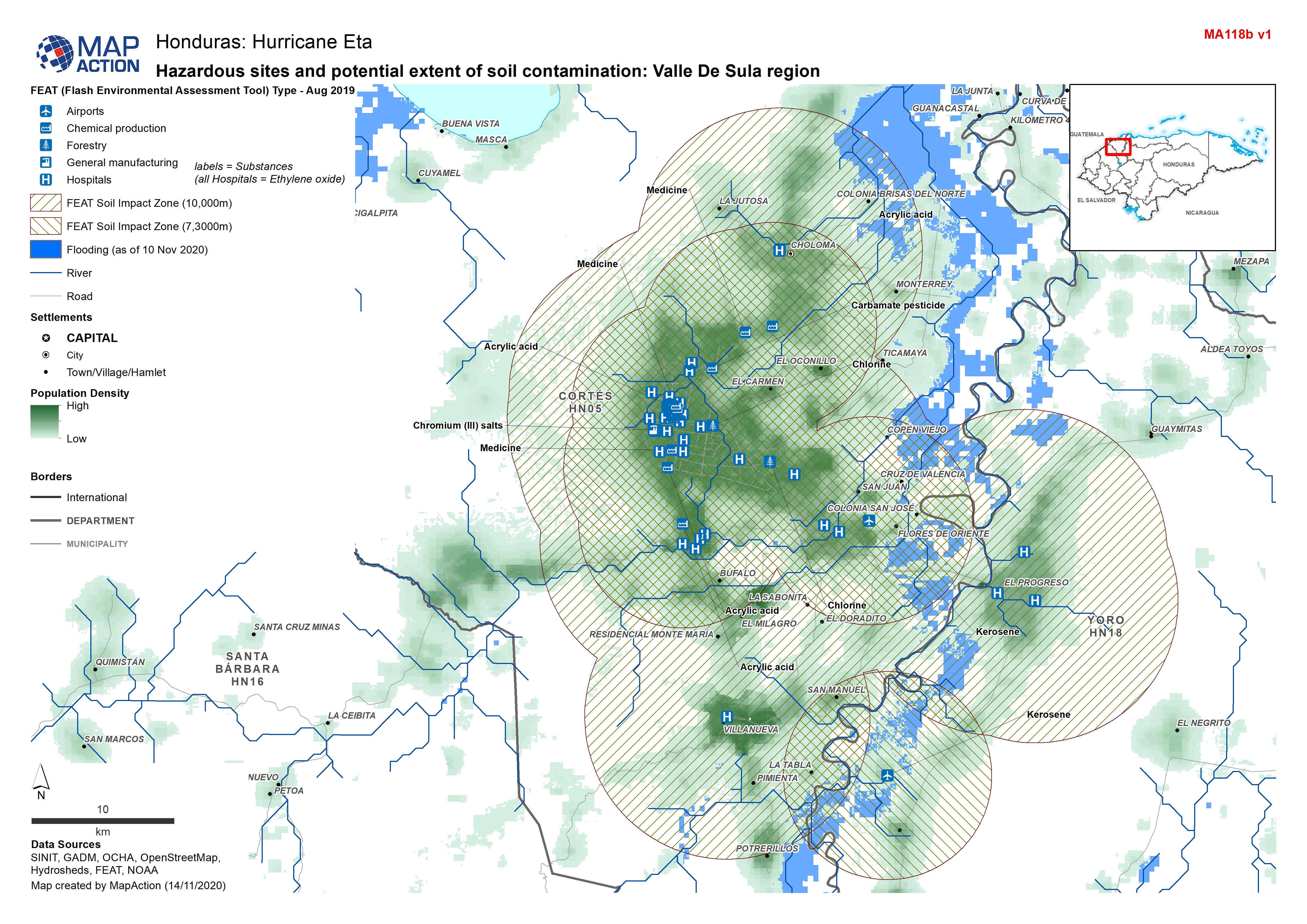
Honduras: Hazardous sites and potential extent of soil contamination: Valle D...
Honduras - Environmental Impact Zones (soil) from FEAT: Valle de Sula region (FEAT - Flash Environmental Assessment Tool) -

Honduras: Hazardous sites and potential extent of water contamination: Valle ...
Honduras - Environmental Impact Zones (water) from FEAT: Valle de Sula region (FEAT - Flash Environmental Assessment Tool) -

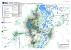
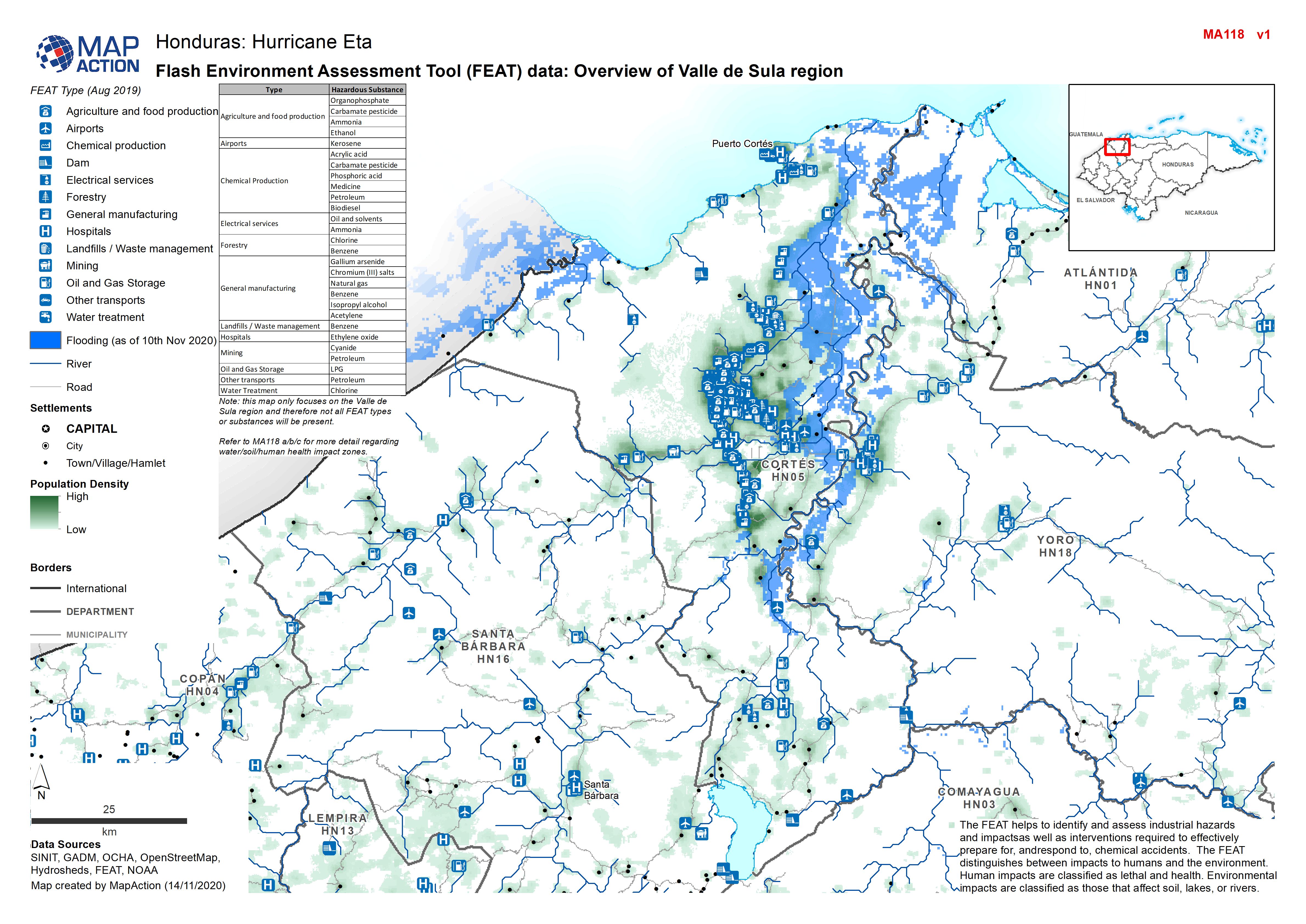
Honduras: Flash Environment Assessment Tool (FEAT) data: Overview of Valle de...
Flash Environment Assessment Tool (FEAT) data: Overview of Valle de Sula region -
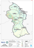
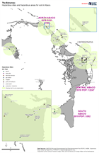
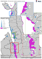
Guyana Reference Map: Administrative Regions
This reference map shows digital elevation data at 90m resolution, with primary roads, airports, major settlements and administrative regions for Guyana. -

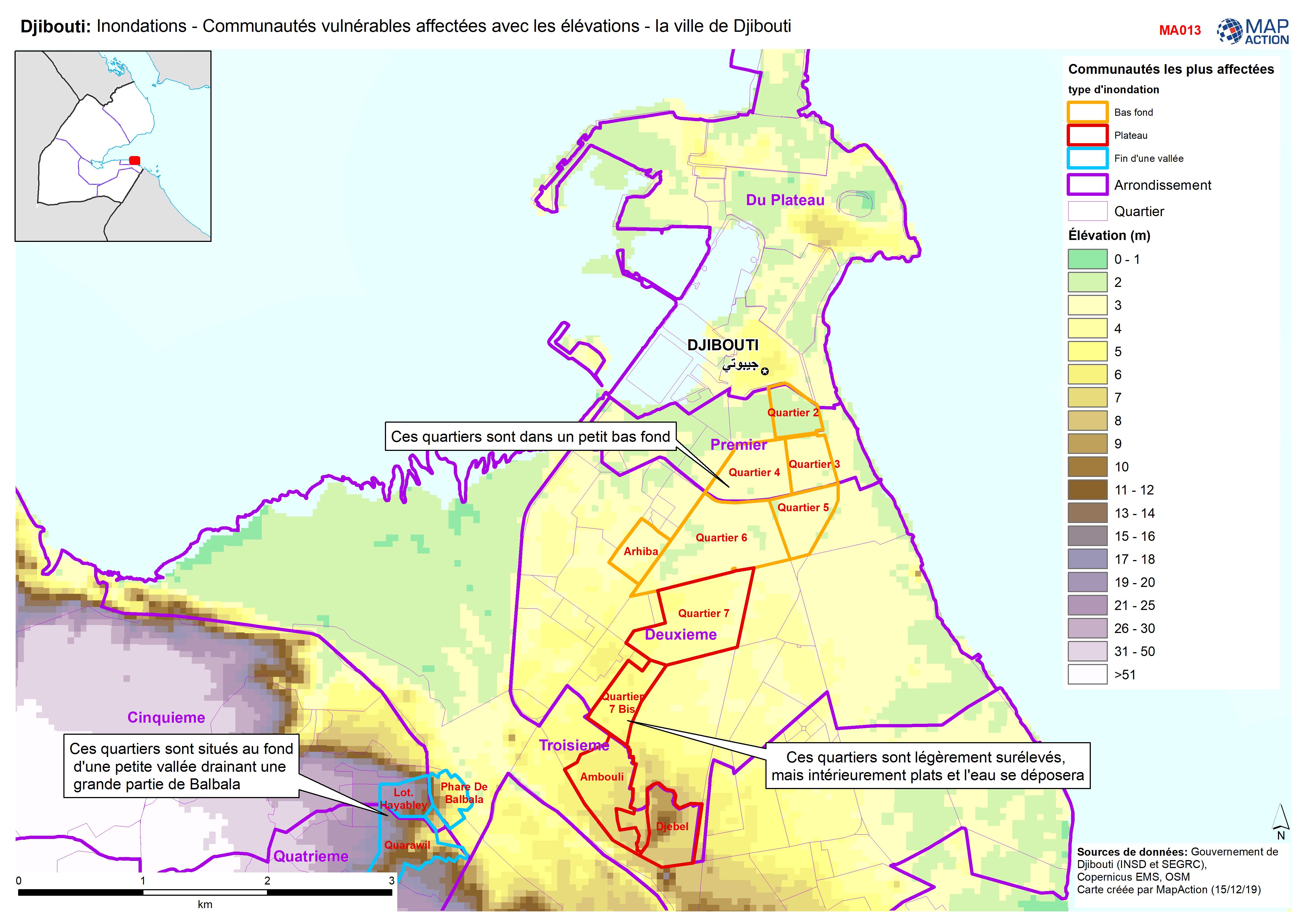
Djibouti: Inondations - Communautés vulnérables affectées avec les élévations...
Djibouti City - Map shows the most affected flooded communities, containing the most vulnerable populations, alongside elevation data to demonstrate the effects of elevation and... -
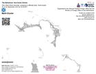
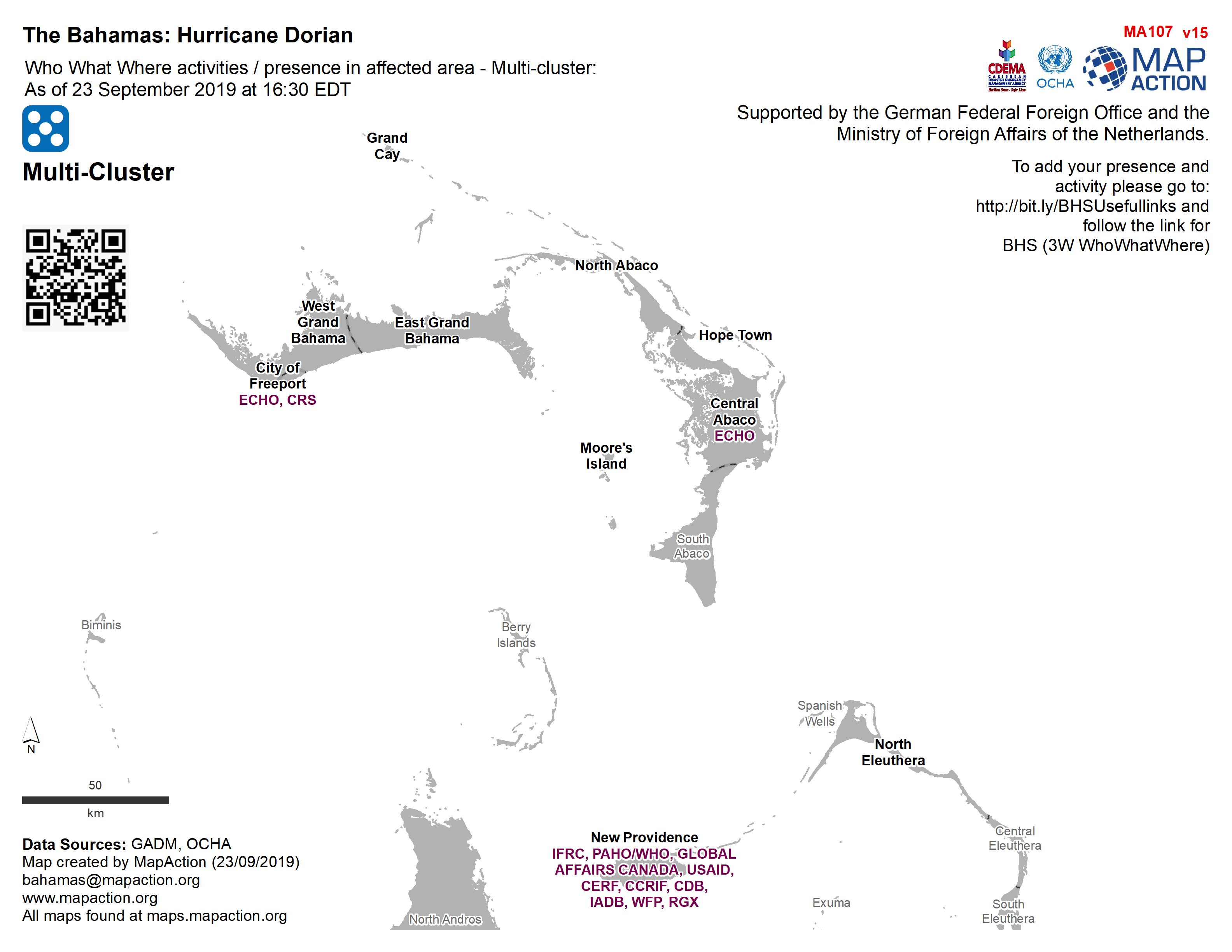
Who What Where activities / presence in affected area - Multi-cluster: As of ...
Who, What, Where for Coordination - Multi-Cluster -
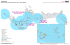
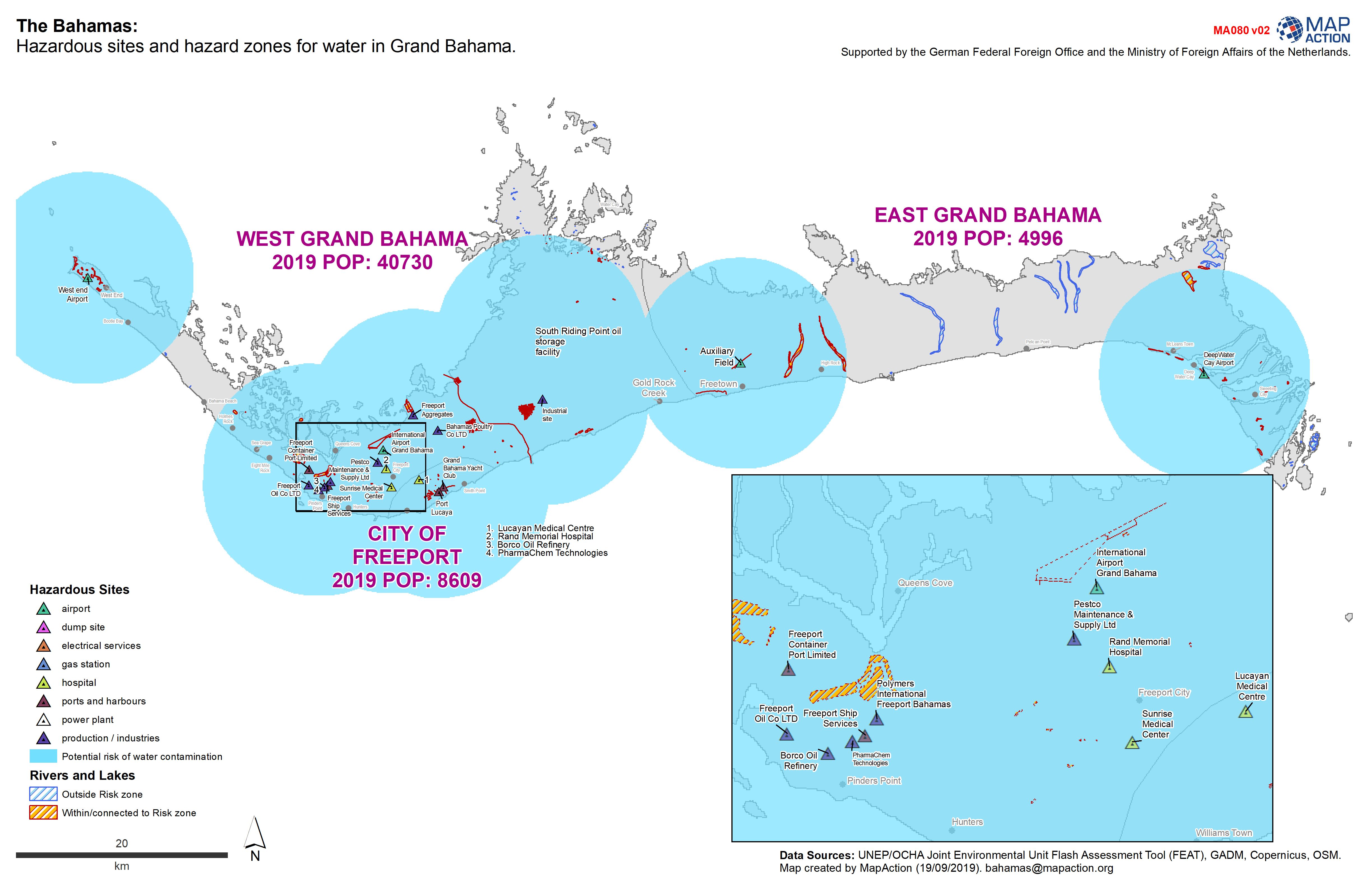
The Bahamas: Hazardous sites and hazard zones for water in Grand Bahama.
Hazardous sites and hazardous zones for human health. -
Who What Where activities / presence in affected area - Multi-cluster: As of ...
Who, What, Where for Coordination - Multi-Cluster -

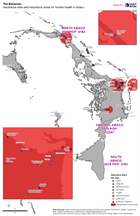
The Bahamas: Hazardous sites and hazardous areas for water in Abaco.
Hazardous sites in Abaco -
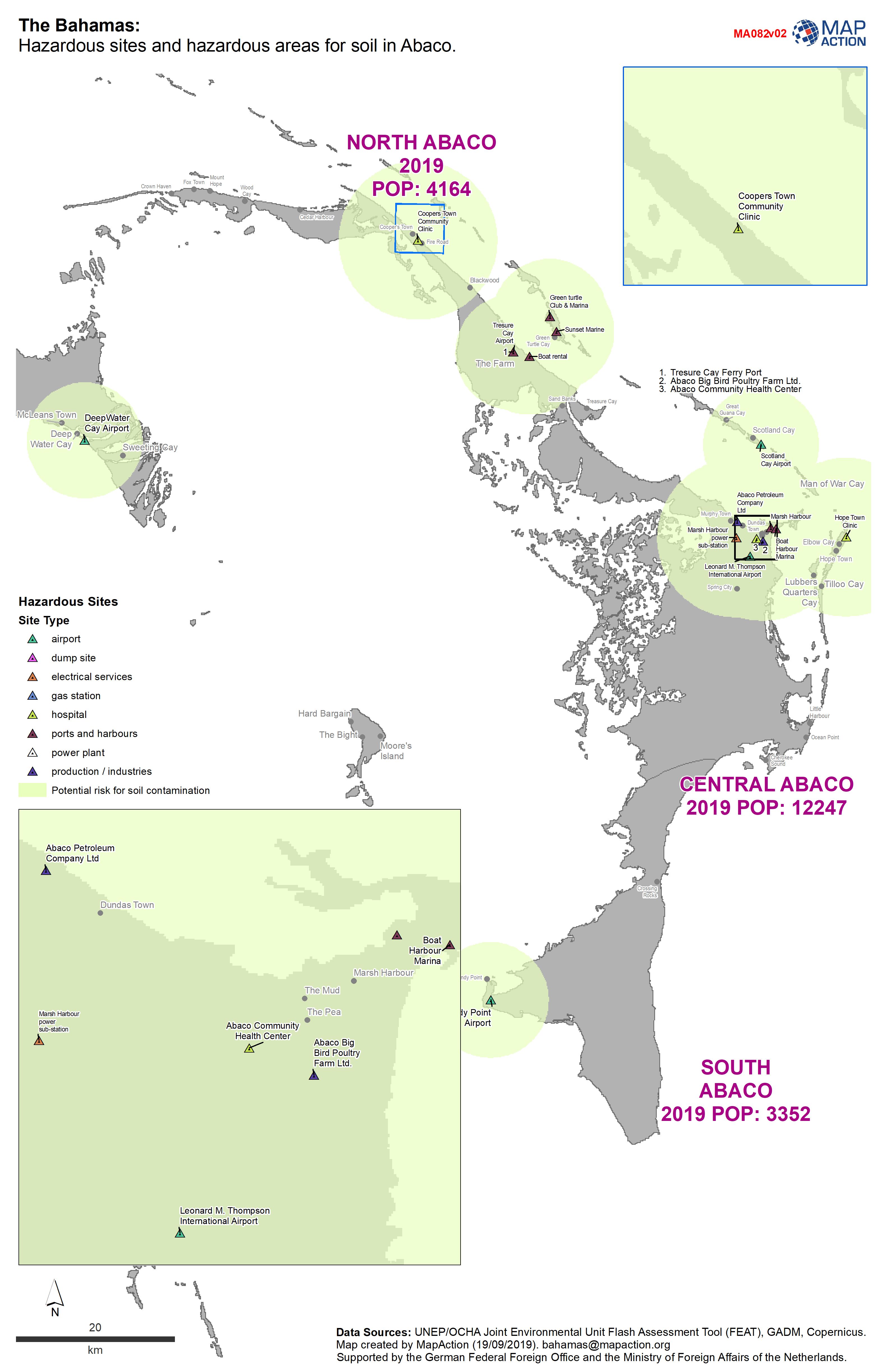
The Bahamas: Hazardous sites and hazardous areas for soil in Abaco.
Hazardous sites in Abaco -
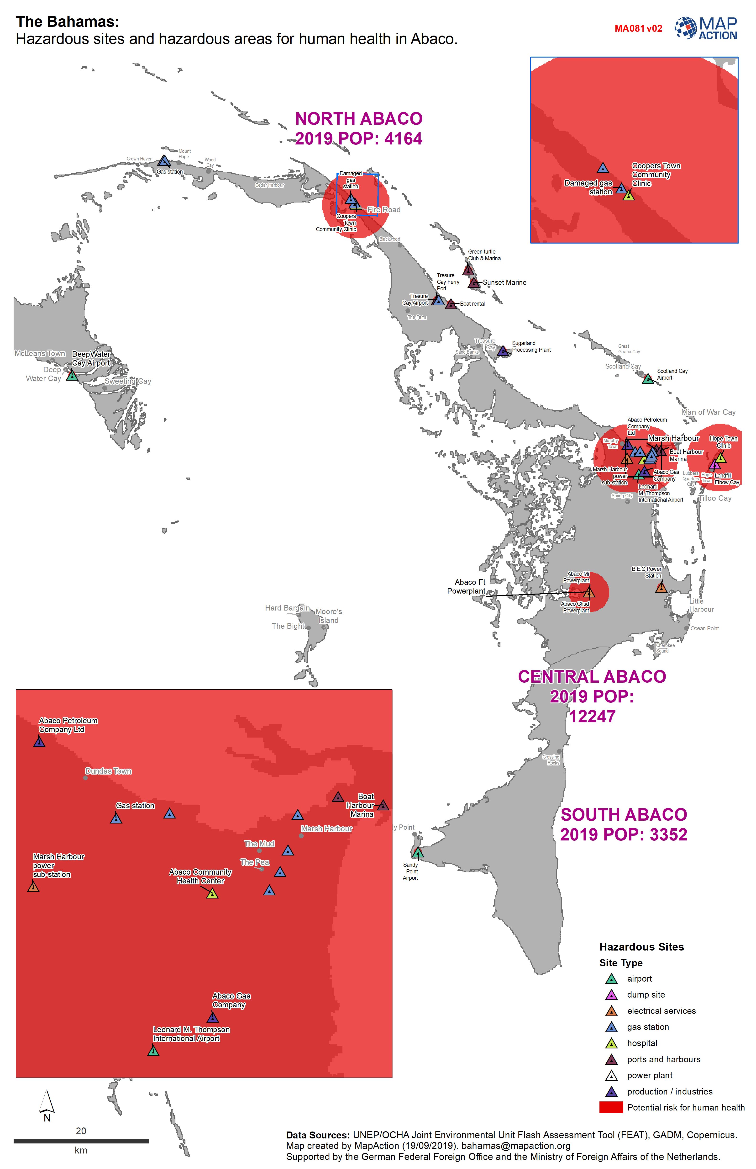
The Bahamas: Hazardous sites and hazardous areas for human health in Abaco.
Sites hazardous to human health in Abaco -
The Bahamas: Hazardous sites and hazardous zones for soil in Grand Bahama.
Hazardous sites and hazardous zones for soil -
The Bahamas: Hazardous sites and hazard zones for human health in Grand Bahama.
Hazardous sites and hazardous zones for human health. -
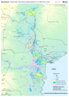
Mozambique: Cyclone Idai - Flood extent change between 20, 31 March and 7 Apr...
Map shows the change in flood extent between the 20, 31 of March and 7 April -
Central Sulawesi: IDP sites within modelled Liquefaction risk areas.
Map shows IDP sites as identified through analysis of Digital Globe imagery from 2nd - 5th October, and areas at risk of liquefaction as determined through the USGS preferred... -

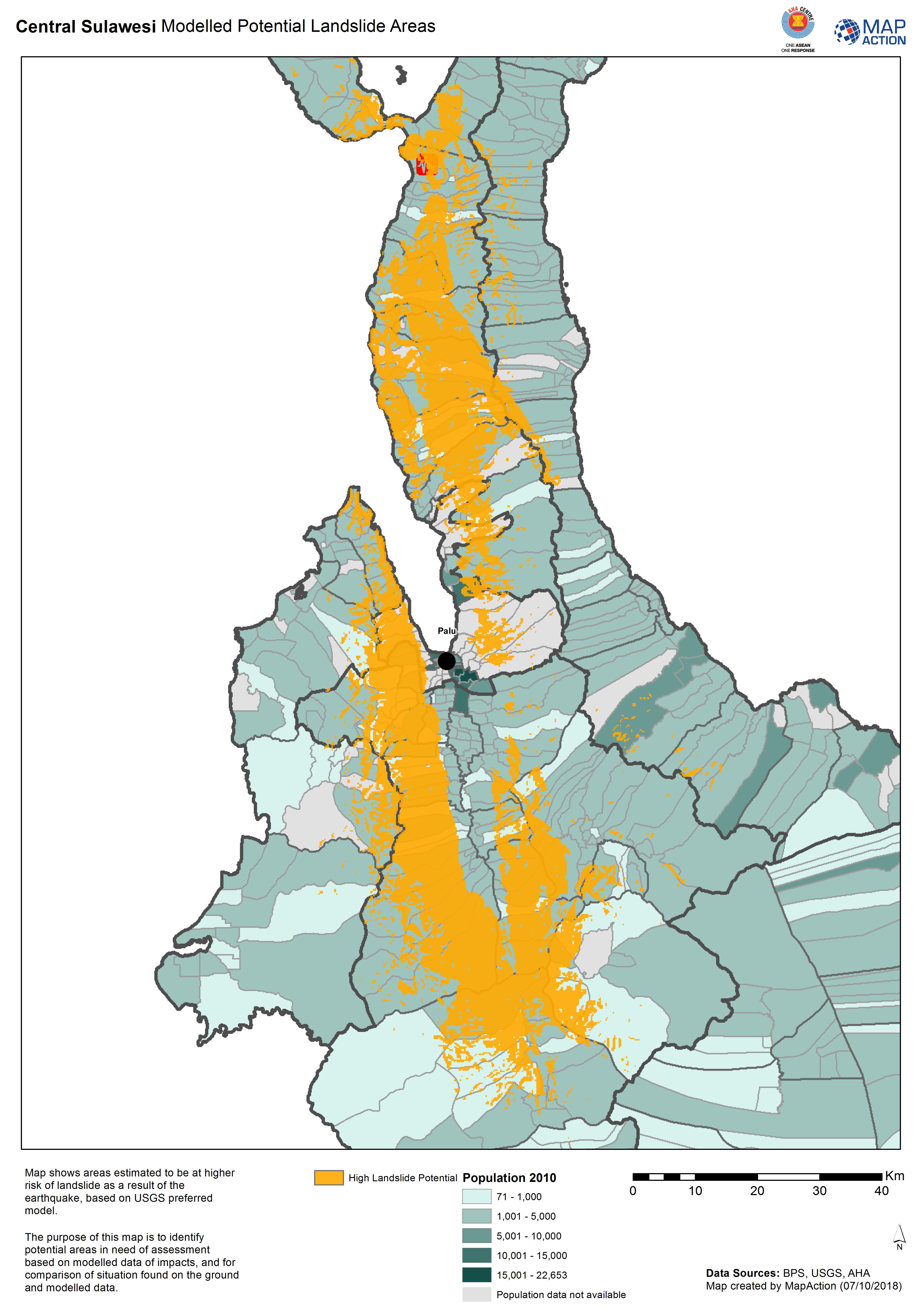
Central Sulawesi Modelled Potential Landslide Areas
Map shows areas estimated to be at higher risk of landslide as aresult of the earthquake, based on USGS preferred model. -

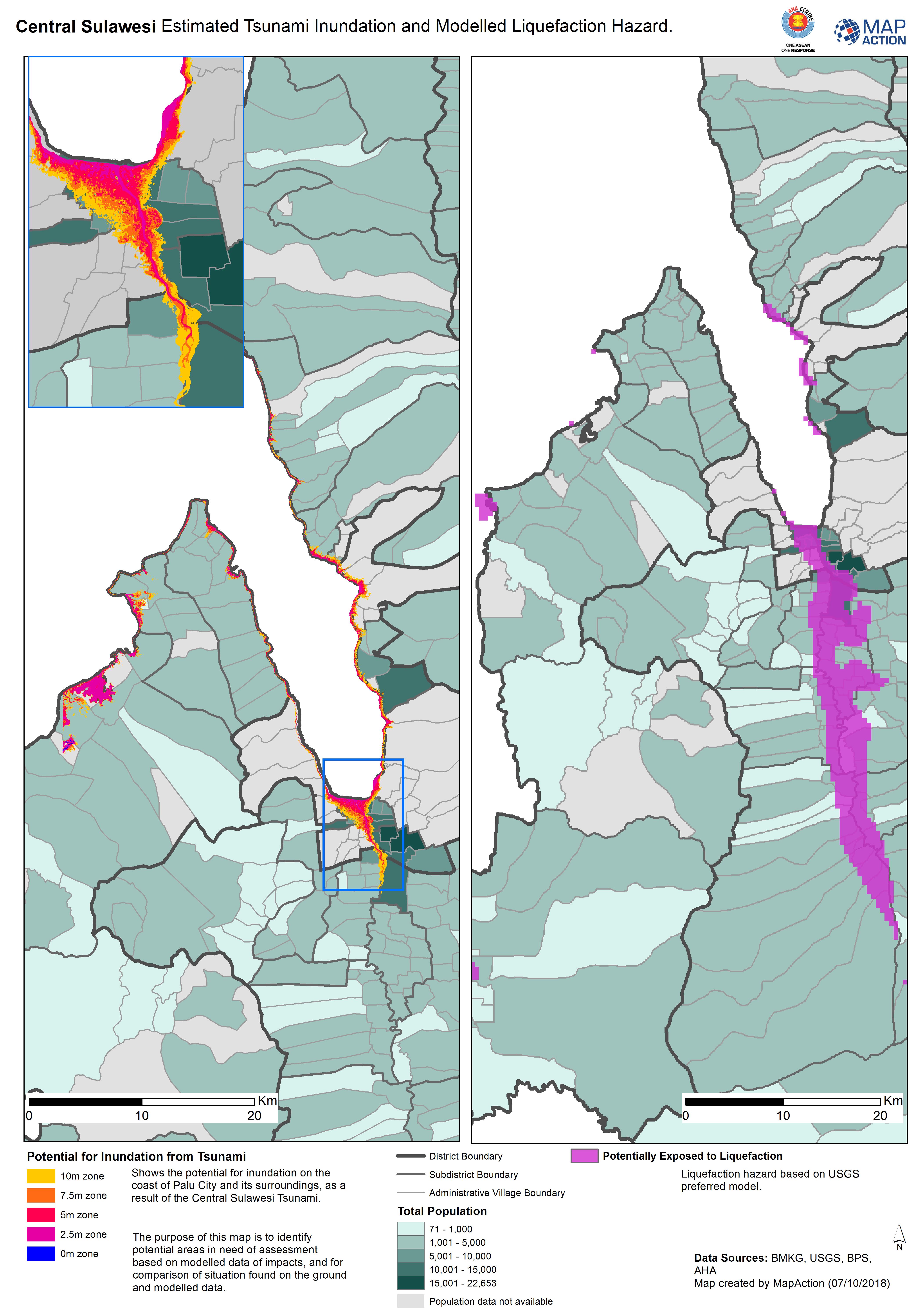
Central Sulawesi Estimated Tsunami Inundation and Modelled Liquefaction Hazard.
Shows the potential for inundation on the coast of Palu City and its surroundings, as a result of the Central Sulawesi Tsunami. The purpose of this map is to identify potential...