-

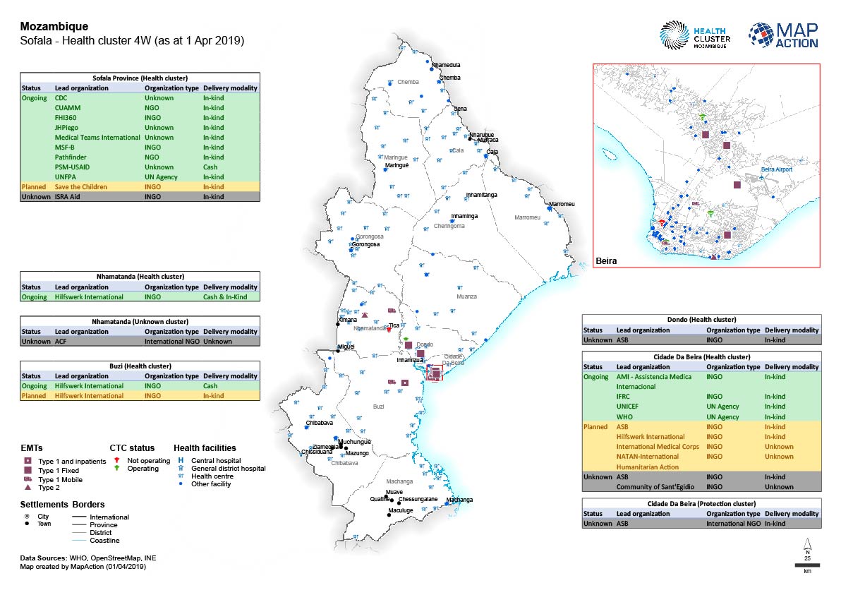
Sofala - Health cluster 4W (as at 1 Apr 2019)
Map shows the organisations that have reported to the Health cluster there activities in Sofala. -
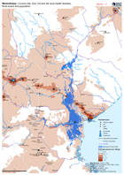
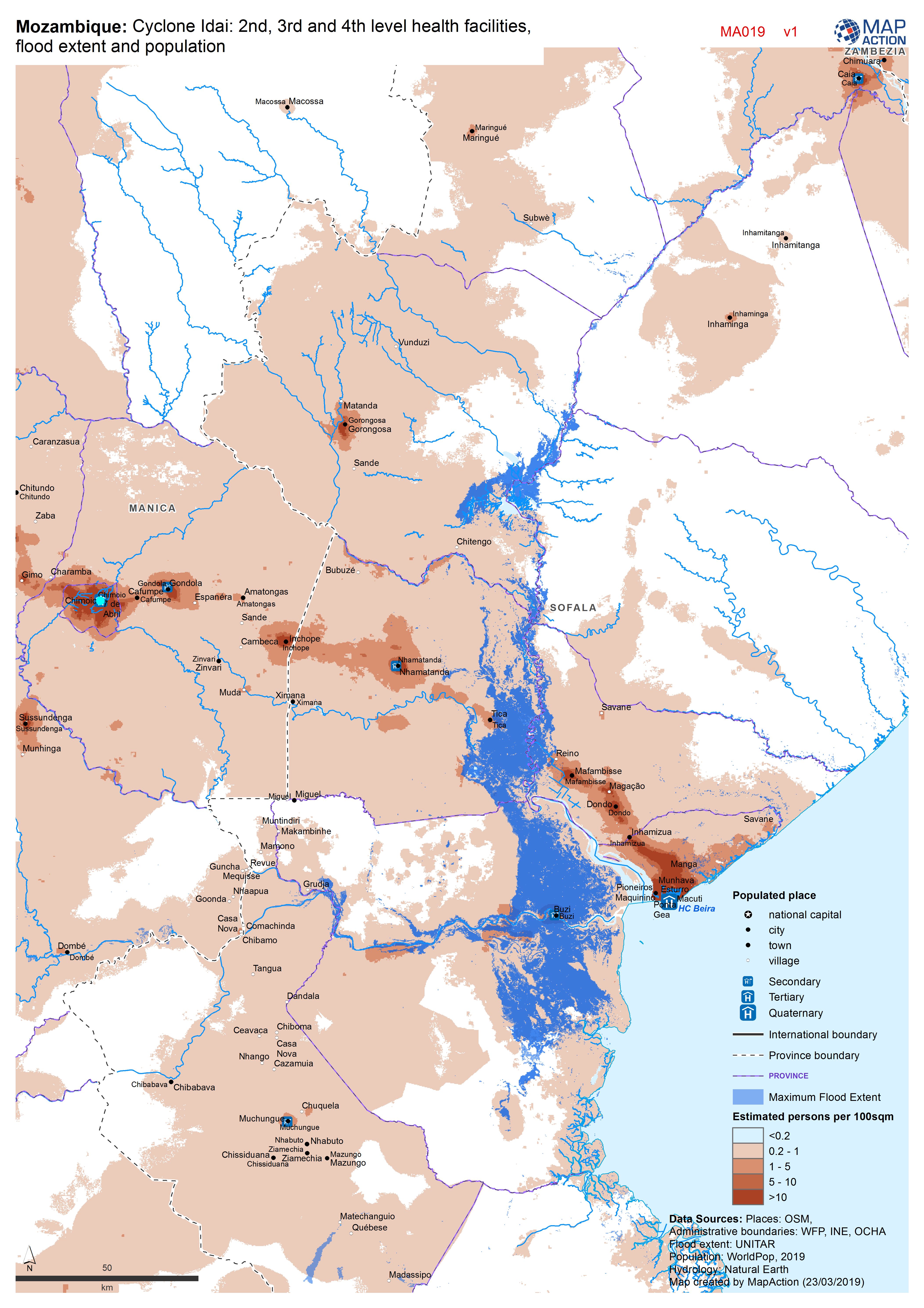
Mozambique: Cyclone Idai - 2nd, 3rd and 4th level health facilities, flood ex...
Map shows the population (based on WorldPop at 100m resolution generating through AI) and the Flood Extents known as of 19/20 March 2019 plus Health facilities -

Mozambique: Cyclone Idai - Health facilities, hospitals and population concen...
Map shows hospitals and health facilities. Background is population (based on WorldPop at 100m resolution generating through AI). -

Mozambique: Cyclone Idai - District details showing Health facilities
Maps show District details and Health facilities -
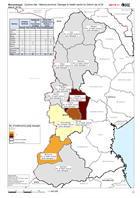
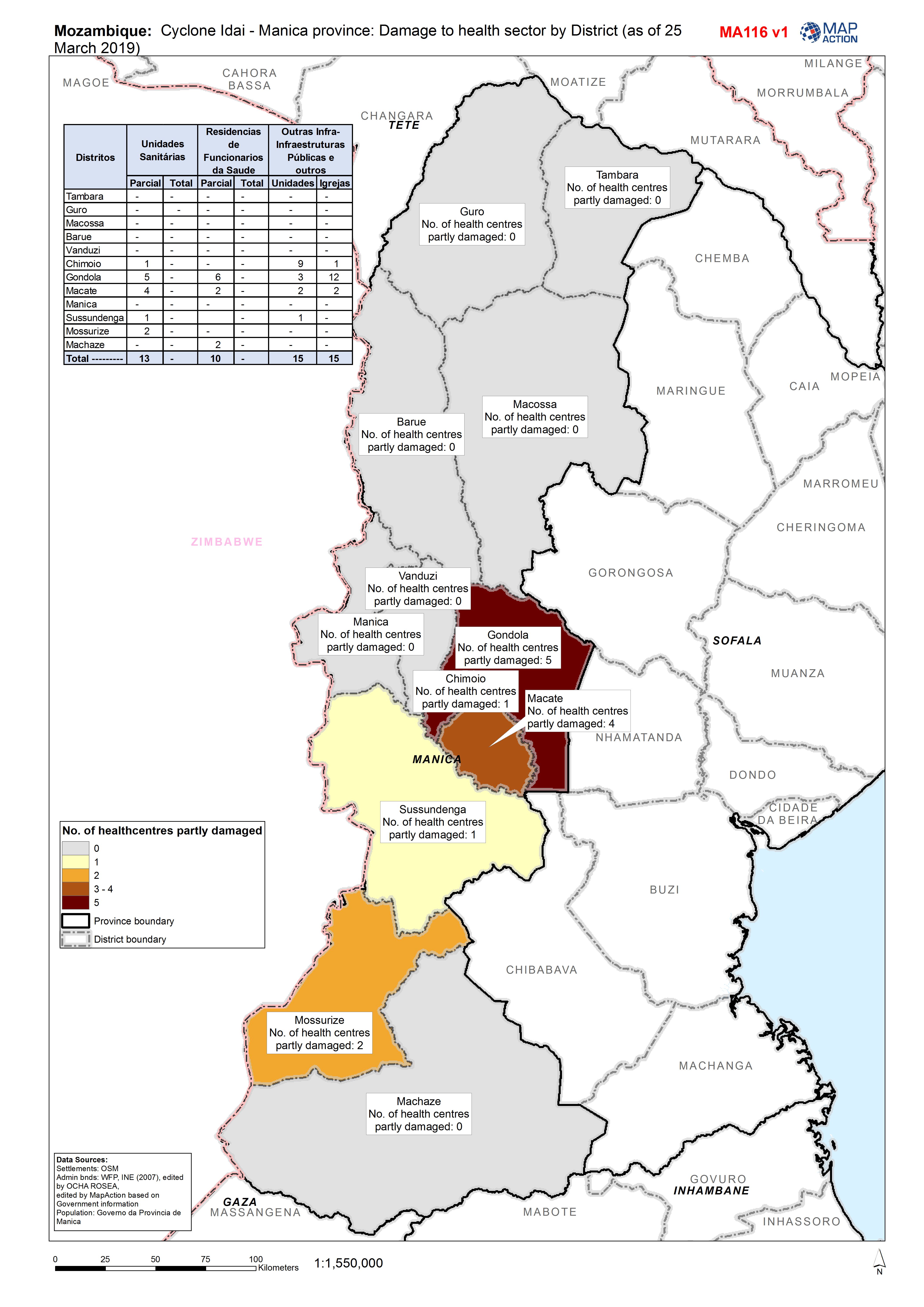
Mozambique: Cyclone Idai - Manica province: Damage to health sector by Distri...
Map shows the damage of health infrastructure per district in the province of Manica -
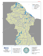
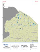
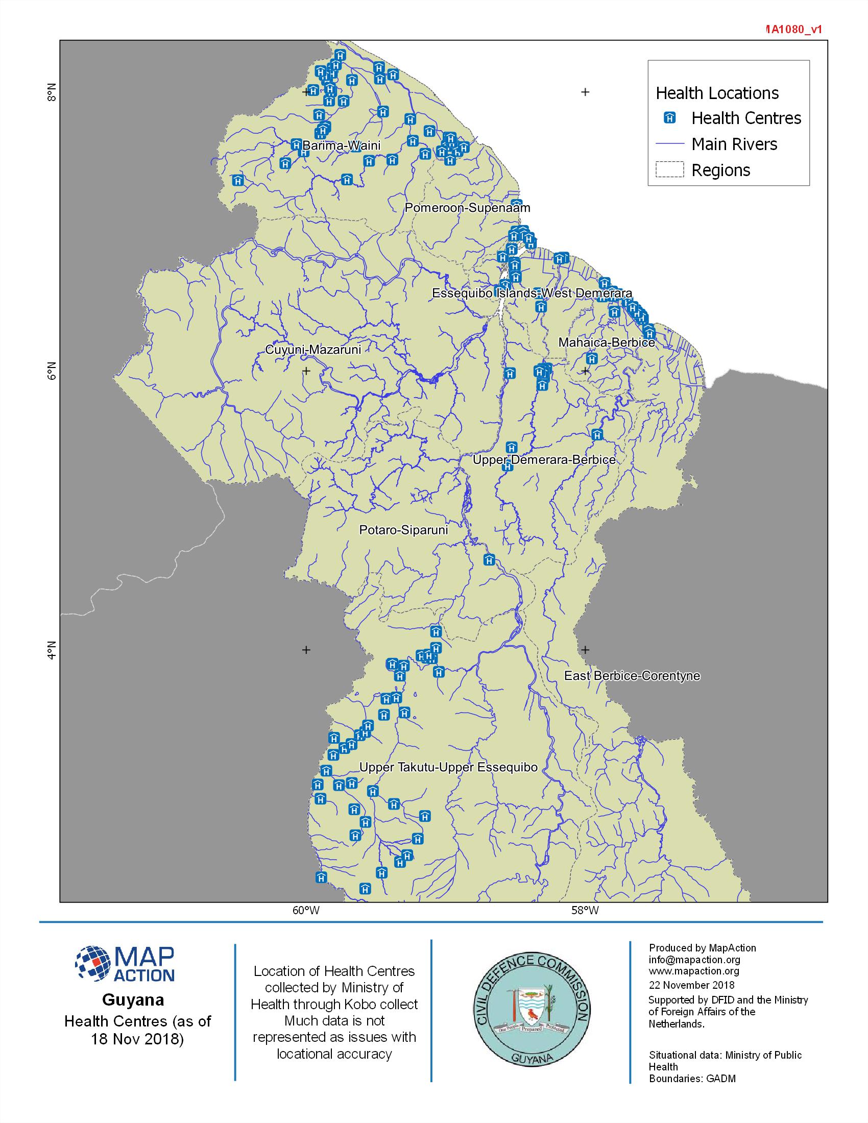
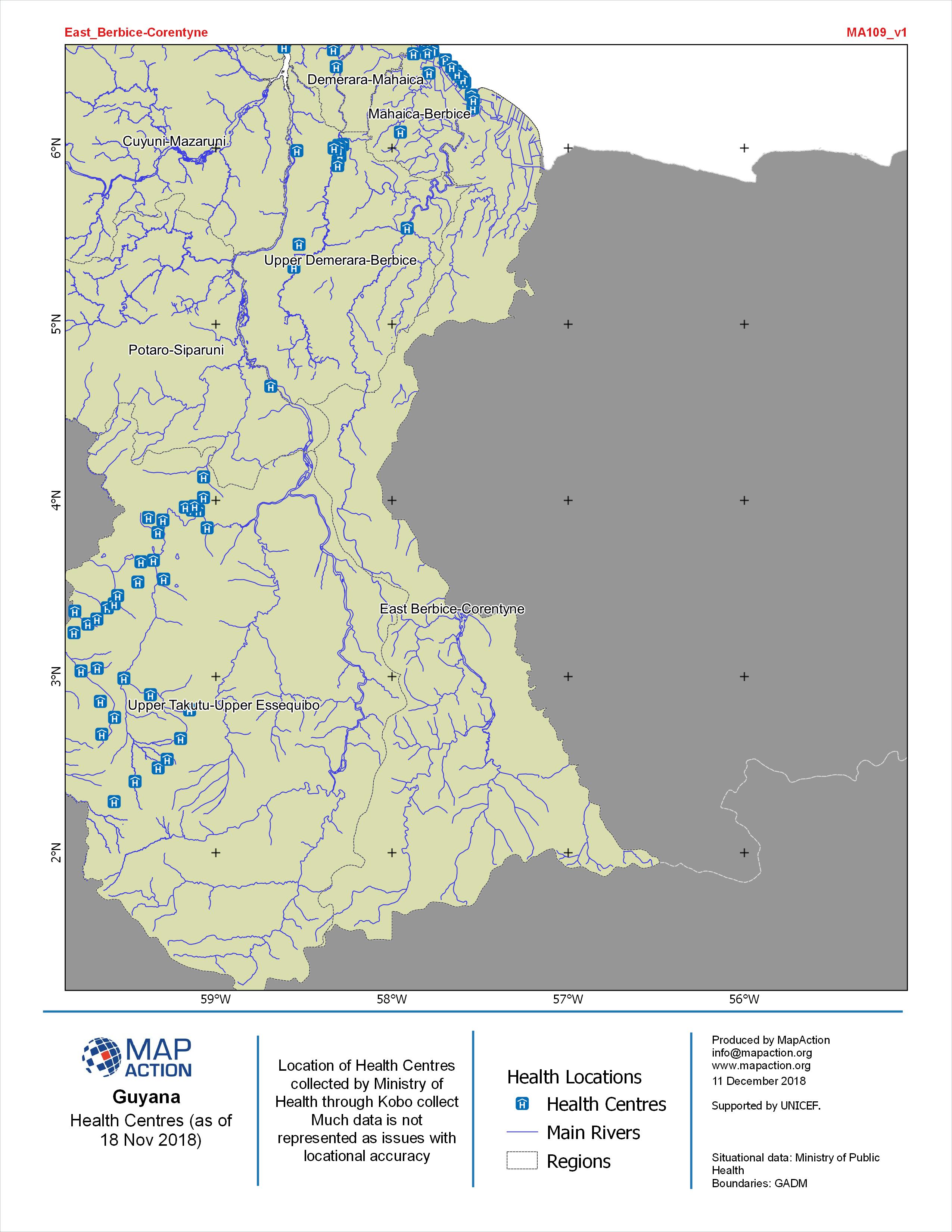
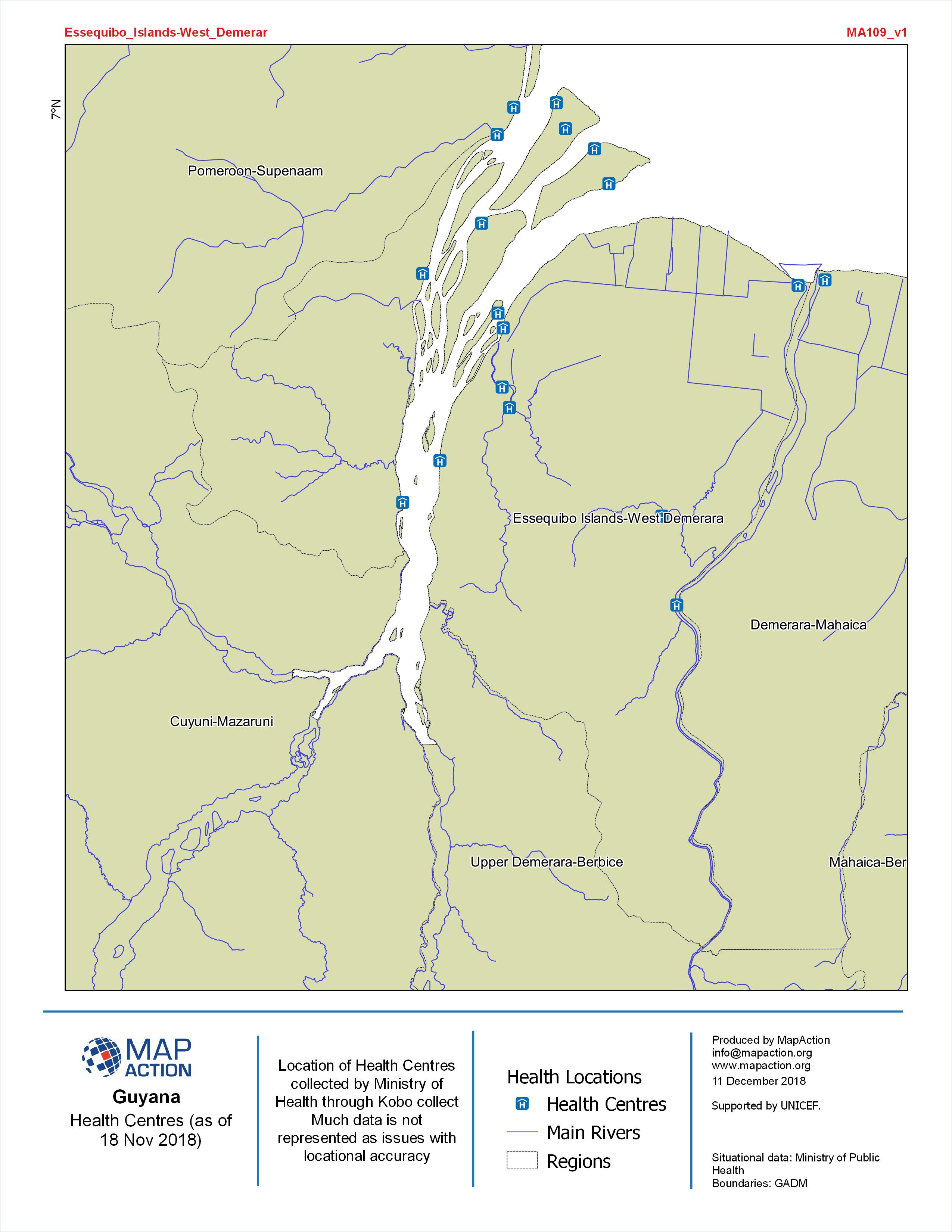
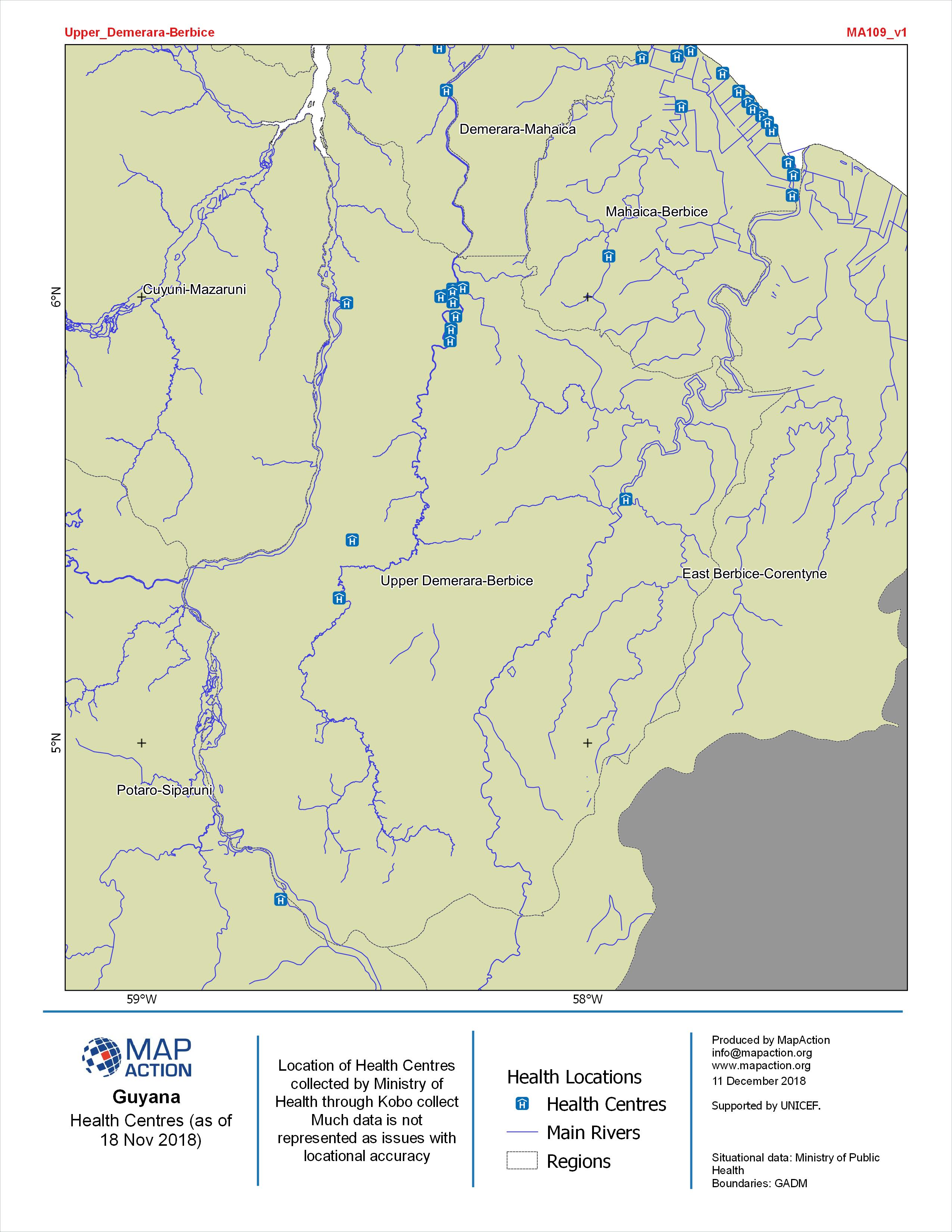
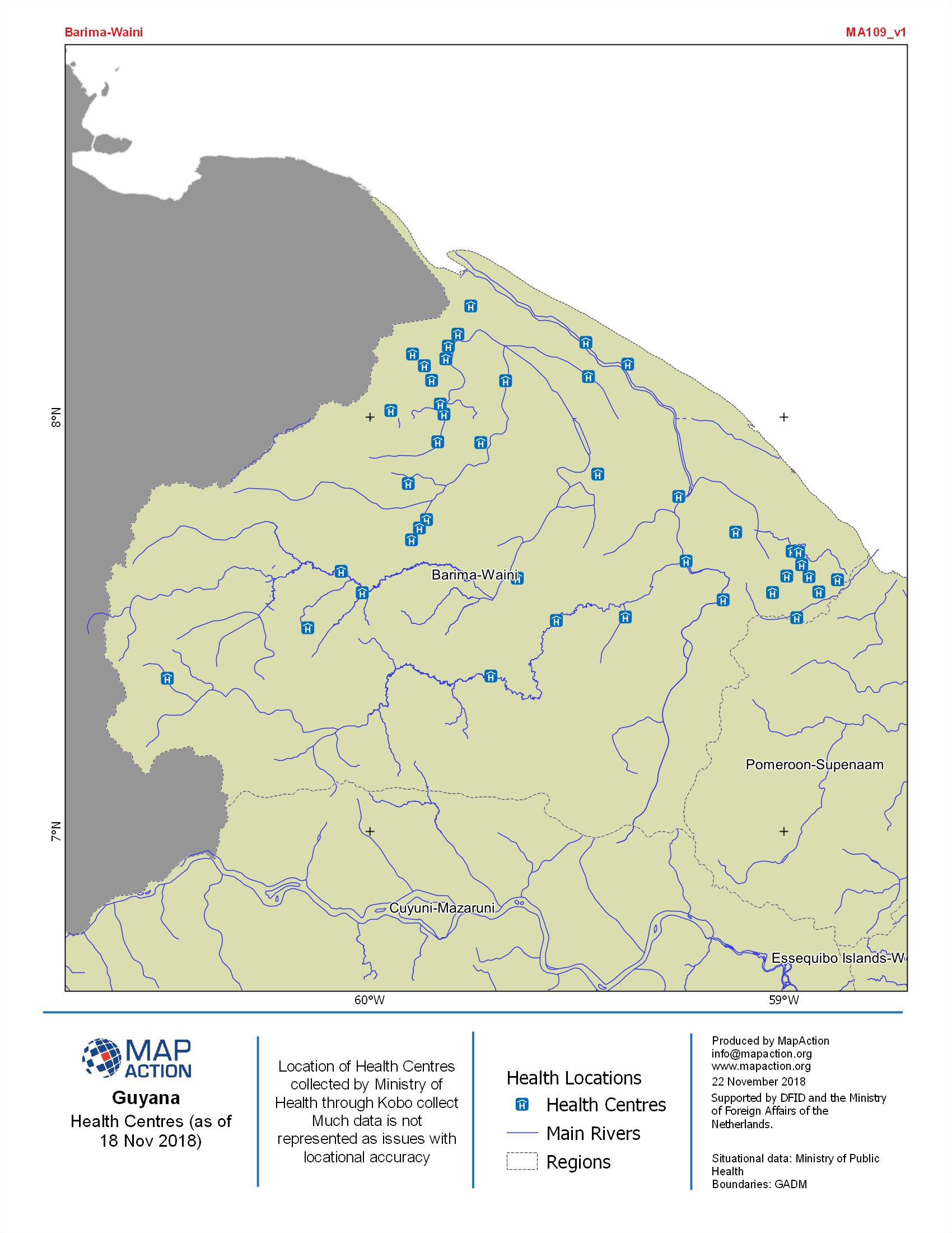
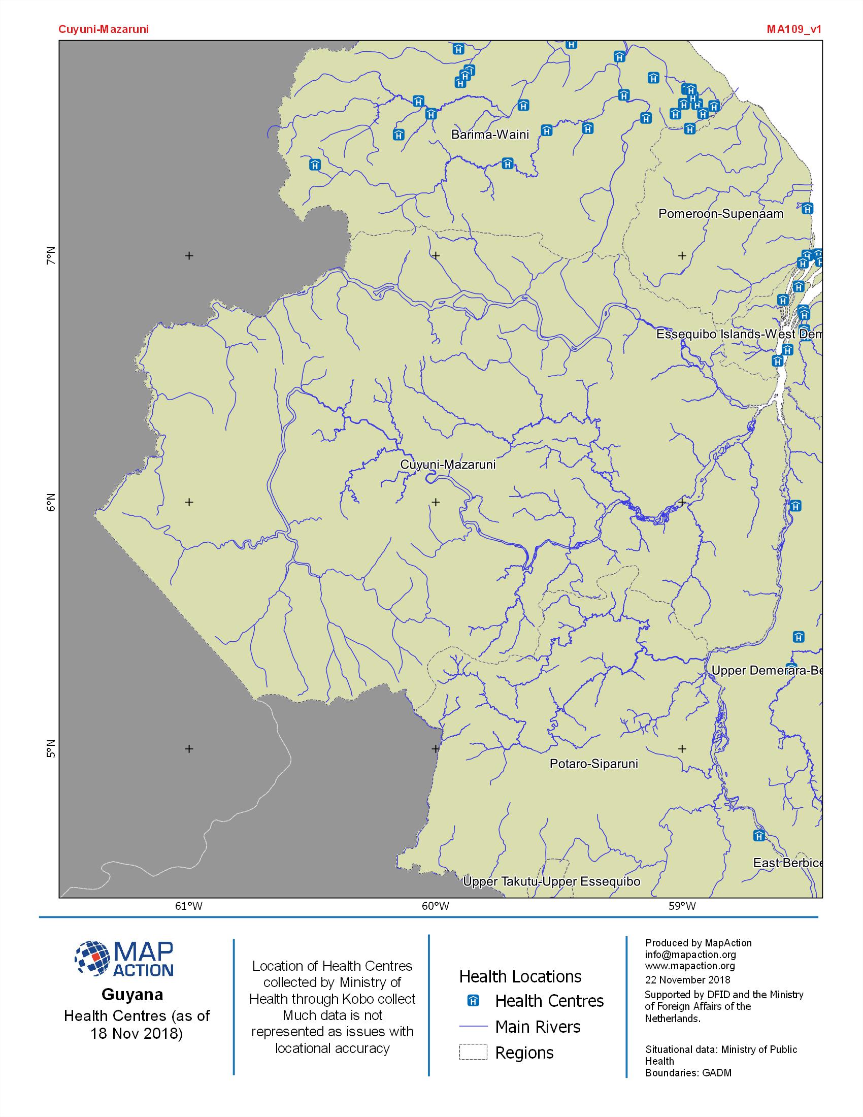
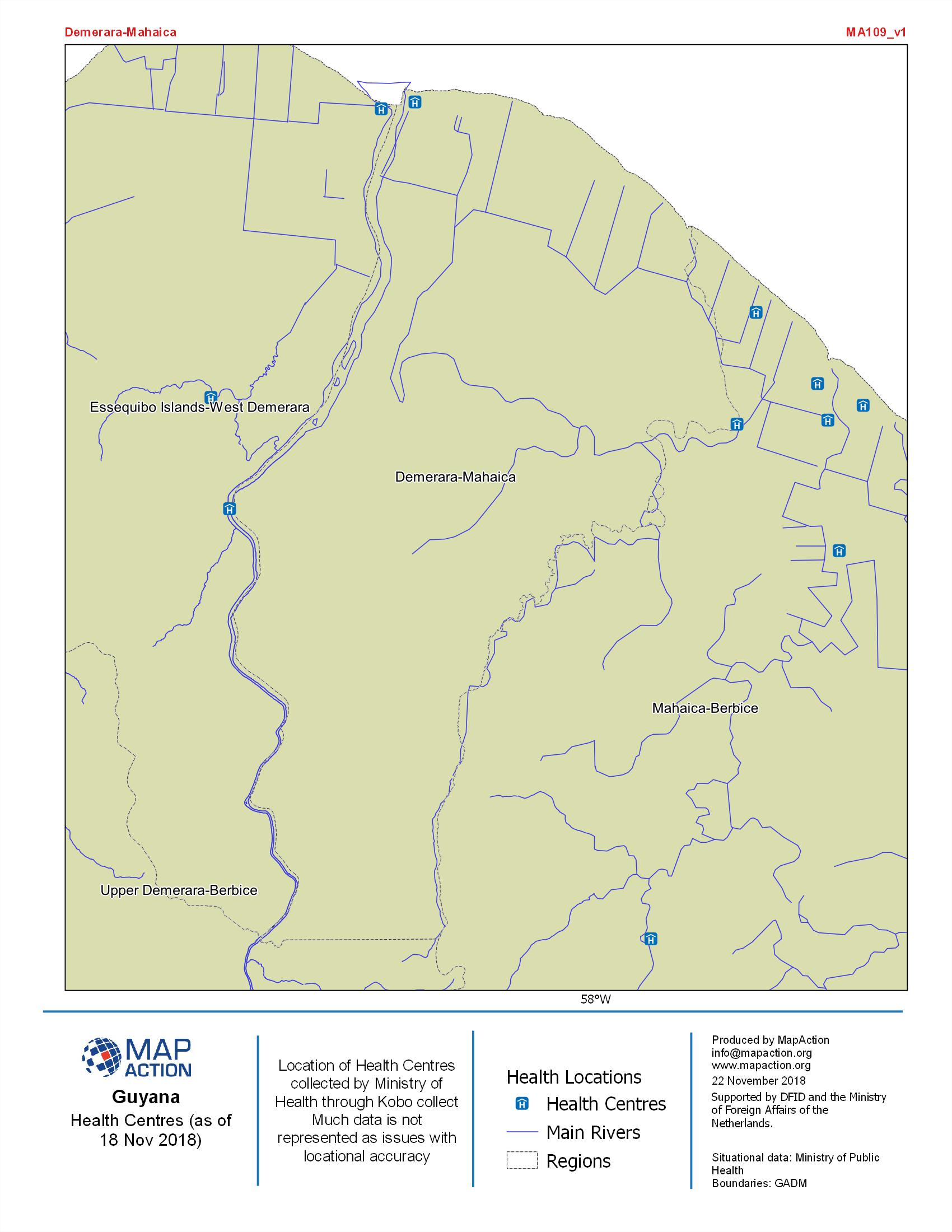
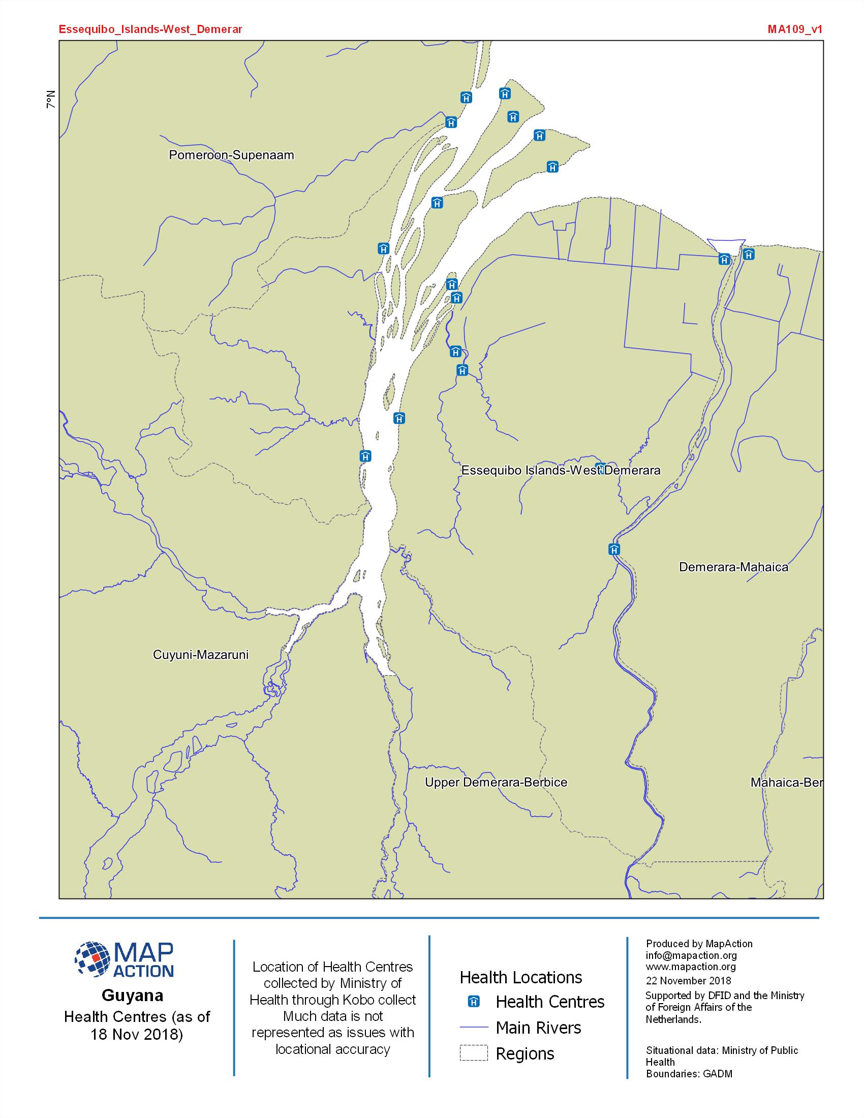
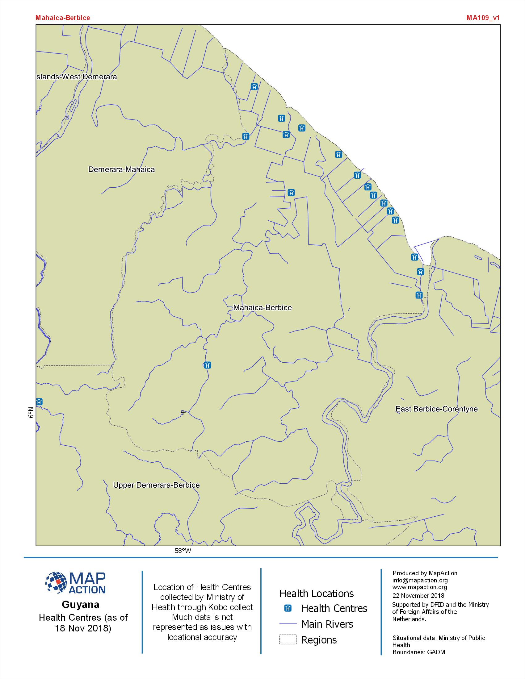
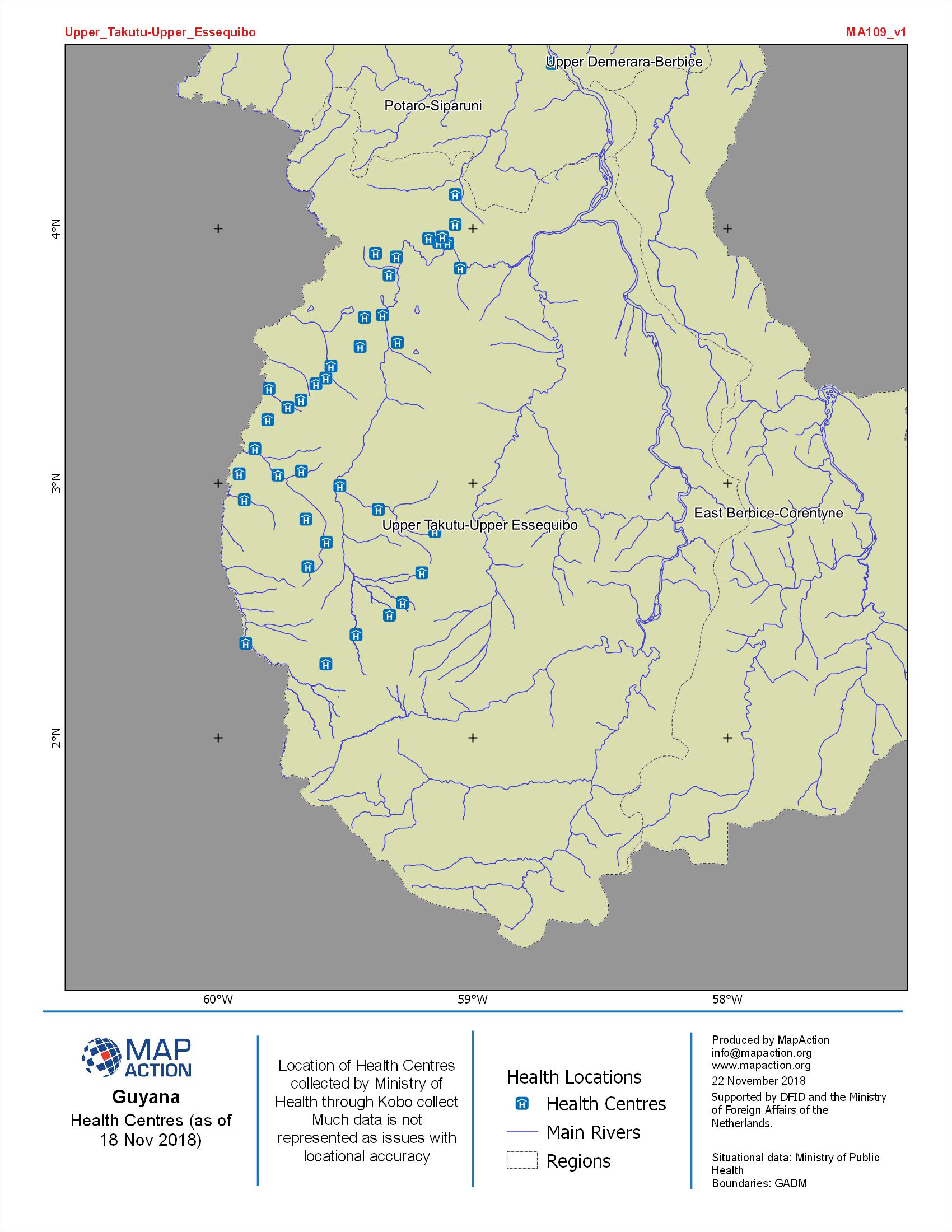
Guyana Health Centres as of 18 Nov 2018
Location of Health Centres collected by Ministry of Public Health through Kobo collect. Much of the data is not represented as issue with locational accuracy -

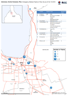
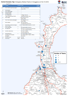
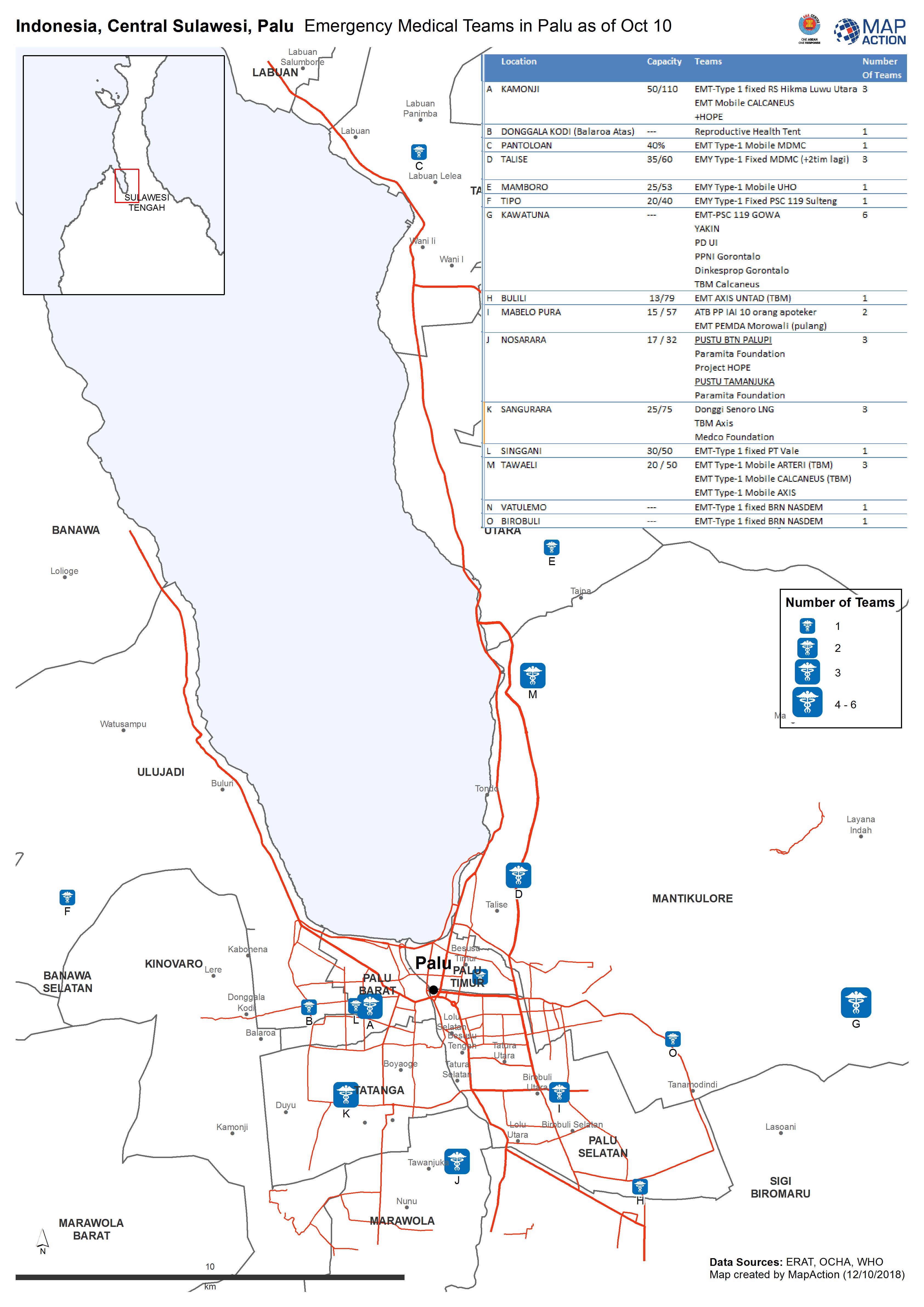
Indonesia, Central Sulawesi, Palu - Emergency Medical Teams in Palu as of Oct...
Emergency Medical Teams in Palu as of Oct 10 2018 -
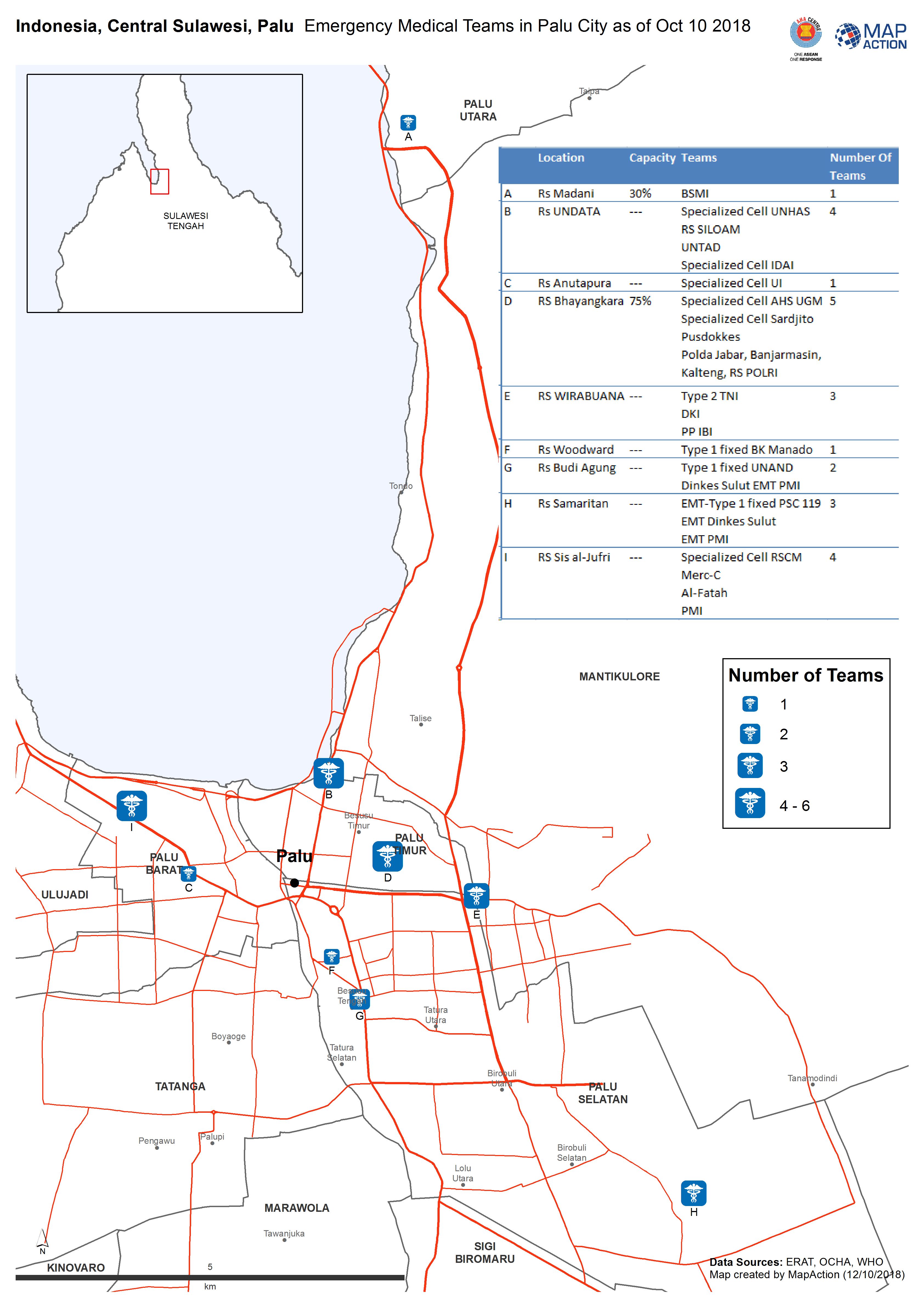
Indonesia, Central Sulawesi, Palu - Emergency Medical Teams in Palu City as o...
Emergency Medical Teams in Palu City as of Oct 10 2018 -
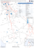
Central Sulawesi, Sigi Emergency Medical Teams in Donggala as of Oct 10 2018
Emergency Medical Teams in Donggala as of Oct 10 2018 -
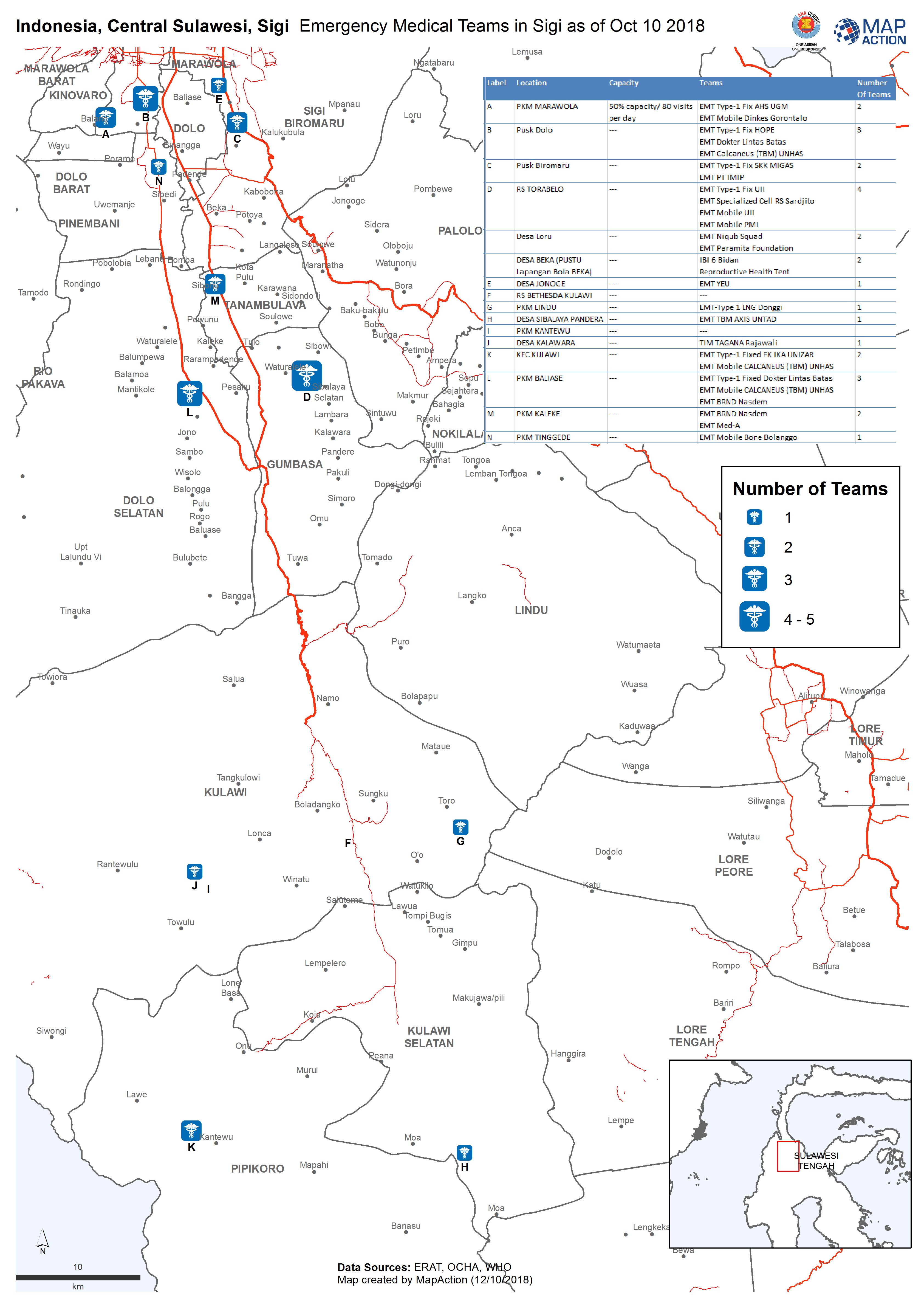
Indonesia, Central Sulawesi, Sigi Emergency Medical Teams in Sigi as of Oct 1...
Emergency Medical Teams in Sigi as of Oct 10 2018 -

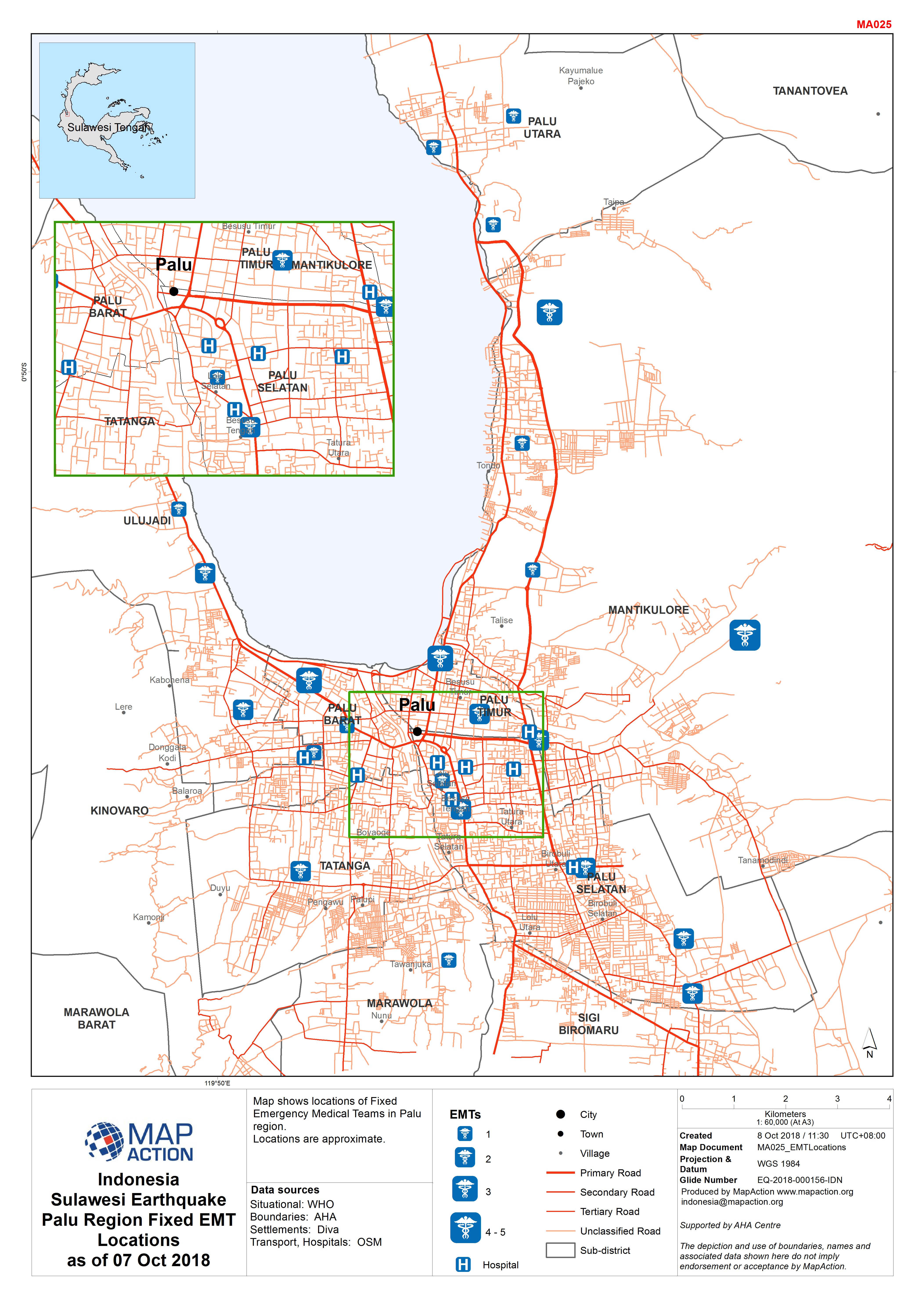
Indonesia Sulawesi Earthquake Palu Region Fixed EMT Locations as of 07 Oct 2018
Map shows locations of Fixed Emergency Medical Teams in Palu region. Locations are approximate. -

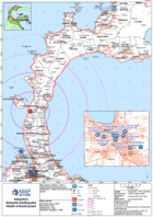
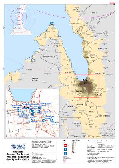
Sulawesi Earthquake - Palu area - Population density and hospitals
Map shows population density in the Palu area, hospitals, level 3 admininstration boundaries and settlements. -
Sulawesi Earthquake - Health
Map shows hospitals, level 3 admininstration boundaries and settlements. Roads and ports are also shown. -
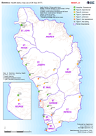
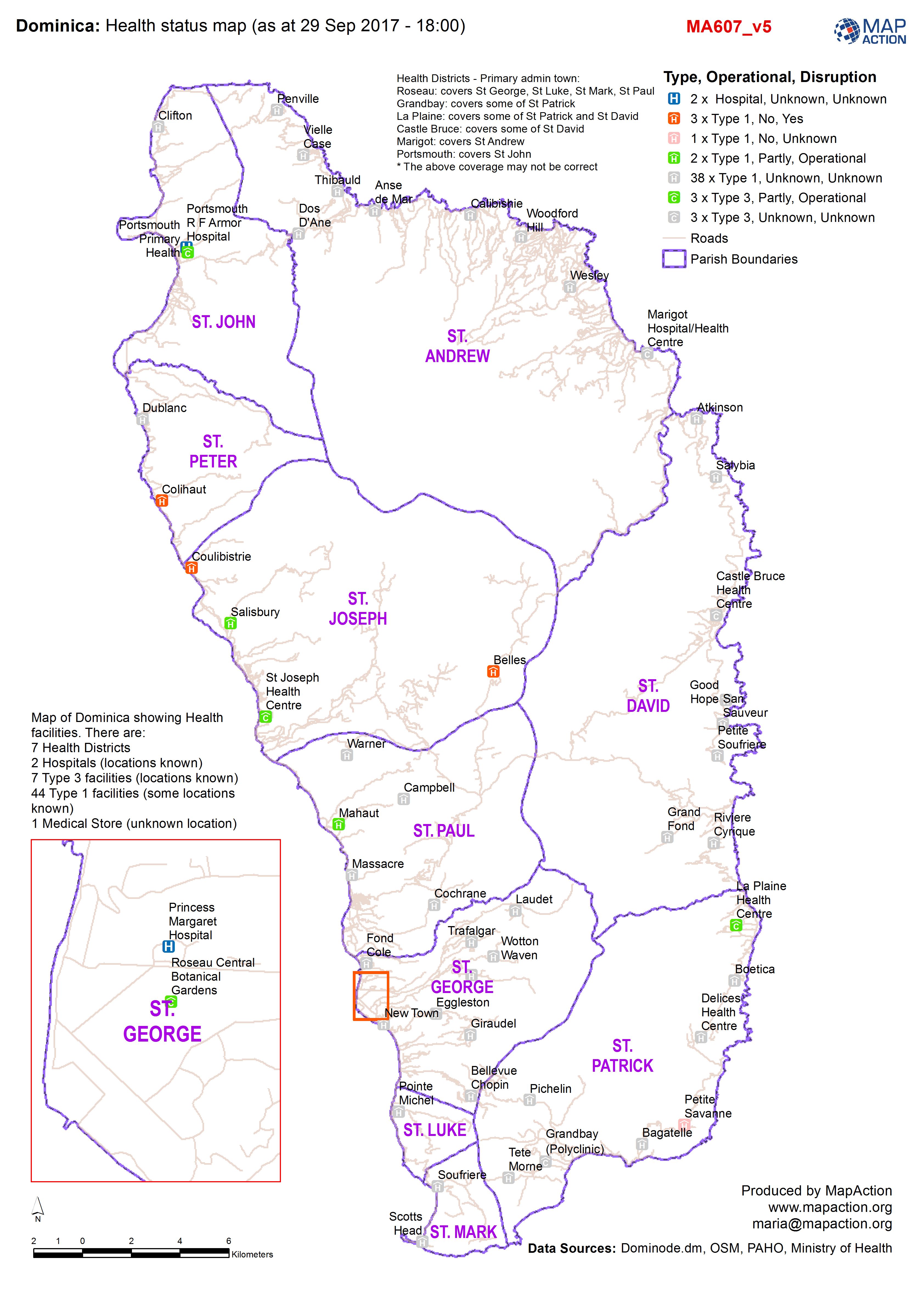
Health status map (as at 29 Sep 2017 - 18:00)
Map of Dominica showing Health facilities. There are: 7 Health Districts 2 Hospitals (locations known) 7 Type 3 facilities (locations known) 44 Type 1 facilities (some locations... -

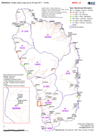
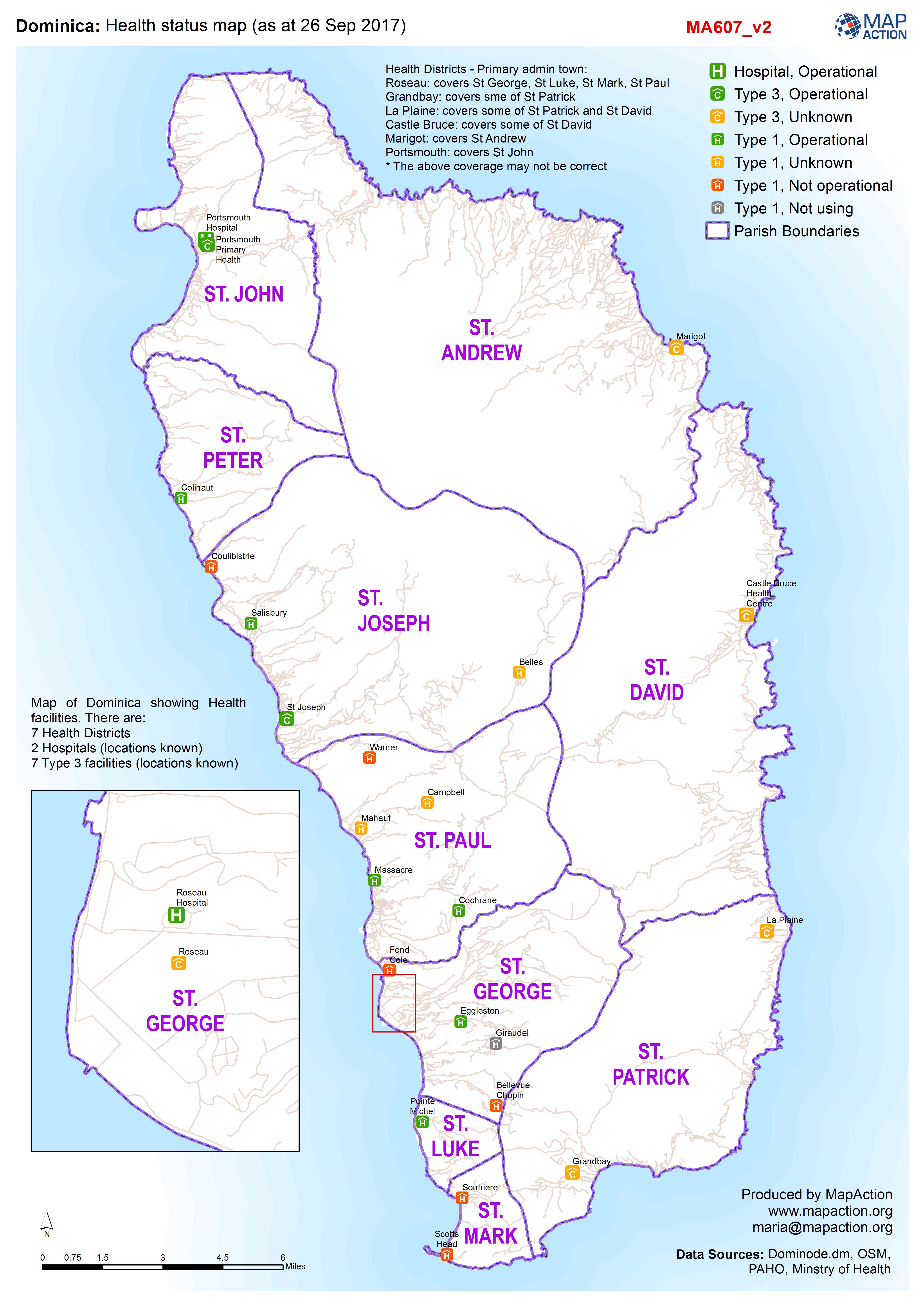
Dominica: Health status map (as at 26 Sep 2017)
Map of Dominica showing Health facilities. There are: 7 Health Districts 2 Hospitals (locations known) 7 Type 3 facilities (locations known) 40 (?) Type 1 facilities (some... -
Dominica: Health status map (as at 26 Sep 2017)
Map of Dominica showing Health facilities. There are: 7 Health Districts 2 Hospitals (locations known) 7 Type 3 facilities (locations known) 40 (?) Type 1 facilities (some... -

British Virgin Island: Hurricane Irma- Health Centres (as of 12 Sep 2017)
Map of Health Centres in British Virgin Islands -
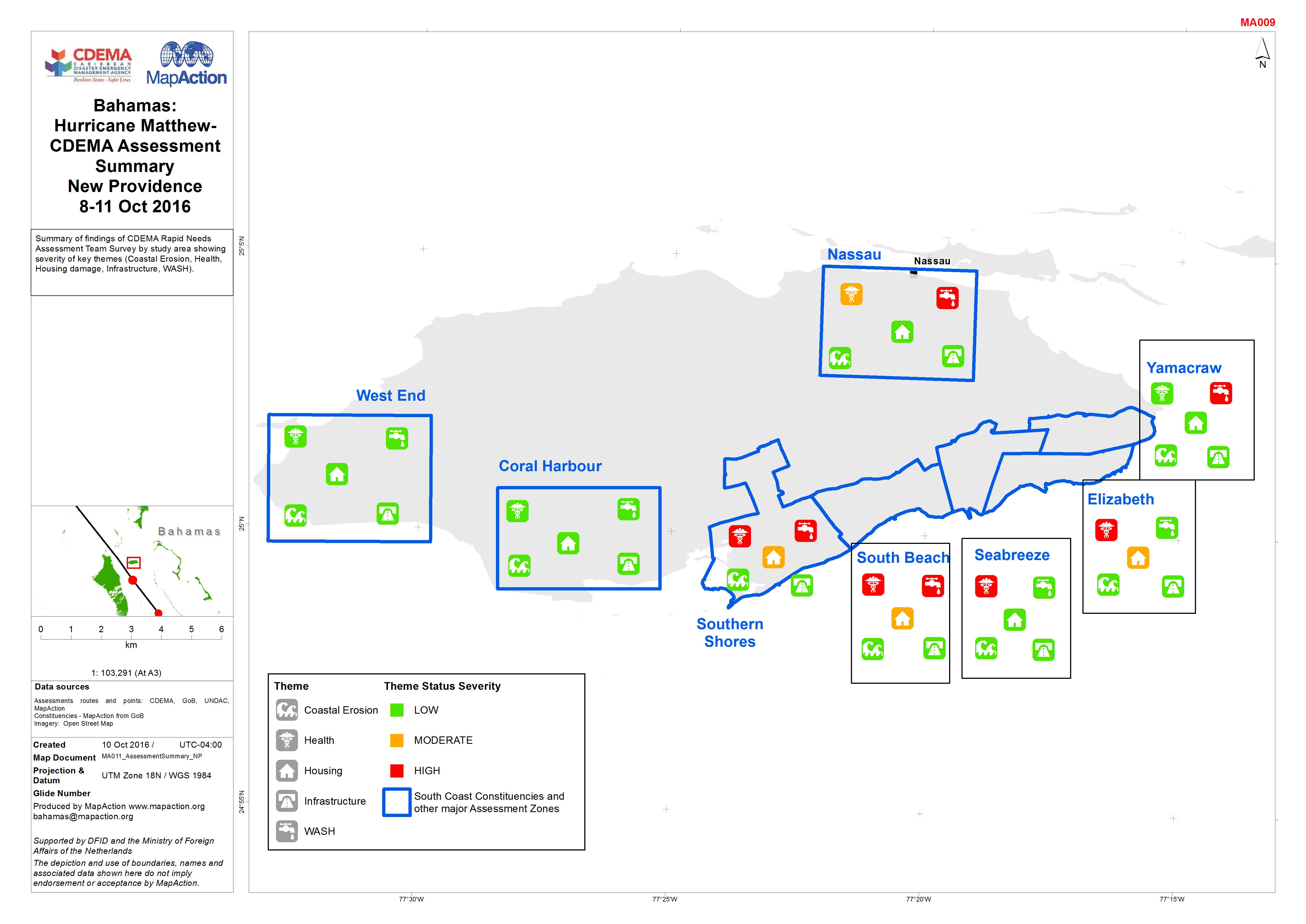
Bahamas: Hurricane Matthew- CDEMA Assessment Summary New Providence 8-11 Oct ...
Summary of findings of CDEMA Rapid Needs Assessment Team Survey by study area showing severity of key themes (Coastal Erosion, Health, Housing damage, Infrastructure, WASH).
