-

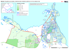
Guatemala: Persons evacuated and in shelter (26 November 2020)
Map shows the number of reported activities per Sector per Department in Guatemala. Critical and High priority response areas are also shown. -

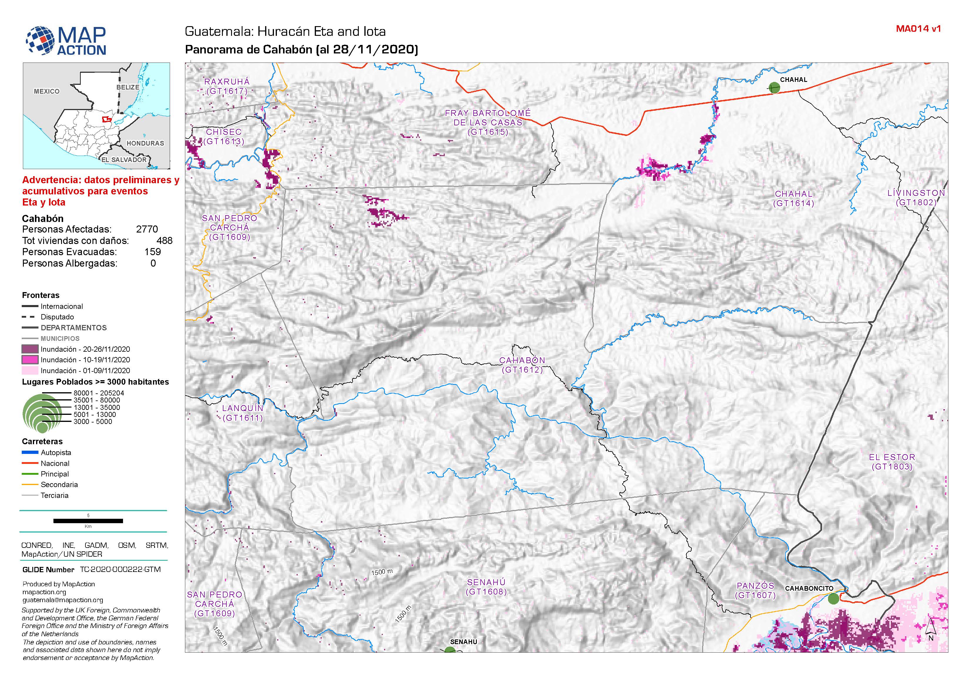
Guatemala: Panorama de Municipios (al 28/11/2020)
Flood extent between 1st and 26th November at municipality level (map series) / Areas inundados entre el 1 y el 26 de noviembre a nivel municipal (serie de mapas) -
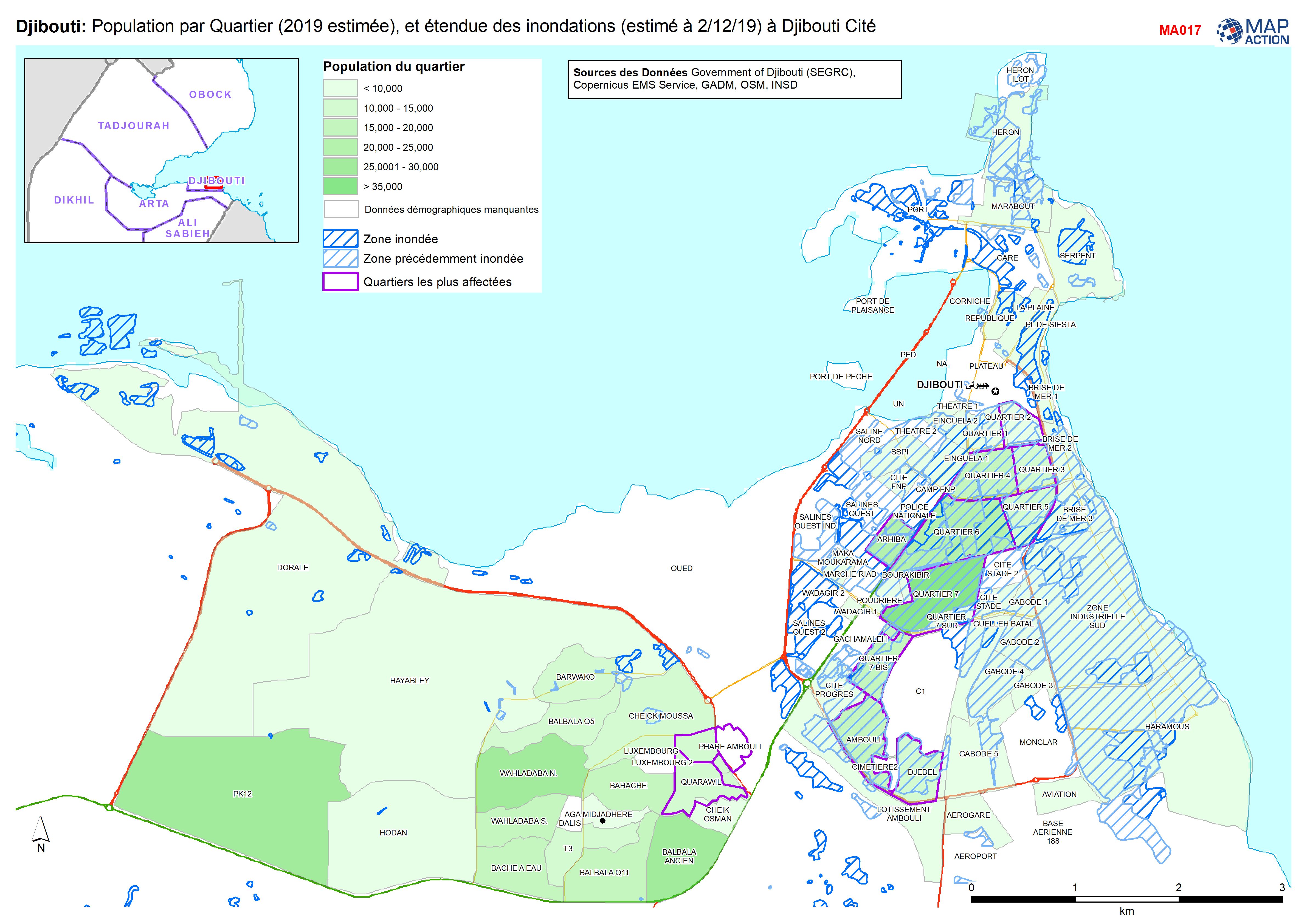
Djibouti: Population par Quartier (2019 estimée), et étendue des inondations ...
Population par Quartier (2019, estimée), et étendue des inondations (estimé à 2/12/19) à Djibouti Cité -

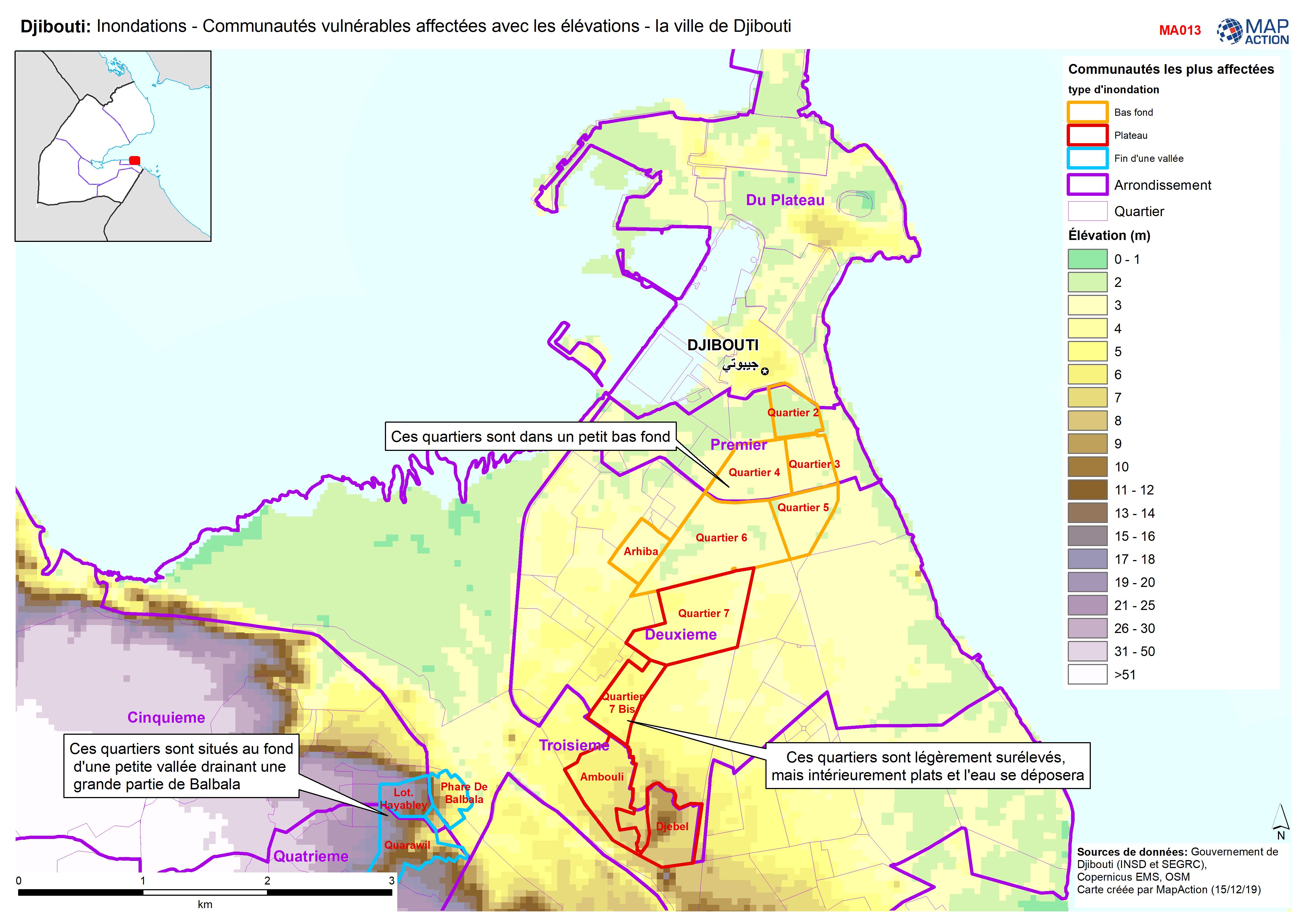
Djibouti: Inondations - Communautés vulnérables affectées avec les élévations...
Djibouti City - Map shows the most affected flooded communities, containing the most vulnerable populations, alongside elevation data to demonstrate the effects of elevation and... -

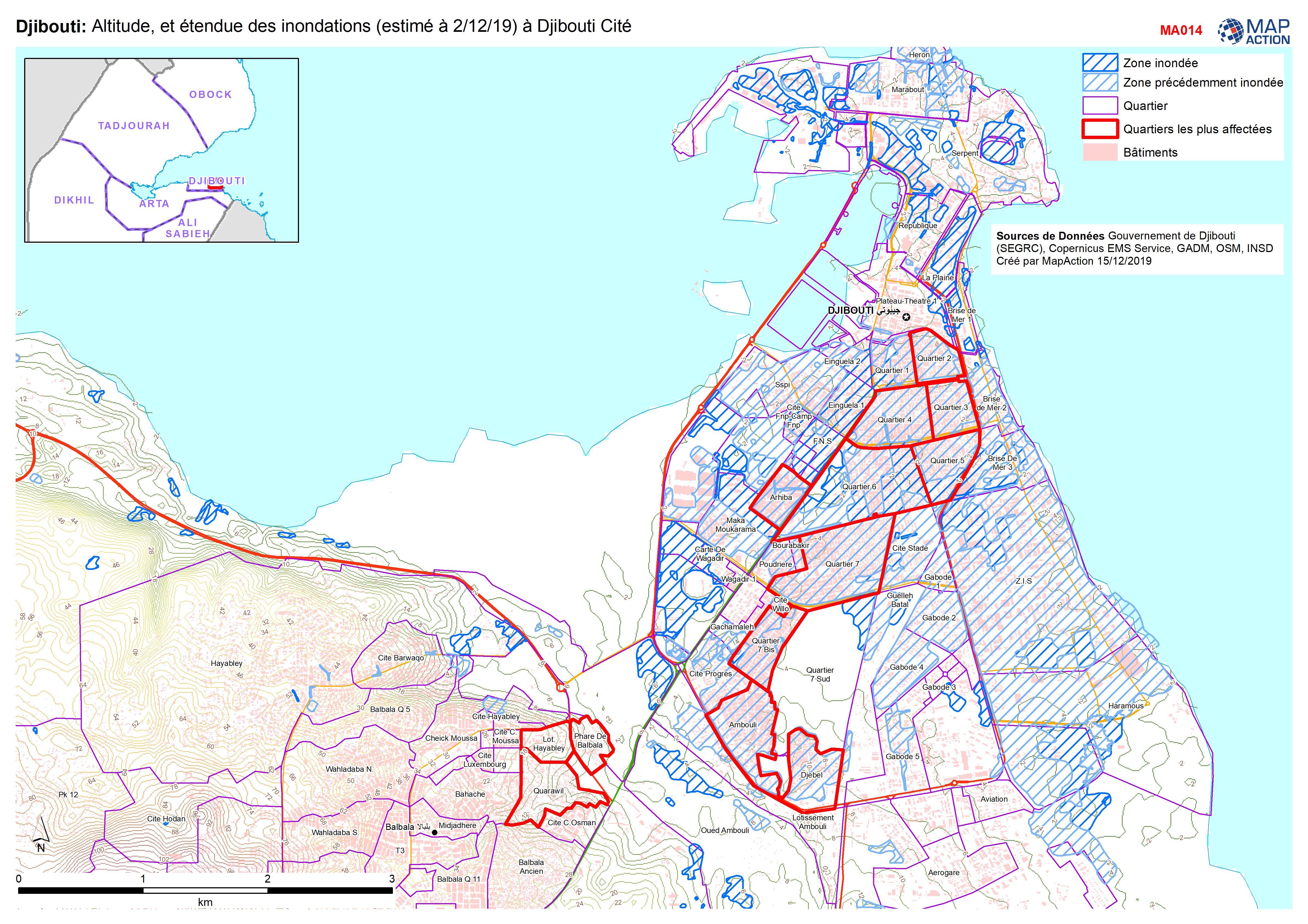
Djibouti: Altitude, et étendue des inondations (estimé à 2/12/19) à Djibouti ...
Flood extent and elevation in Djibouti city -

Djibouti: Floods - Affected Locations Countrywide and in Djibouti City
Country level map shows numbers of families affected in villages and towns across Central and South Djibouti (no reports from north) and by Quartiers in Djibouti City. Map for... -
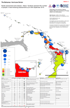
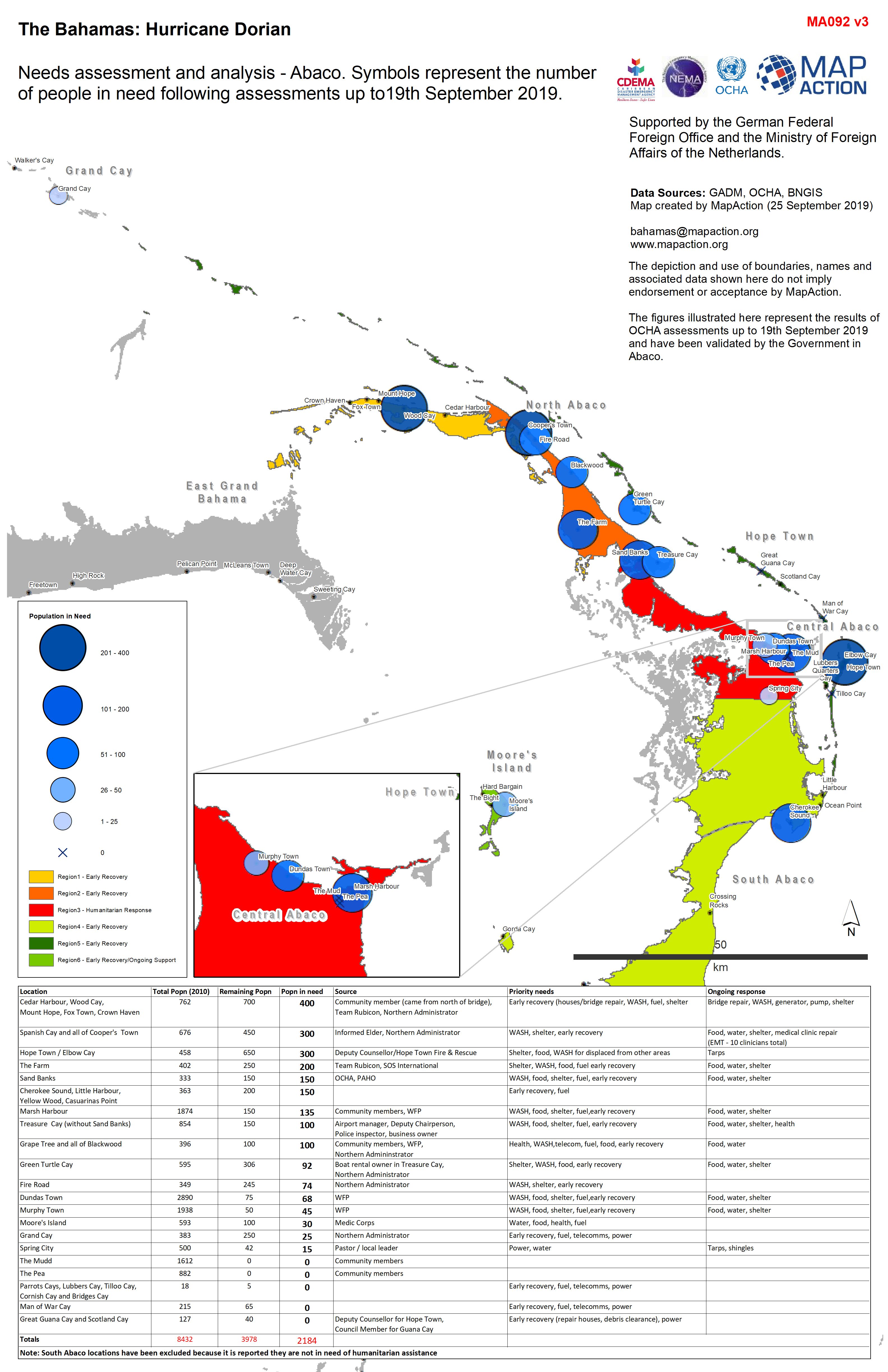
Needs assessment and analysis - Abaco. Symbols represent the number of people...
Needs assessment and analysis - Abaco. Symbols represent the number of people in need following assessment as of 19th Spetember 2019 -

Needs assessment and analysis - Abaco. Symbols represent the number of people...
Needs assessment and analysis - Abaco. Symbols represent the number of people in need following assessment as of 19th Spetember 2019 -
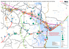
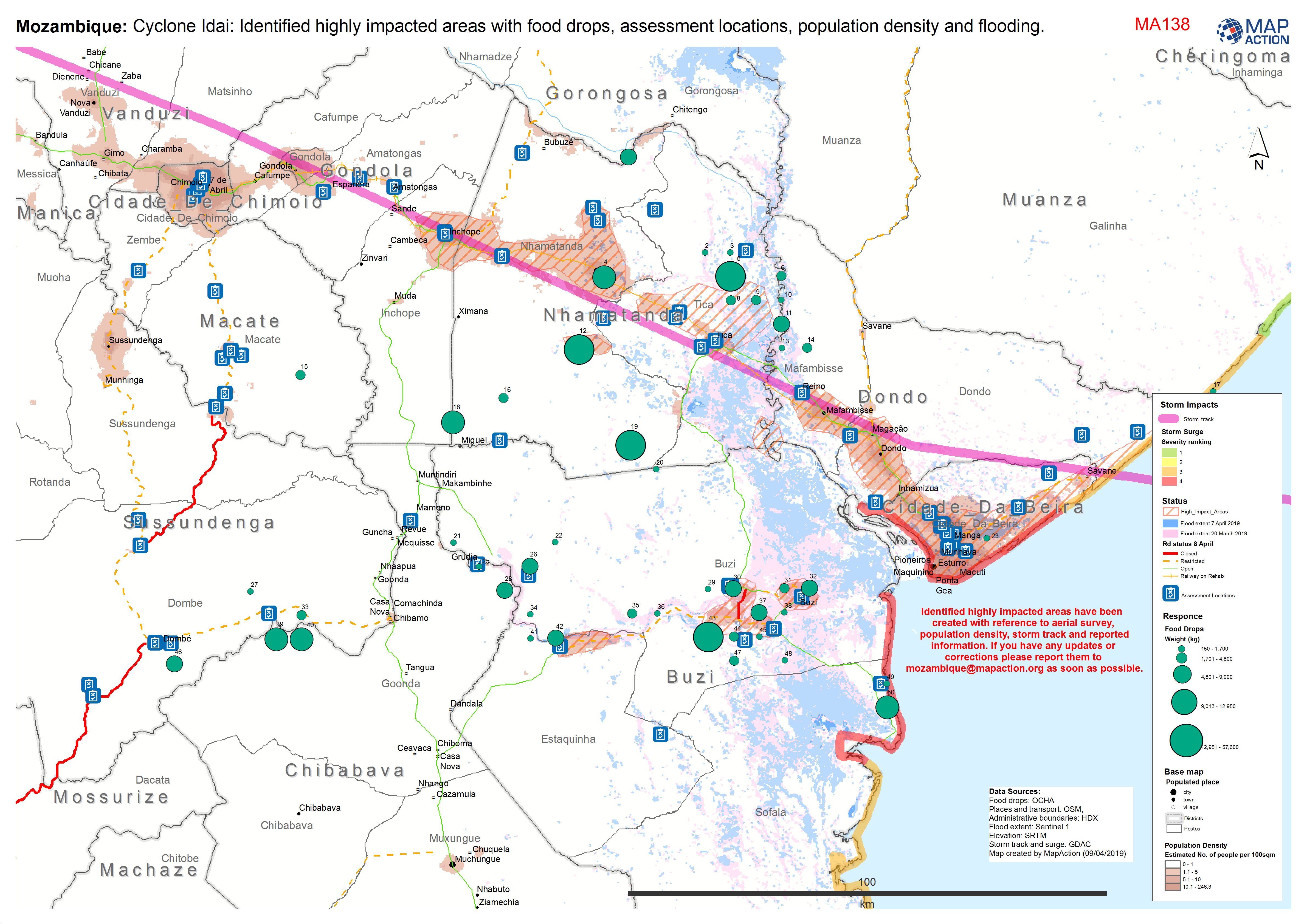
Mozambique: Cyclone Idai: Identified highly impacted areas with food drops, a...
Situation map showing areas of high impact, assessment locations, access and food drops to date. As at 9 April 2019. -
Mozambique: Cyclone Idai - results and analysis of aerial survey as of 28th M...
UNDAC and IFRC surey started 23rd March and will continue until finished -
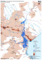
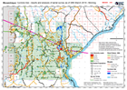
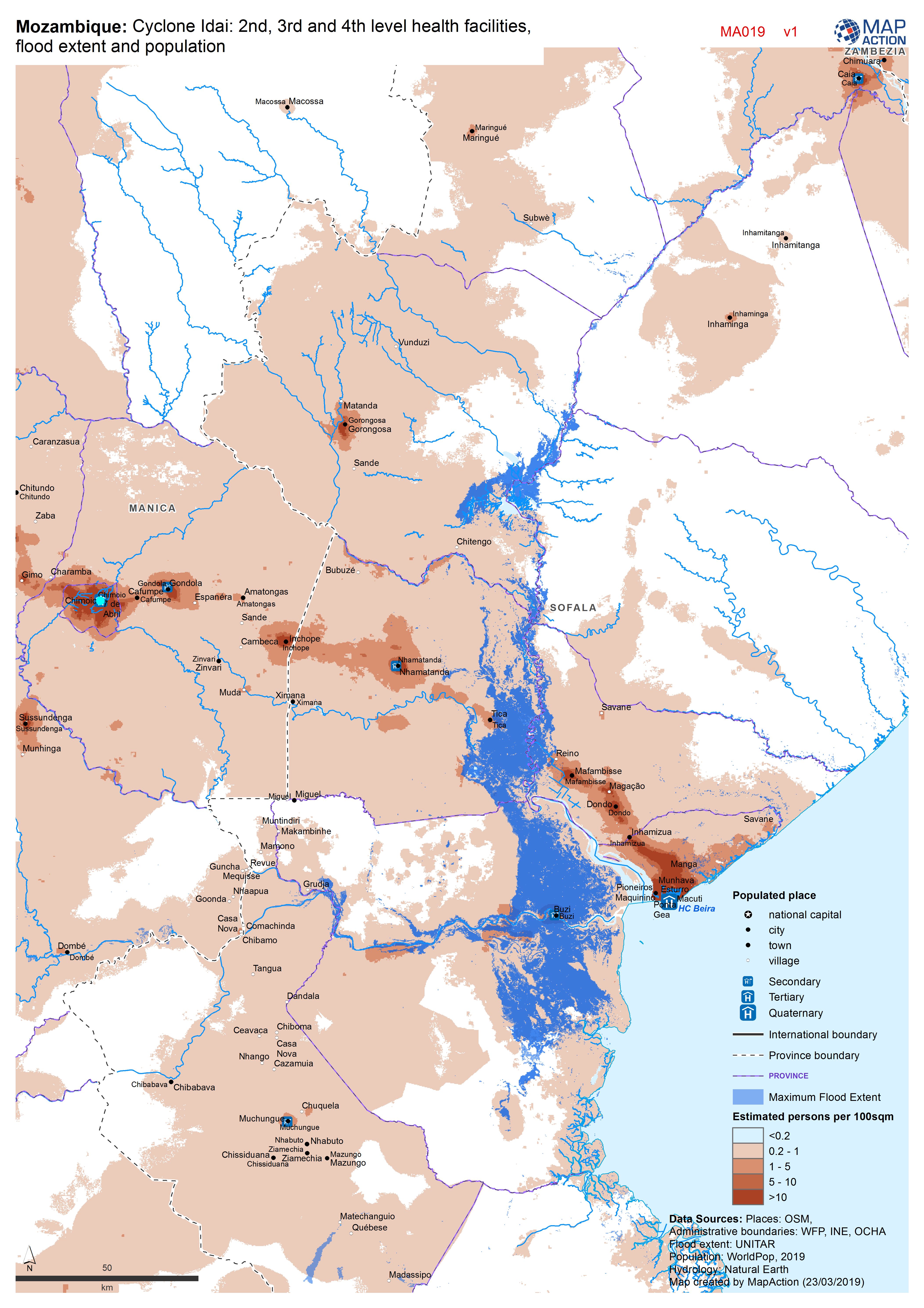
Mozambique: Cyclone Idai - 2nd, 3rd and 4th level health facilities, flood ex...
Map shows the population (based on WorldPop at 100m resolution generating through AI) and the Flood Extents known as of 19/20 March 2019 plus Health facilities -

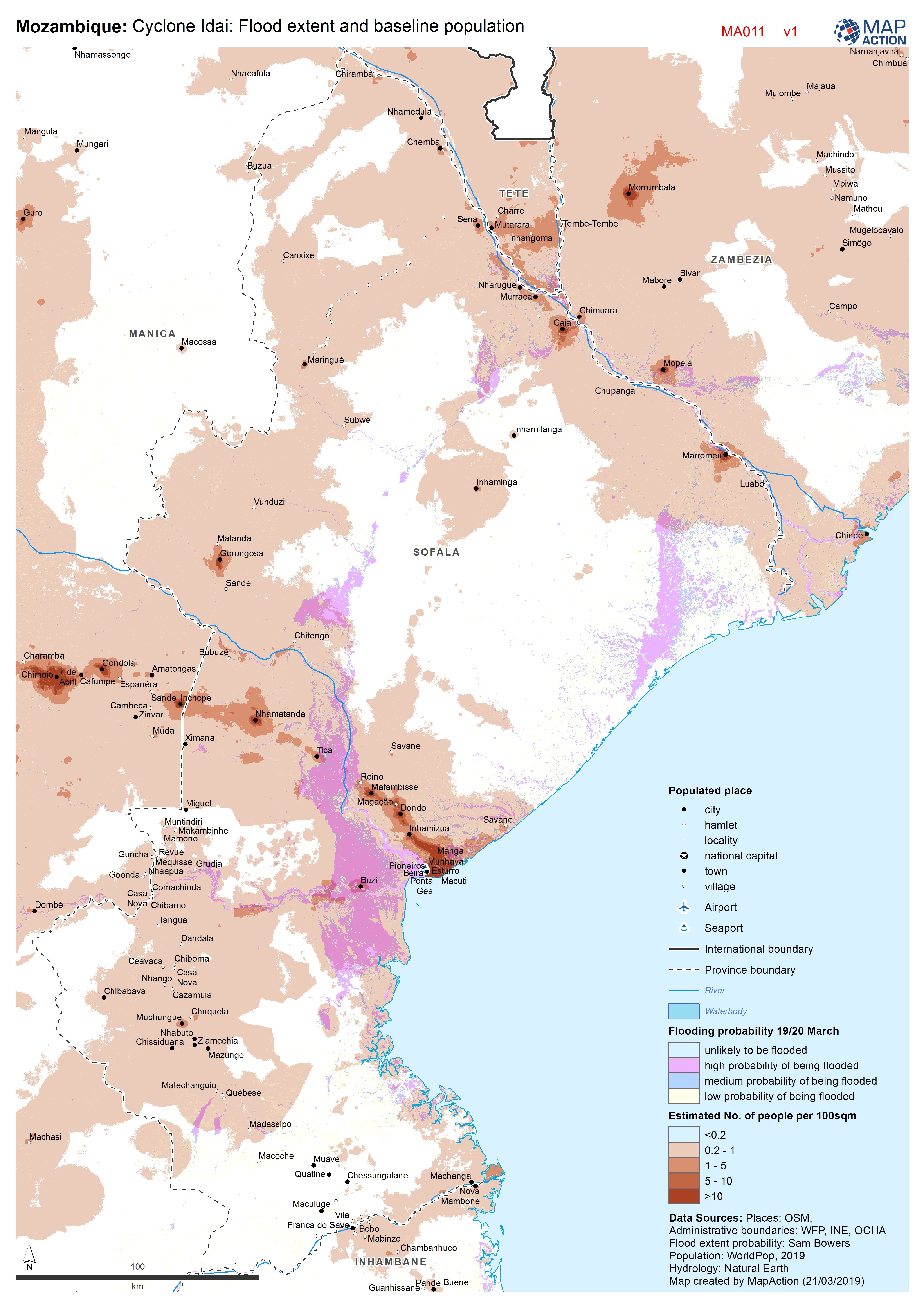
Cyclone Idai: Flood extent and baseline population
Map shows the population (based on WorldPop at 100m resolution generating through AI) and the Flood Extents known as of 19/20 March 2019 -
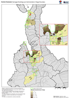
Central Sulawesi Damaged Buildings per Administrative Village Boundary
Based on Copernicus analysis, this map summarises the building damage detected in the areas where satellite imagery was captured and processed. The total numbers mapped include... -

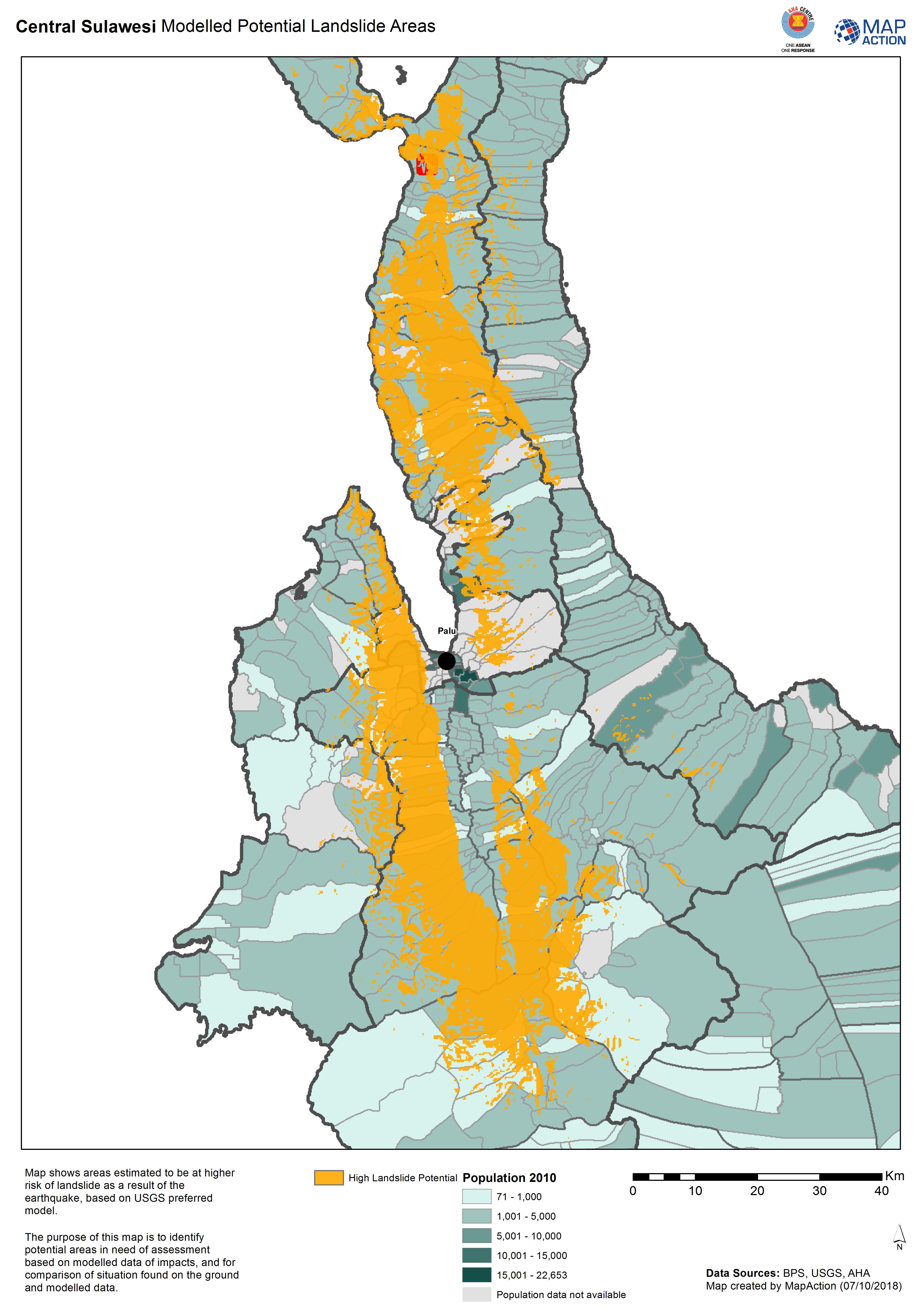
Central Sulawesi Modelled Potential Landslide Areas
Map shows areas estimated to be at higher risk of landslide as aresult of the earthquake, based on USGS preferred model. -

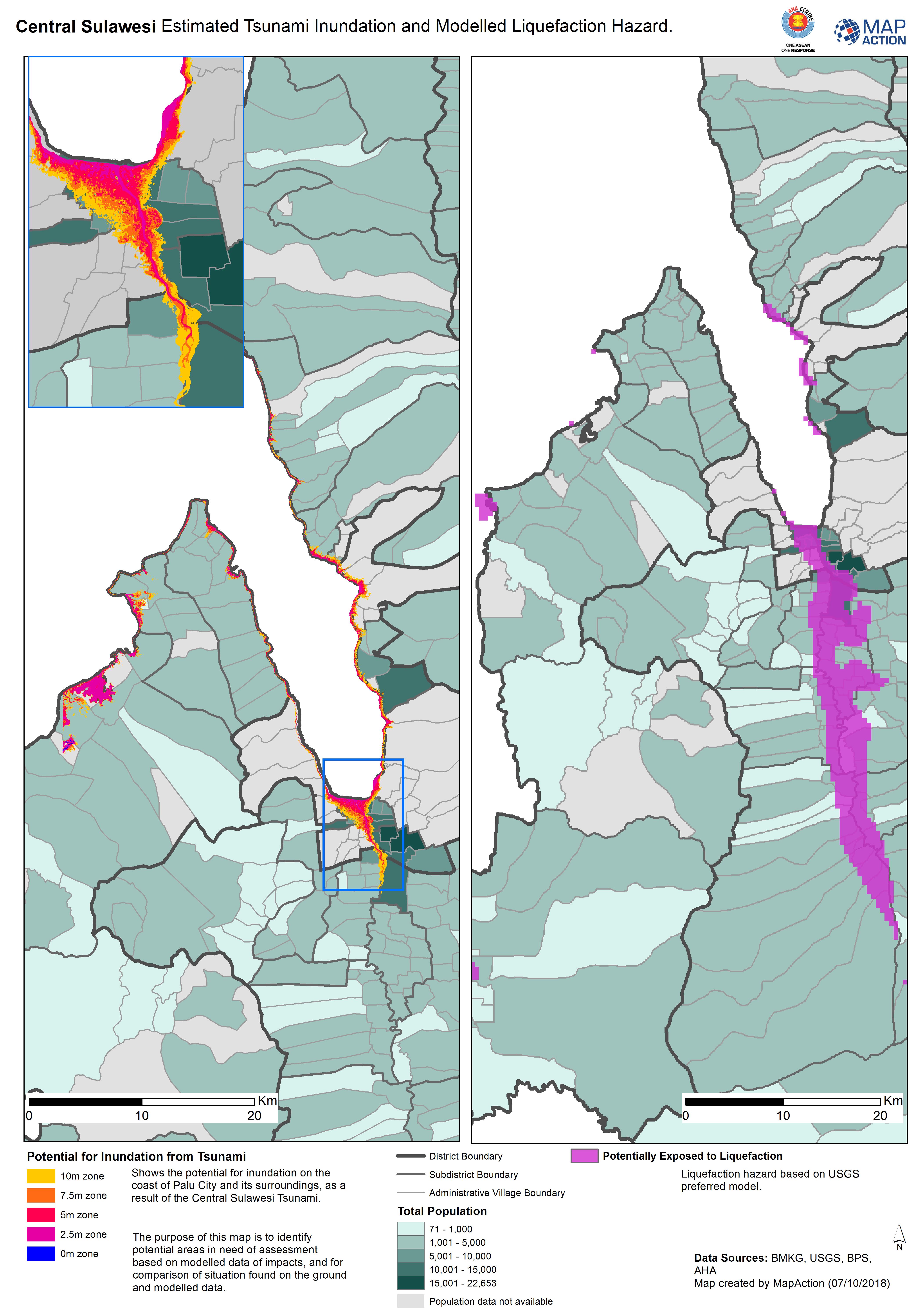
Central Sulawesi Estimated Tsunami Inundation and Modelled Liquefaction Hazard.
Shows the potential for inundation on the coast of Palu City and its surroundings, as a result of the Central Sulawesi Tsunami. The purpose of this map is to identify potential... -
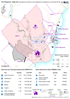
The Philippines - Naga City: Situational overview of area affected by landsli...
Map shows the affected areas, number of displaced and location of the evacuation centres being used as a result of the landslide to hit Naga city. The table below shows the... -
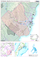
The Philippines - Naga City: Affected areas affected by landslide (as at 28 S...
Map shows the affected by the landslide in Naga City, Cebu. -
Madagascar: Cyclone Enawo - Impacts of cyclone (affected people and damage to...
Map shows the impacts of Cyclone Enawo through 6 different indicators - affected population, number of evacuation sites, damaged houses, flooded houses, destroyed houses and... -
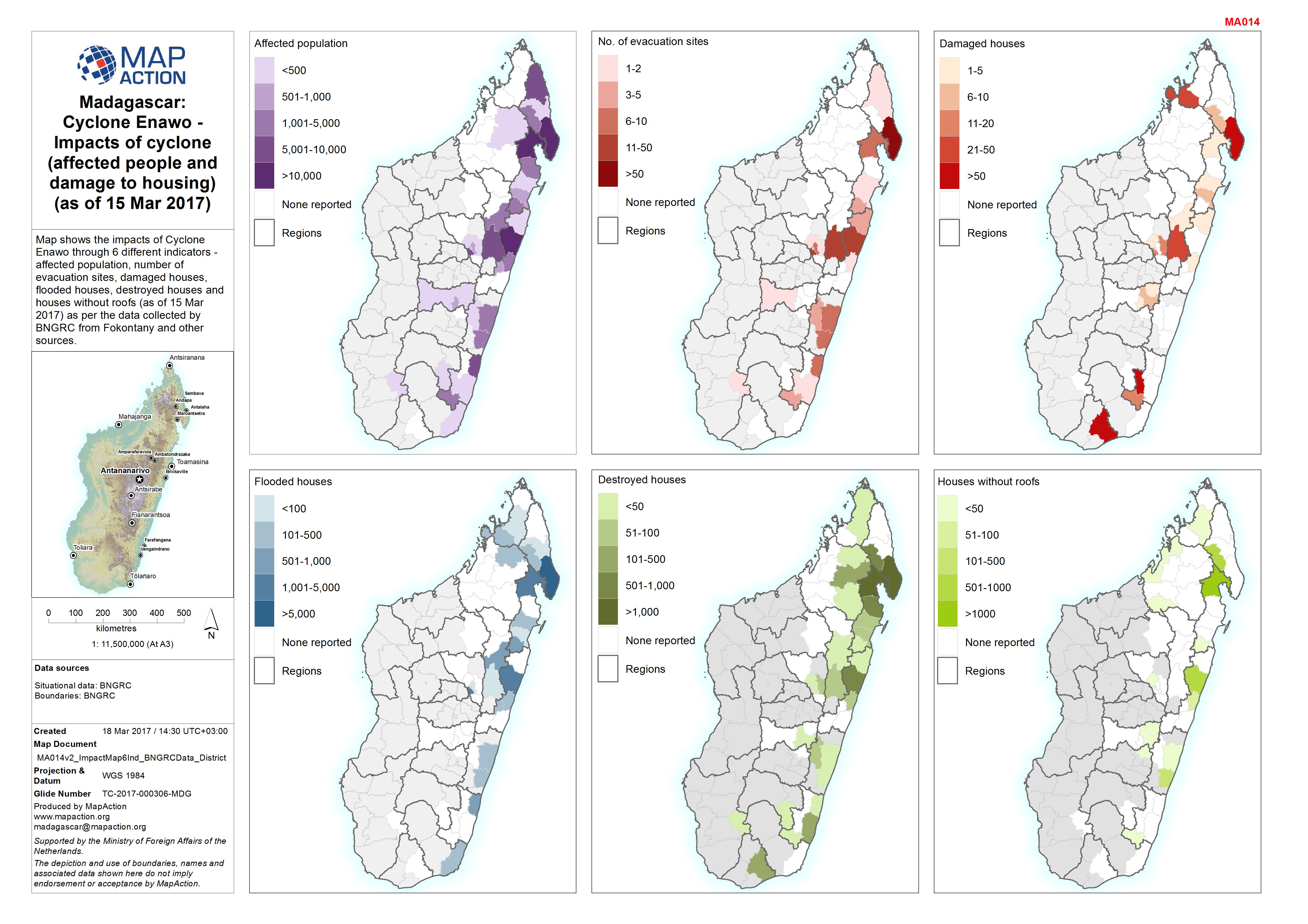
Madagascar: Cyclone Enawo - Impacts of cyclone (affected people and damage to...
Map shows the impacts of Cyclone Enawo through 6 different indicators - affected population, number of evacuation sites, damaged houses, flooded houses, destroyed houses and... -

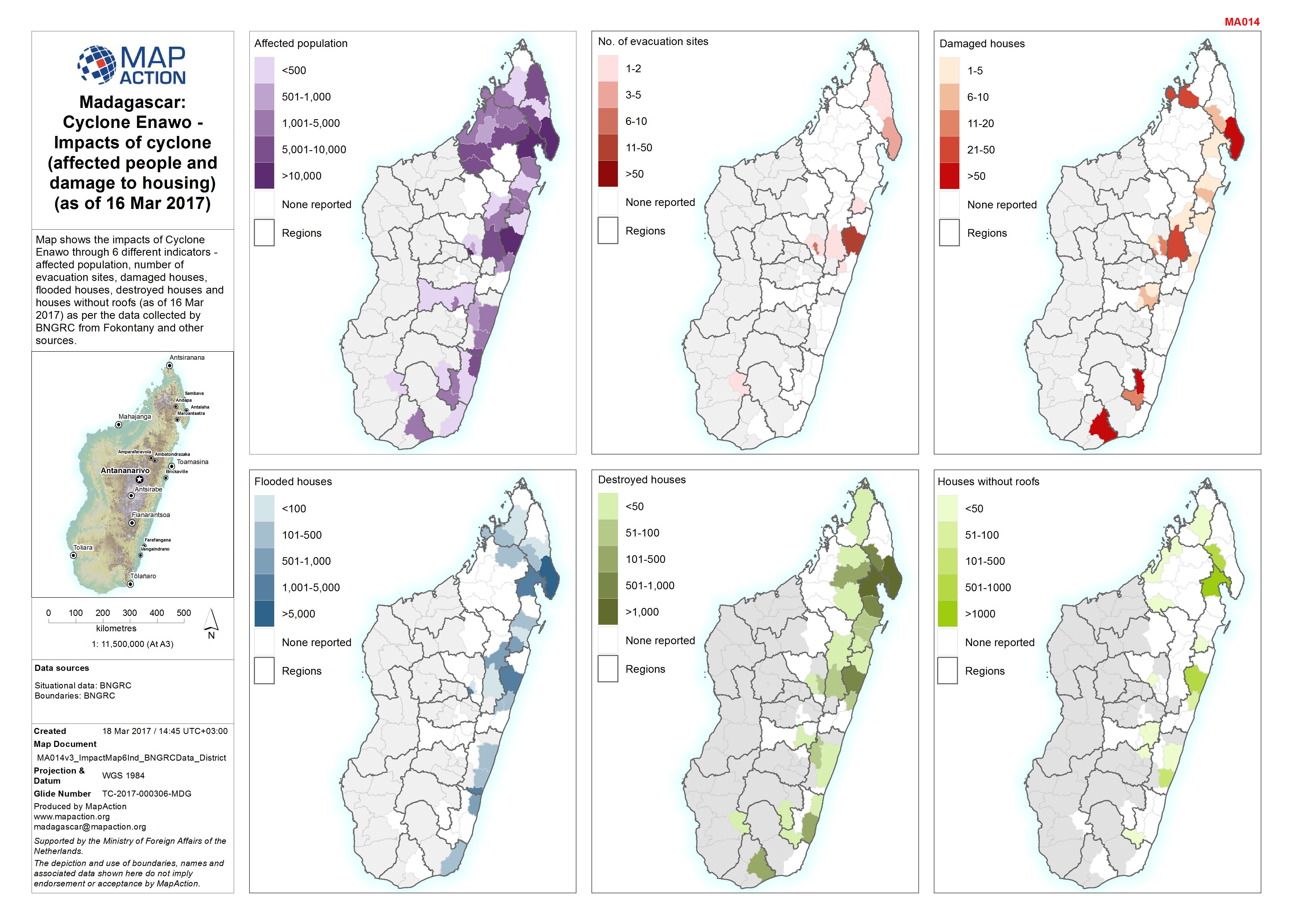
Madagascar: Cyclone Enawo - Impacts of cyclone (affected people and damage to...
Map shows the impacts of Cyclone Enawo through 6 different indicators - affected population, number of evacuation sites, damaged houses, flooded houses, destroyed houses and...