MA014v2_ImpactMap6Ind_BNGRCData_District-300dpi ...
From the dataset abstract
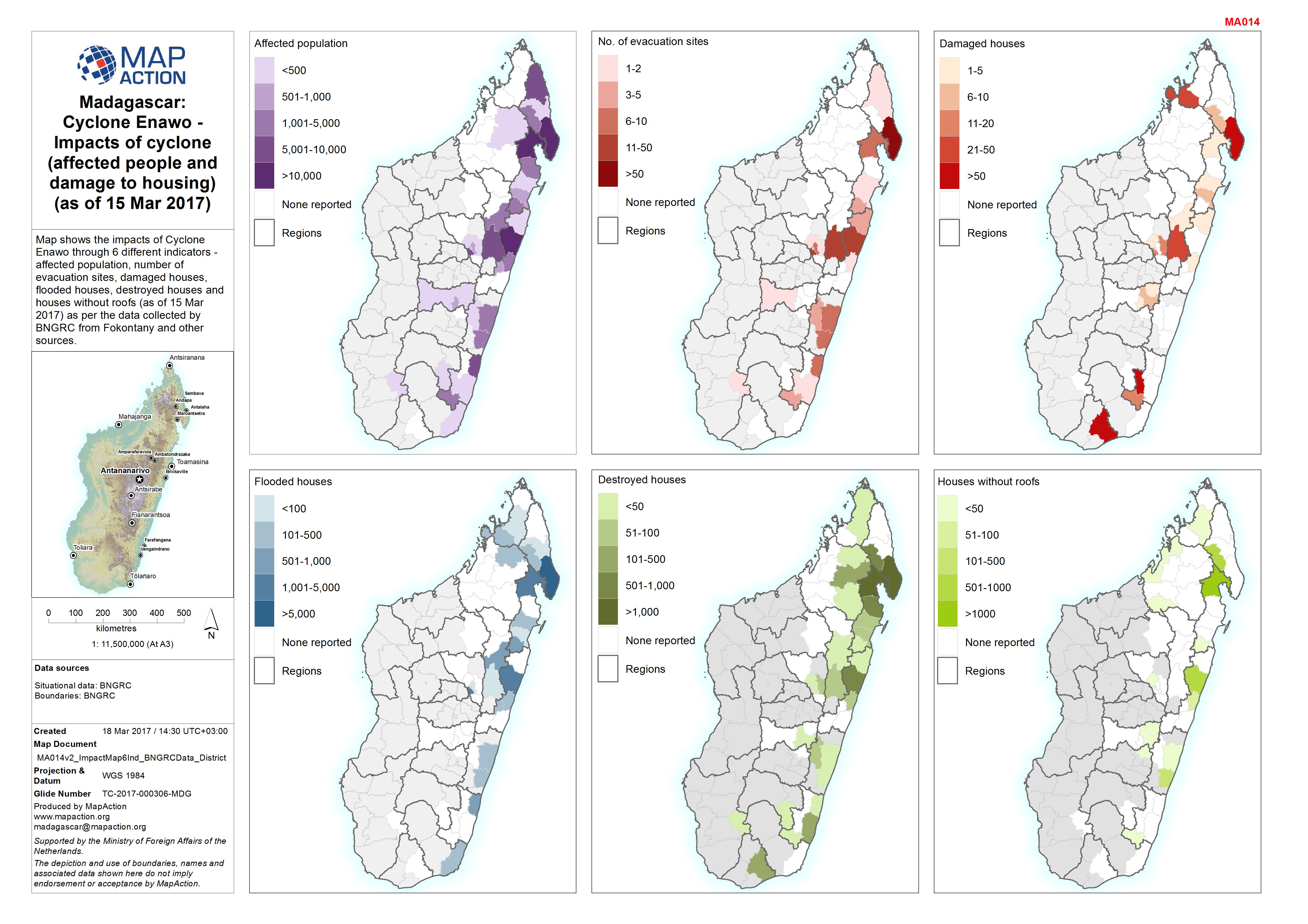
Map shows the impacts of Cyclone Enawo through 6 different indicators - affected population, number of evacuation sites, damaged houses, flooded houses, destroyed houses and houses...
Additional Information
| Field | Value |
|---|---|
| Data last updated | March 19, 2017 |
| Metadata last updated | March 19, 2017 |
| Created | March 19, 2017 |
| Format | JPEG |
| License | License not specified |
| Has views | True |
| Id | cc36e6d2-c824-4f43-b9be-39798f901e69 |
| On same domain | True |
| Package id | 37931bcc-f658-45d0-aaf4-98c166a69f31 |
| Revision id | 5e1368db-0627-40cc-8005-d37104838356 |
| State | active |
| Url type | upload |